Local council makes planning maps available to public
Waitaki District Council | New Zealand

The challenge
The Waitaki District in New Zealand stretches from the Kakanui coastline almost to the foot of Aoraki/Mount Cook. The mostly rural district is home to around 22,300 residents and large swaths of farmland across approximately 7,152 square kilometers (about 2,761 square miles), with almost 14,000 of those residents living in the town of Oamaru.
The district is governed locally by a territorial authority, the Waitaki District Council (WDC), which is shaping the future to benefit its residents and community by revising the Waitaki District Plan in accordance with New Zealand’s Resource Management Act 1991 (RMA). The district plan is the tool through which WDC manages the use, development, protection and sustainable management of land and associated natural and physical resources as required by the RMA.
The solution
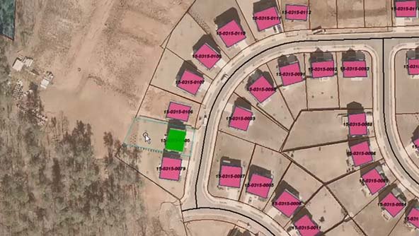
To implement the mapping portion of its district plan, the WDC uses Hexagon’s GeoMedia products to deliver interactive maps to its residents through an online, self-service portal. GeoMedia Smart Client allowed WDC users to visualize and agree on the mapping layers and symbology, and GeoMedia WebMap makes the GIS data and portal accessible to the public. Residents can type in an address and populate a customized map with layers that are relevant to their inquiries.
The district plan map portal is not just for residents. It also serves city planners, consultants and developers. Leveraging GeoMedia Smart Client, they have the tools they need, including the required shapefiles, to create and edit data before it becomes part of the revised plan. With the portal, they can pull out a planning profile for each property. They can also use the portal to research properties and zones before making planning decisions.
Learn more
Also explore
GeoMedia Smart Client
GeoMedia WebMap