Marine visualisation software
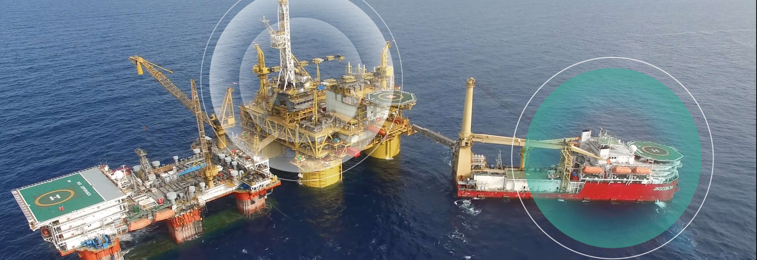
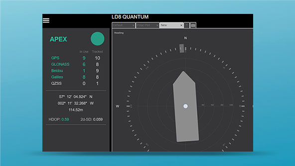
We offer a range of software options to serve your marine visualisation and processing needs. Our software provides information and tools such as real-time position, quality control, real-time tide estimation or coverage mapping. It also provides you with critical information that will help you make sound decisions regarding your quality of position.
Explore our marine visualisation software
We offer a range of software options to serve your marine visualisation and processing needs.
Ready to get started?
Talk to an expert and discover what Hexagon can do for your organization.
-
 Product
Quantum is GNSS visualisation software for status monitoring and system diagnostics for marine dynamic positioning.
$ProductName
$SustainabilityImpactLabel
$GreenGoalsLabel: $GreenGoalsContent
$ShortDescription
$SustainabilityCTABandHeadingLabel
$SustainabilityCTABandDescriptionLabel