Mobile mapping systems
Mobile mapping systems efficiently collect geo-information and geo-data with a moving (kinematic) sensing platform.

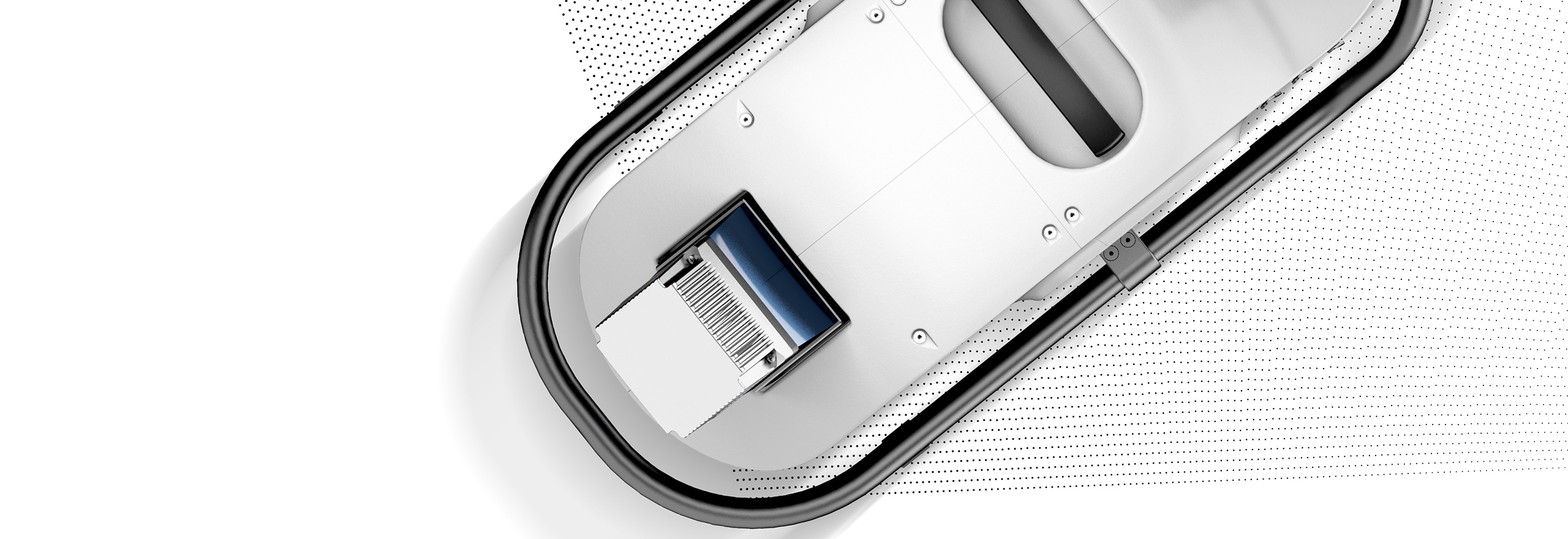
Introducing the Leica Pegasus TRK300
Capture detailed asset and infrastructure data with a lightweight, high-performance mobile mapping system.
Leica Pegasus TRK Neo: a complete mobile reality capture solution
Transforming mobile mapping with autonomy, intelligence and simplicity through next-generation AI-enhanced capabilities
Ready to get started
Modular mobile mapping systems for every environment
Mobile mapping allows teams to collect high-volume geospatial data with less time in the field and reduced safety risk. The Leica Pegasus TRK portfolio delivers accurate data faster, enabling confident decisions across industries. With modular design, seamless software integration, and clear upgrade paths, Pegasus TRK adapts to changing needs, from asset documentation to complex infrastructure environments.
-
 Product
A complete mobile mapping solution from a single provider, including software to capture, post-process, and store acquired data.
-
×Human-Assisted autonomyTravel along a route and activate specific functions to automate data capture.
-
-
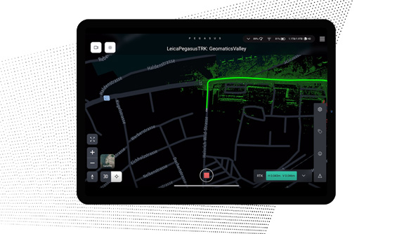 Product
Plan and execute projects with visual and audio feedback along the route to make data collection failure a thing of the past.
-
×Human-Assisted autonomyDedicated processing workflows in the field are automated to increase efficiency and collaboration.
-
-
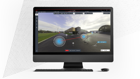 Product
Deliver high-resolution point clouds with classification, anonymised images and exchangeable formats in one batch-process.
-
×Human-Assisted autonomyDedicated processing workflows in the office are automated to increase efficiency and collaboration.
-