Discover Geospatial Content
Discover our on-demand aerial data, analytics, geospatial imagery and mapping services.

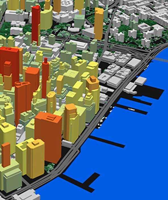
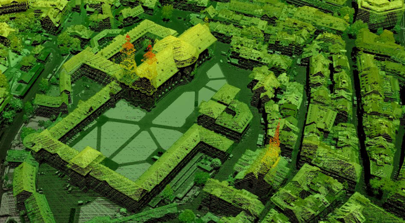
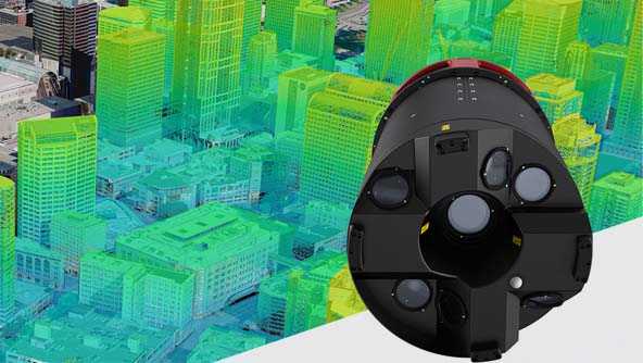
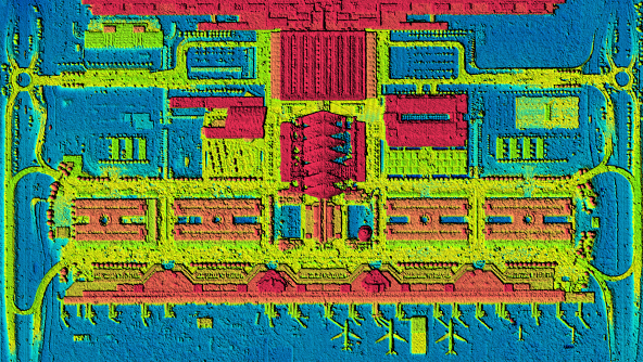
Digital twins of major cities
The Metro HD city program offers ultra-high-resolution 2D and 3D data of global cities on demand.
Digital twins of major cities
The Metro HD city program offers ultra-high-resolution 2D and 3D data of global cities on demand.
Accurate geospatial content
-
Overview
-
Data
-
Analytics
-
Services
Democratising access to quality maps
Cities are growing due to urbanisation, rural areas are developing as infrastructure evolves and farmlands are adapting to feed an increasing population. Such rapid change outpaces the speed at which we can map countries, cities and infrastructure.
To keep up with the real world, Hexagon has changed the way we map. The HxGN Content Program continuously captures geospatial data and produces maps according to consistent specifications and refresh schedules, creating a standardised product suitable for many applications. As part of the “sharing economy” the data is made available to everyone through the cloud at affordable price points.
Together with our network of local partners, we are continuously expanding the coverage areas and data products of the HxGN Content Program to keep democratising access to high-quality maps.

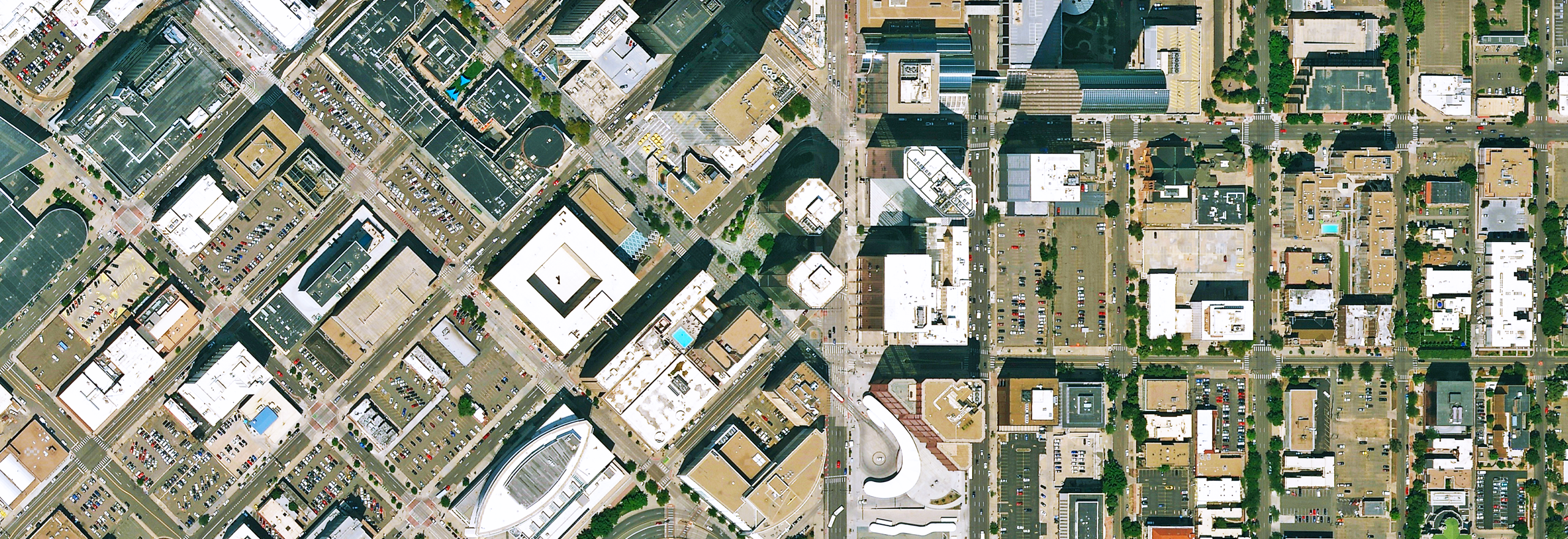
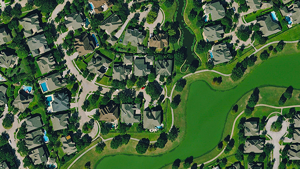
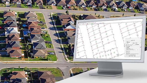
High-quality cloud-based geospatial data
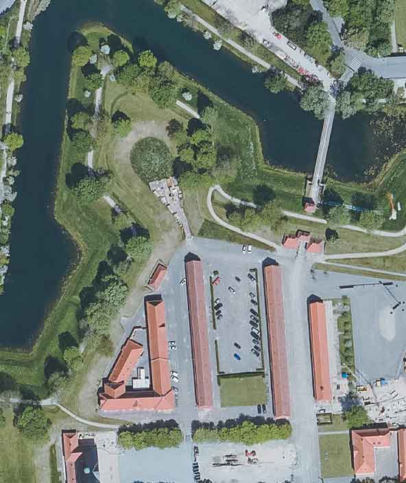
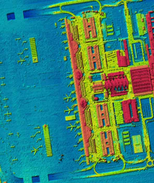
The HxGN Content Program, Hexagon’s aerial data program, offers the largest library of high-resolution aerial imagery, elevation data, 3D models and analytics across North America and Europe.
Since its inception in 2014, the Content Program has followed rigorous acquisition and processing standards to offer the high positional accuracy for various applications such as mapping, urban planning, asset management, feature extraction, object classification, app basemaps and more. The exceptional data consistency over large areas makes the solution an ideal training data set for machine learning and artificial intelligence algorithms.
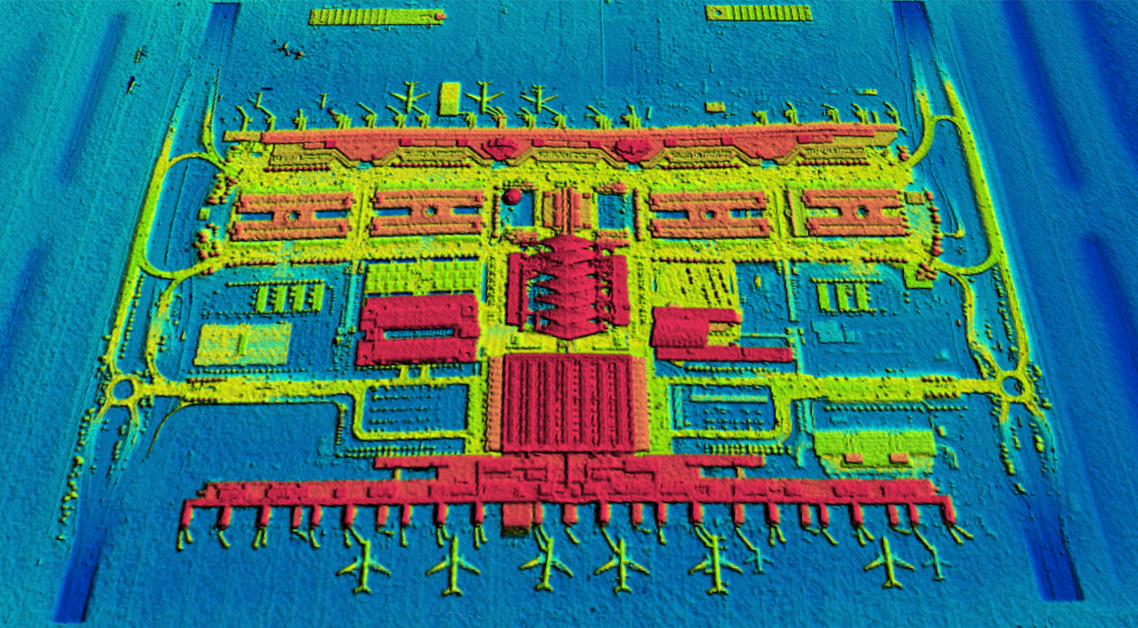
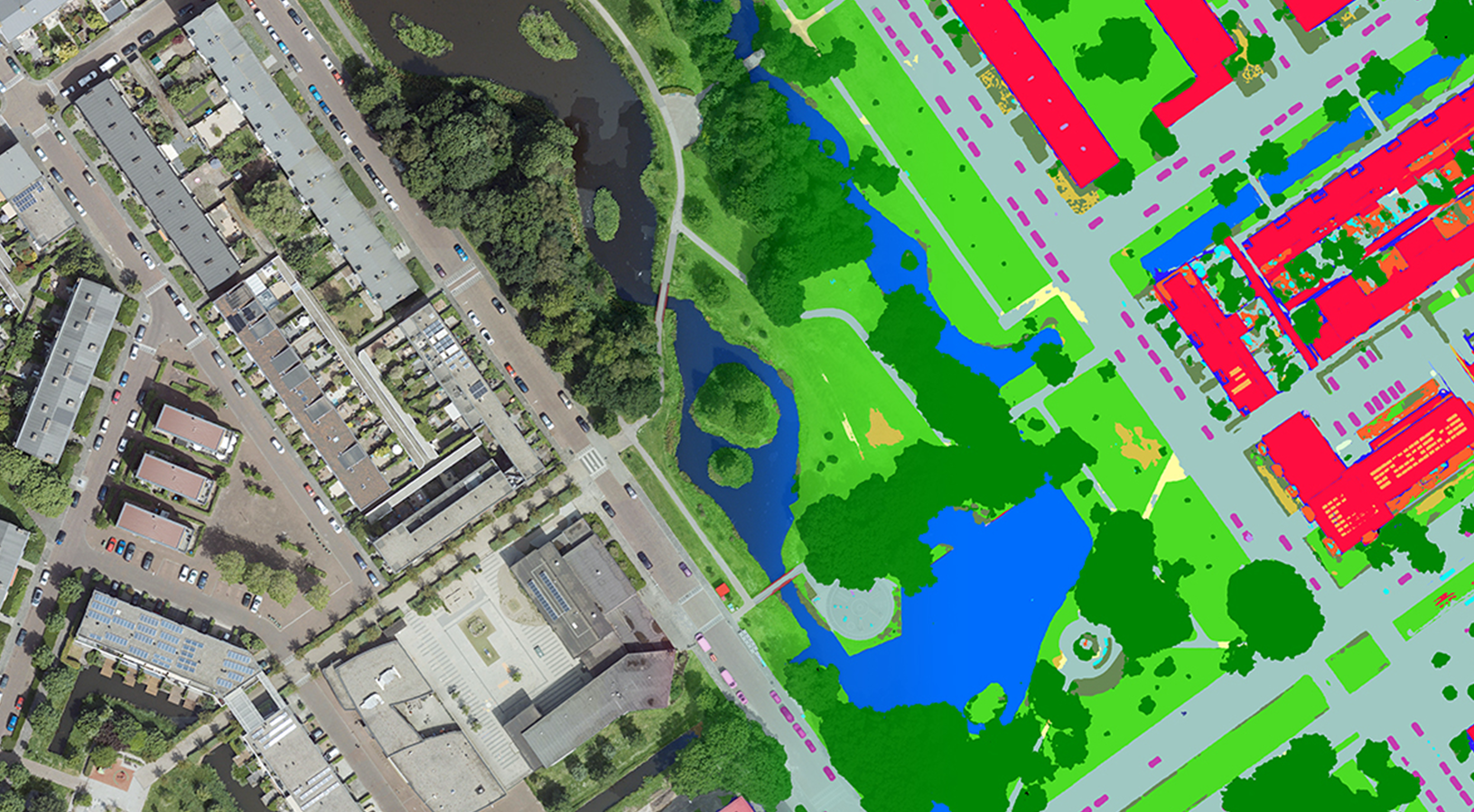
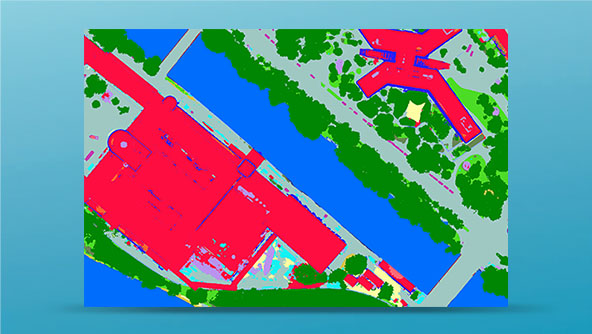
Extract information with AI & machine learning
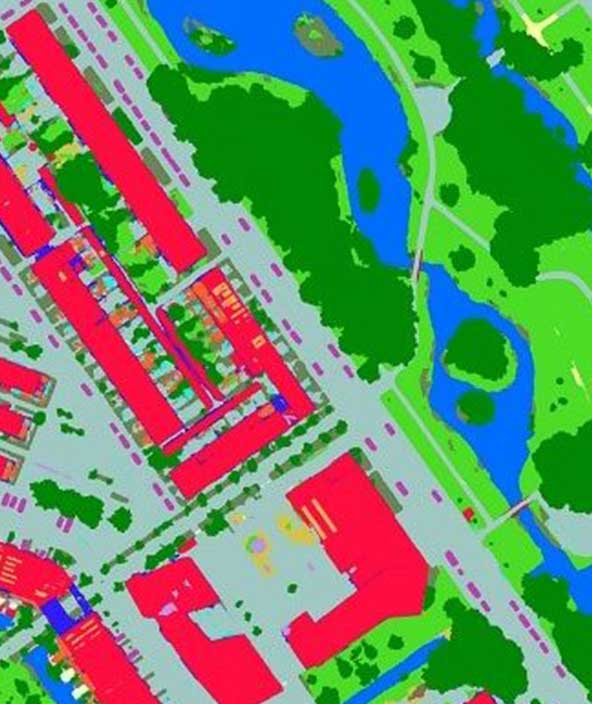
The unprecedented quality, consistency and repeatability makes Hexagon’s aerial data an ideal base for machine learning and AI applications to extract features and classify objects. This new way of extracting information from aerial data enables Hexagon as well as our customers and partners to provide intelligent information layers.
Typical extractions include land cover maps, building footprints and height models, vegetation classifications, transport infrastructure maps and many more. In addition, Hexagon offers flexible use terms that allow users to create any derived products.
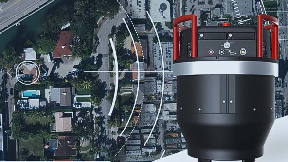
Geospatial Mapping Services
Is your area not covered by the HxGN Content Program? Do you need to cover large areas according to exact specifications? Hexagon provides mapping and data processing services for very select projects and in collaboration with our local mapping customers and partners. We only deploy our cutting-edge airborne sensor technology and workflows to provide best-in-class data quality.
Over the last ten years, our global production centers have processed over 30 million square kilometers of aerial data and feature some of the world’s best data centers for geospatial content creation, which have helped many customers temporarily scale their production capacities. Contact us to enquire about mapping and processing services.
- Overview
Democratising access to quality maps
Cities are growing due to urbanisation, rural areas are developing as infrastructure evolves and farmlands are adapting to feed an increasing population. Such rapid change outpaces the speed at which we can map countries, cities and infrastructure.
To keep up with the real world, Hexagon has changed the way we map. The HxGN Content Program continuously captures geospatial data and produces maps according to consistent specifications and refresh schedules, creating a standardised product suitable for many applications. As part of the “sharing economy” the data is made available to everyone through the cloud at affordable price points.
Together with our network of local partners, we are continuously expanding the coverage areas and data products of the HxGN Content Program to keep democratising access to high-quality maps.
- Data
High-quality cloud-based geospatial data
The HxGN Content Program, Hexagon’s aerial data program, offers the largest library of high-resolution aerial imagery, elevation data, 3D models and analytics across North America and Europe.
Since its inception in 2014, the Content Program has followed rigorous acquisition and processing standards to offer the high positional accuracy for various applications such as mapping, urban planning, asset management, feature extraction, object classification, app basemaps and more. The exceptional data consistency over large areas makes the solution an ideal training data set for machine learning and artificial intelligence algorithms.
- Analytics
Extract information with AI & machine learning
The unprecedented quality, consistency and repeatability makes Hexagon’s aerial data an ideal base for machine learning and AI applications to extract features and classify objects. This new way of extracting information from aerial data enables Hexagon as well as our customers and partners to provide intelligent information layers.
Typical extractions include land cover maps, building footprints and height models, vegetation classifications, transport infrastructure maps and many more. In addition, Hexagon offers flexible use terms that allow users to create any derived products.
- Services
Geospatial Mapping Services
Is your area not covered by the HxGN Content Program? Do you need to cover large areas according to exact specifications? Hexagon provides mapping and data processing services for very select projects and in collaboration with our local mapping customers and partners. We only deploy our cutting-edge airborne sensor technology and workflows to provide best-in-class data quality.
Over the last ten years, our global production centers have processed over 30 million square kilometers of aerial data and feature some of the world’s best data centers for geospatial content creation, which have helped many customers temporarily scale their production capacities. Contact us to enquire about mapping and processing services.
Explore
Integrated airborne sensors and processing workflows offer complete solutions to address your specific application needs.
- Airborne solutions
Leica Geosystems' comprehensive airborne software provides the highest productivity for mission planning and data processing.
 Product
A multi-sensor post-processing platform for airborne sensors. Enables creation of all known data products in one interface.
-
×Partial autonomyLeica HxMap guides users through the geospatial data production process from data injest to product delivery.
-
- Airborne solutions
Leica Geosystems airborne solutions offer sensor technology and processing workflows for efficient mapping.
 Product
A hybrid oblique imaging and LiDAR airborne sensor. Efficiently digitalises cities and creates accurate 3D models and meshes.
-
×Human-Assisted autonomyCapturing data with the Leica CityMapper is enabled by an automated workflow from flight planning to product creation.
 Product
The Leica ContentMapper is an innovative, efficient airborne mapping solution for large-scale geospatial content collection.
-
×Human-Assisted autonomyCapturing data with the Leica ContentMapper is enabled by an automated workflow from flight planning to product creation.
-
Hexagon solutions help you visualise, document and verify every stage of construction projects.
 FeaturedProduct
Hexagon’s Deviation Analysis automates quality assurance by comparing as-built scan data to 3D design models, detecting deviations, predicting clashes, and providing actionable insights to improve construction accuracy and reduce rework.
-
×Conditional autonomyAutomatically identifies construction deviations and predicts clashes using AI-driven scan data for proactive quality assurance and insights.
 Product
Efficiently capture 360° photos, videos, and 2D images, mapped to online floor plans for seamless access, sharing, and visualization.
-
×Human-Assisted autonomyAutomatically maps captured 360° photos, videos, and 2D images to online floor plans, streamlining documentation and visualization.
-
 Product
Track construction progress with 360° photos linked to BIM for real-time visibility, collaboration, and schedule risk mitigation.
-
×Partial autonomyAutomatically maps 360° photos to BIM, providing real-time progress insights and collaboration tools with minimal manual effort.
Geospatial data from the largest database of consistent, high-resolution aerial imagery and elevation data.
- Geospatial content
The world’s largest database of consistent, high-resolution aerial imagery, elevation data, 3D models and analytics.
 Product
3D Models
×HxGN Content ProgramUnlock deeper insights using ultra-high-definition 3D digital twins of your urban environment.
-
×Partial autonomyIdeal for creating simulations and deriving analytics of dense urban environments via AI and ML algorithms.
-
 Product
Aerial Imagery
×HxGN Content ProgramTransform your geospatial project with high-resolution aerial imagery that enables you to make better-informed decisions.
-
×Partial autonomyExtensive coverage and consistency makes it ideal for deriving analytics and extracting features using AI and ML algorithms.
 Product
Analytics
×HxGN Content ProgramMonitor the changing landscape with maps that offer more information and context about your area of interest.
-
×Partial autonomyDetailed AI-based vector maps offer context to analyse and monitor the urban landscapes.
-
 Product
Elevation Data
×HxGN Content ProgramMeasure and analyse the earth's surface and above-ground features with high-accuracy elevation data.
-
×Partial autonomyElevation data is key to simulations, interpreting the environment and extracting height maps.
-
Industry-revolutionising survey software expands capabilities with seamless field and office workflows.
- Survey software
Office software to prepare, compile, compare and analyse measurement data and create deliverables.
 Product
LISCAD is a field-to-finish surveying and engineering software that processes survey data from all major equipment models.
-
×Human-Assisted autonomyThe customisable CAD output parameter files in LISCAD allows automated creation of survey plan annotations via feature codes.
-
 Product
Listech Neo is an easy-to-use surveying and geospatial software that easily transforms raw data into useful information.
-
×Human-Assisted autonomyNeo's inbuilt query language provides a powerful automation tool for creating and editing attributes associated with objects.
-