ERDAS IMAGINE

World’s preferred remote sensing software package
Save time and money, leverage existing data investments and improve image analysis capabilities.
Geographic imaging professionals need to process vast amounts of geospatial data every day — often relying on software designed for other purposes and add-on applications that create almost as many problems as they solve.
Save time and money, leverage existing data investments and improve image analysis capabilities with ERDAS IMAGINE. Available in four product tiers, it provides true value, consolidating remote sensing, photogrammetry, LiDAR analysis, basic vector analysis and radar processing in a single product.

ERDAS IMAGINE is available in four product tiers, providing the right level of functionality.
| IMAGINE Essentials |
IMAGINE Advantage |
IMAGINE Professional |
IMAGINE Photogrammetry |
|
|---|---|---|---|---|
| Image, vector and LiDAR mapping and visualization tools that allow different types of geospatial data to be combined and quickly organized for projects | IMAGINE Essentials | IMAGINE Advantage | IMAGINE Professional | IMAGINE Photogrammetry |
| Precise mapping with sensor model support and geospatial data processing functions such as mosaicking, radar analysis, change detection and image analysis | IMAGINE Essentials | IMAGINE Advantage | IMAGINE Professional | IMAGINE Photogrammetry |
| Hyperspectral image analysis, advanced multispectral image and point cloud classification, artificial intelligence (AI) capabilities as well as advanced graphical spatial data modeling, which is a unique capability for analyzing spatial data | IMAGINE Essentials | IMAGINE Advantage | IMAGINE Professional | IMAGINE Photogrammetry |
| Block-based triangulation can be used to transform raw imagery into accurate and reliable ortho images, terrain models or point clouds with dozens of rigorous and RPC geometry models | IMAGINE Essentials | IMAGINE Advantage | IMAGINE Professional | IMAGINE Photogrammetry |
Each product adds new functionality to the supported product tiers.
| IMAGINE Essentials |
IMAGINE Advantage |
IMAGINE Professional |
IMAGINE Photogrammetry |
|
|---|---|---|---|---|
|
ERDAS Engine
Expand your processing power by distributing demanding, resource-intensive processes to more cores and workstations. |
IMAGINE Essentials | IMAGINE Advantage | IMAGINE Professional | IMAGINE Photogrammetry |
|
MrSID Desktop and Workstation
Compress large amounts of imagery to the MrSID wavelet format. |
IMAGINE Essentials | IMAGINE Advantage | IMAGINE Professional | IMAGINE Photogrammetry |
|
IMAGINE Stereo Analyst
Simple stereo viewing and 3D feature extraction. |
IMAGINE Essentials | IMAGINE Advantage | IMAGINE Professional | IMAGINE Photogrammetry |
|
IMAGINE Terrain Editor
An extensive toolset to edit your terrain data draped directly over a stereo image pair. |
IMAGINE Essentials | IMAGINE Advantage | IMAGINE Professional | IMAGINE Photogrammetry |
|
ATCOR Workflow For IMAGINE
Removes haze as well as atmospheric and topographic effects and generates true surface characteristics. The results are brilliant images and appropriate input data for multitemporal analysis. |
IMAGINE Essentials | IMAGINE Advantage | IMAGINE Professional | IMAGINE Photogrammetry |
|
IMAGINE Expansion Pack
Advanced tools for realistic 3D visualization, NITF support, radar DEM extraction, stereo feature collection, wizard-based change detection, and automated image to image registration. |
IMAGINE Essentials | IMAGINE Advantage | IMAGINE Professional | IMAGINE Photogrammetry |
|
IMAGINE SAR Interferometry
Advanced radar interferometry that includes coherence change detection, time series change analysis, displacement mapping, and DEM extraction. |
IMAGINE Essentials | IMAGINE Advantage | IMAGINE Professional | IMAGINE Photogrammetry |
|
IMAGINE SAR Feature Extraction
Extracts features and information from Your radar images. |
IMAGINE Essentials | IMAGINE Advantage | IMAGINE Professional | IMAGINE Photogrammetry |
|
IMAGINE Objective
Intuitive object based classification to identify and extract feature data from imagery. |
IMAGINE Essentials | IMAGINE Advantage | IMAGINE Professional | IMAGINE Photogrammetry |
|
ERDAS IMAGINE LiveLink for Google Earth Engine
Adds access to the Google Earth Engine data and processing within the Spatial Modeling environment. |
IMAGINE Essentials | IMAGINE Advantage | IMAGINE Professional | IMAGINE Photogrammetry |
|
Spatial Modeler SDK
Spatial Modeler SDK is a C++ toolkit for building custom extensions for the Spatial Modeler environment. Either IMAGINE Professional or GeoMedia Professional is required. |
IMAGINE Essentials | IMAGINE Advantage | IMAGINE Professional | IMAGINE Photogrammetry |
|
IMAGINE DSM Extractor
Computer cluster-enabled automatic surface modeling from stereo imagery. |
IMAGINE Essentials | IMAGINE Advantage | IMAGINE Professional | IMAGINE Photogrammetry |
|
ORIMA
Adds engineering-grade aerial triangulation capability for ADS and frame sensor imagery. |
IMAGINE Essentials | IMAGINE Advantage | IMAGINE Professional | IMAGINE Photogrammetry |

Unleash imagery potential
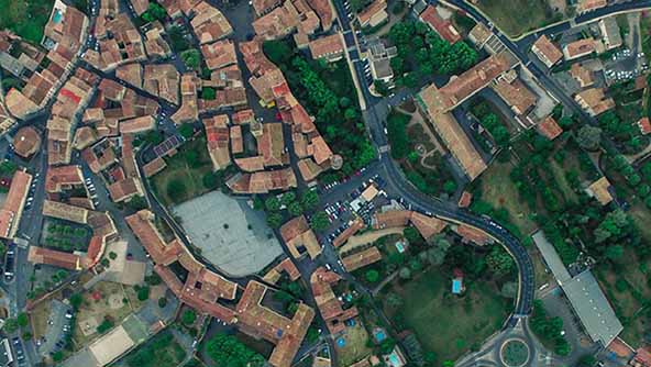
Simplify image classification and segmentation, orthorectification, mosaicking, reprojection, elevation extraction and image interpretation.

Multiple classification solutions
Access K-Means, ISODATA, object-based image segmentation, machine learning and deep learning AI algorithms.

Point cloud processing
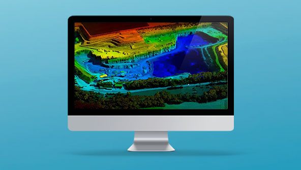
Display, edit and analyze point clouds derived from LiDAR or point correlation of stereo pairs.

Spatial Modeler
Capture domain expertise and turn it into reusable algorithms thanks to the flexibility of the graphical editing environment.
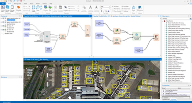
History of machine learning
Machine learning has been in wide use in the geospatial industry since the 1980s. Processing satellite images using K-Means or ISODATA clustering algorithms was one of the first uses of remote sensing software like ERDAS IMAGINE. In more recent years, Bayesian networks, classification and regression trees (CART), support vector machines (SVM) and random forests have all been used to extract features from imagery in user-interactive workstations.
With the advent of powerful computers and proliferation of high-resolution images, deep learning has boomed. Deep learning technology is now used as one of the main technologies in addressing challenges in urban planning, agriculture, disaster management and defense.
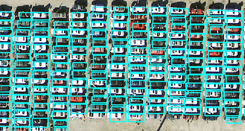
Target/object detection and identification
Target/object detection and identification is one of the tasks geospatial analysts perform. With the increased amount of data being collected and shorter revisit cycles, manual identification of targets is becoming nearly impossible. Fortunately, this analysis can be performed faster using AI, by training a deep learning algorithm to detect and identify the targets/objects of interest. Once trained, the trained DL model can process new images faster and with higher accuracy. The work of the geospatial analyst is then be focused on quality control and final analysis.
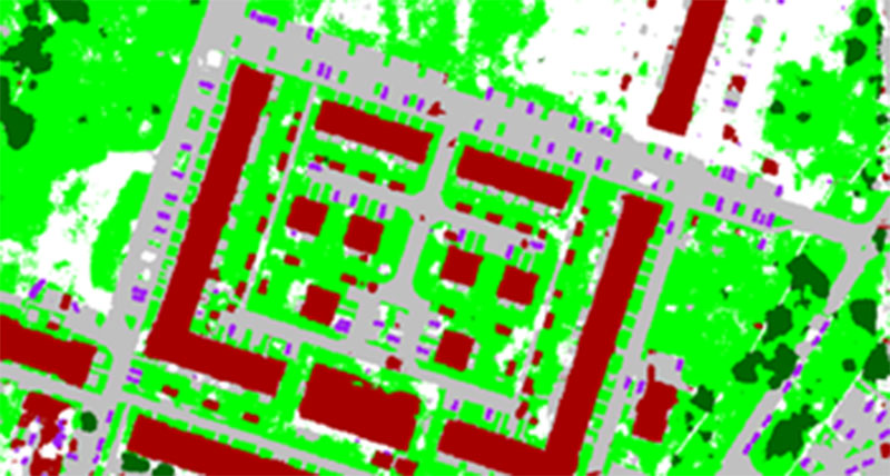
Deep learning-based semantic segmentation
Pixel-level image classification is as old as images, and numerous techniques have been developed to perform the task. One of the drawbacks of pixel-based image classification is the salt and pepper effect in the results.
Deep learning-based semantic segmentation solves this problem by looking at the spectral and geometric relationships of neighboring pixels. Pixels that have similar spectral properties and form the shape of the training classes are grouped together to avoid the salt and pepper problem encountered in traditional classification techniques.
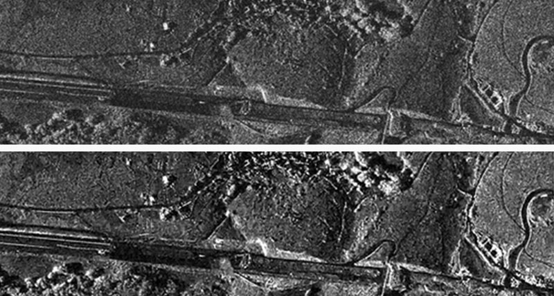
AI-based despeckle functionality
These two versions of a synthetic aperture radar (SAR) image clearly demonstrate the advantage of using AI-based despeckle functionality. The lower image, after despeckling, shows features at all scales more clearly defined and with better contrast. This cleanup is desirable for both human and machine interpretation.
The despeckle deep learning model is fully automatic; analysts do not need to make decisions to optimize the operation. This functionality is idea for rapid, automatic behind-the-scenes preprocessing of all radar images, regardless of their intended use.
Videos
- AI, machine learning and deep learning - part 1
- AI, machine learning and deep learning - part 2
- Introduction to machine learning in Spatial Modeler
- Machine learning: Feature data preparation
- Machine learning: Feature classification
- Machine learning: Training data preparation for raster classification
- Machine learning: Raster classification
- Object detection (oil palm mapping)
Customer success stories
-
Brochures
-
Case studies
-
Videos
-
White papers
-
Technical documents
ERDAS IMAGINE Add-ons
ERDAS Extensions for ArcGIS
Spatial Modeler SDK
ImageStation
M.App Enterprise
ERDAS APOLLO
M.App X
Need assistance? Our dedicated support team is ready to provide expert guidance and timely solutions.
We offer a range of services, including:
- Technical alerts: Stay informed with critical notifications about security updates, urgent issues and other important time-sensitive information
- Licensing: Quickly and easily generate run-time licenses
- Developer content: Access a wealth of resources, tools and documentation to aid in your development efforts
- Tutorials: Learn how to effectively use our products through step-by-step guides and tutorials
- Q&A: Find answers to common questions or post your own inquiries in our active community forum
- Release information: Stay informed about the latest product releases, updates and known issues
Visit our online home for customer support, software licensing, product tutorials, user community engagement and more.


