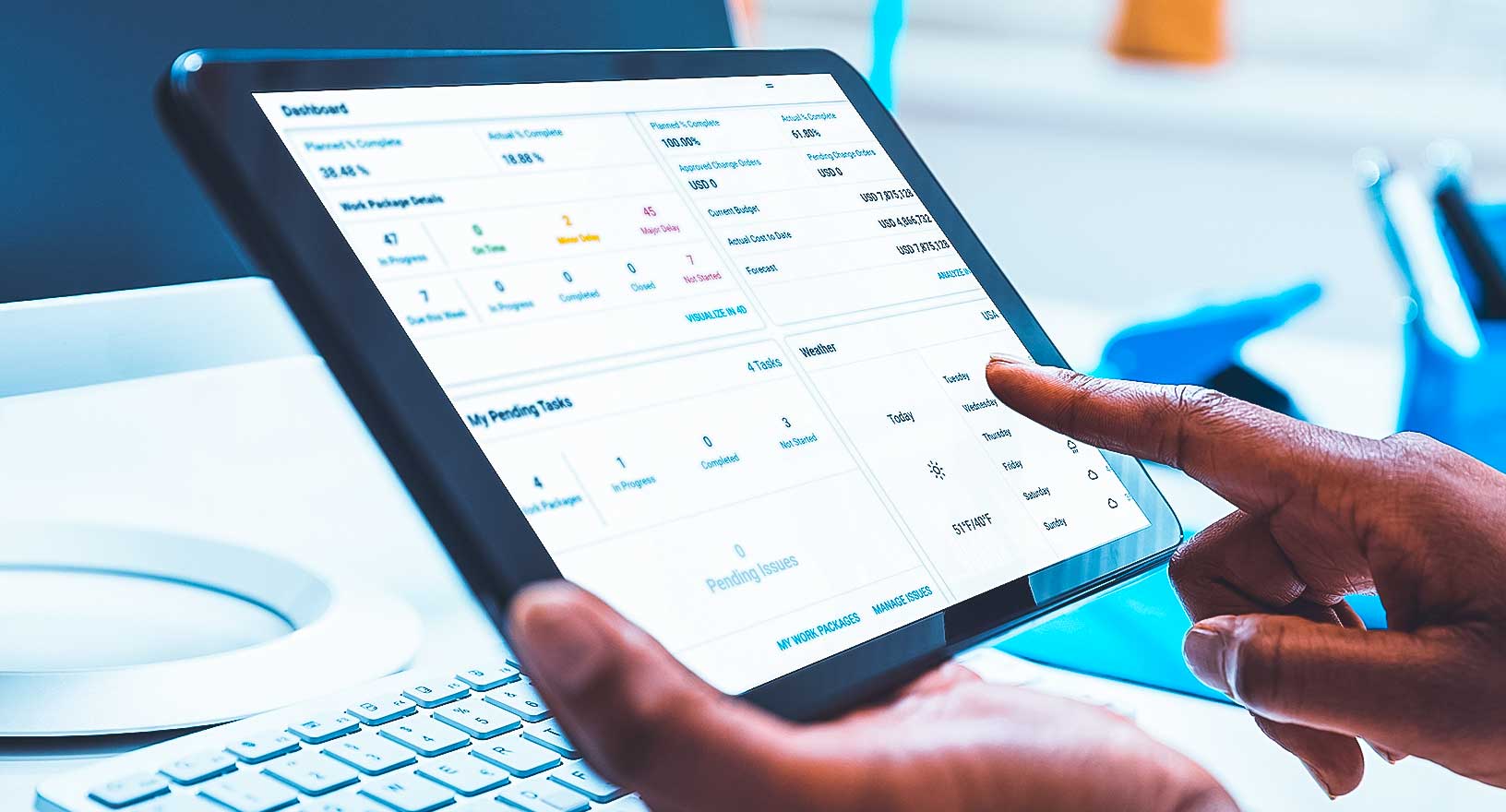
Map-based Dashboards and Apps
Create dynamic maps, dashboards and applications to improve services, assets and more.

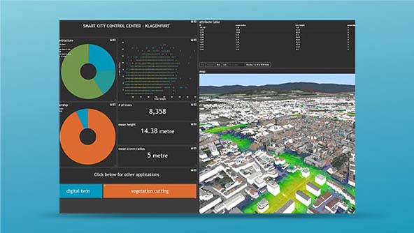
Urban digital twins and climate change
In this white paper, learn how cities can use an urban digital twin to solve specific challenges and create value for officials and residents.
Hexagon gives governments and businesses the ability to create dynamic geospatial dashboards and applications that monitor, evaluate and operationalise data from maps, imagery, IoT sensors, real-time feeds, databases and more to improve their services.
-
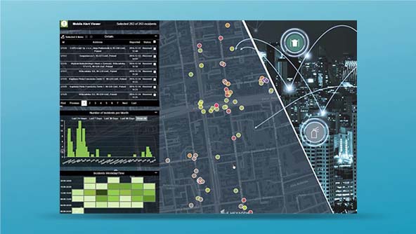
Public safety
-
Public services
-
Transportation
-
Utilities
-
Mapping
From high-profile events to daily operations, Hexagon's dynamic map-based dashboards and applications help public safety agencies make data-driven decisions to improve citizen and community safety. With our platforms, police and other emergency services can leverage maps and imagery, monitor real-time data, analyse and report crime and incident trends and more.

With our geospatial platforms, government authorities and departments can visualise, analyse and share location-based information impacting residents, infrastructure and services. Our map-based solutions improve planning, streamline administration and enhance daily operations for land and property administration, public works, emergency management and numerous other public services.

From fleet management to network operations to service optimisation, Hexagon’s dynamic map-based dashboards and applications combine spatial data with real-time information about passengers, assets and more to help transportation authorities and departments improve planning, operations and maintenance, service reliability and safety.
Hexagon’s dynamic map-based dashboards and applications help utilities and telecommunication companies monitor and analyse information about their networks, assets, service territories, customers and more. Our geospatial platforms streamline planning and operations processes and help decision-makers obtain greater insights about their services and networks.

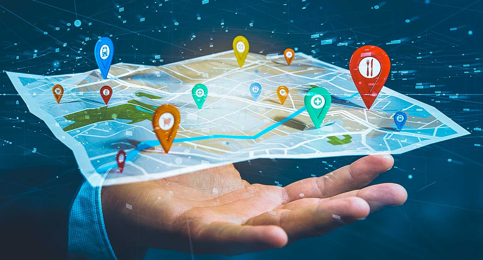
With our geospatial platforms, any organization can embed location-based visualisation, analysis and capabilities into their workflows. From sharing maps to empowering customers and employees to deriving greater insights into services and operations, Hexagon’s dynamic map-based dashboards and applications help mapping providers and location-enabled services improve their productivity, effectiveness and outcomes.
- Public safety
From high-profile events to daily operations, Hexagon's dynamic map-based dashboards and applications help public safety agencies make data-driven decisions to improve citizen and community safety. With our platforms, police and other emergency services can leverage maps and imagery, monitor real-time data, analyse and report crime and incident trends and more.
- Public services
With our geospatial platforms, government authorities and departments can visualise, analyse and share location-based information impacting residents, infrastructure and services. Our map-based solutions improve planning, streamline administration and enhance daily operations for land and property administration, public works, emergency management and numerous other public services.
- Transportation
From fleet management to network operations to service optimisation, Hexagon’s dynamic map-based dashboards and applications combine spatial data with real-time information about passengers, assets and more to help transportation authorities and departments improve planning, operations and maintenance, service reliability and safety.
- Utilities
Hexagon’s dynamic map-based dashboards and applications help utilities and telecommunication companies monitor and analyse information about their networks, assets, service territories, customers and more. Our geospatial platforms streamline planning and operations processes and help decision-makers obtain greater insights about their services and networks.
- Mapping
With our geospatial platforms, any organization can embed location-based visualisation, analysis and capabilities into their workflows. From sharing maps to empowering customers and employees to deriving greater insights into services and operations, Hexagon’s dynamic map-based dashboards and applications help mapping providers and location-enabled services improve their productivity, effectiveness and outcomes.
Explore products
Our geospatial platforms provide tools for building real-time situational awareness applications and interactive dashboards.
 Platform
Google APIs from Hexagon for adding maps, routes and places capabilities to web and mobile apps
-
×Human-Assisted autonomyMaps can be updated automatically.
-
 FeaturedPlatform
A platform for configuring applications featuring 2D and 3D maps, business intelligence tools and office-to-field workflows
-
×Partial autonomyTriggers human-defined workflows which can notify field units and mobile operators on incidents automatically.
Our solutions combine technology, business data and workflows to improve government, transportation and defence operations.
 Solution
A dynamic solution for visualising and managing assets with an actionable digital twin of public transit networks
-
×Partial autonomyIncludes algorithms for predictive maintenance. Notifications can be sent out automatically.
 Solution
A cloud-based service that provides governments and utilities with crowdsourced location-based information from the public
-
×Human-Assisted autonomyAutomatic notifications can be set up.