HxGN Mass Transit
See HxGN Mass Transit in action
See how public transportation operators can easily plan and coordinate maintenance activities with HxGN Mass Transit.
See HxGN Mass Transit in action
See how public transportation operators can easily plan and coordinate maintenance activities with HxGN Mass Transit.
Request pricing
I am interested in finding out more about pricing.
Benefits
Edit and access transportation network data
Individuals across the entire public transportation organization can create data, maps, reports and queries for their projects, instead of having to rely on GIS specialists.

Inspect and capture asset data in the field
A mobile app configured to your organization's needs gives workers total access to data needed to fulfill specific tasks.
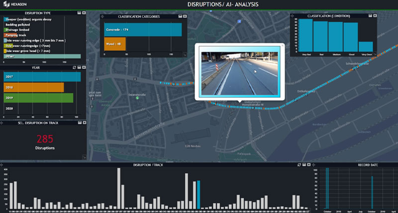
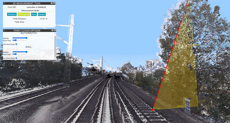
Analyze and monitor for improved planning
Leverage HxDR and AI to enhance digital twins for powerful analytics and precise measurements, like verifying bus fit on roads.
Edit and access transportation network data
Individuals across the entire public transportation organization can create data, maps, reports and queries for their projects, instead of having to rely on GIS specialists.
Capabilities
-
Network
-
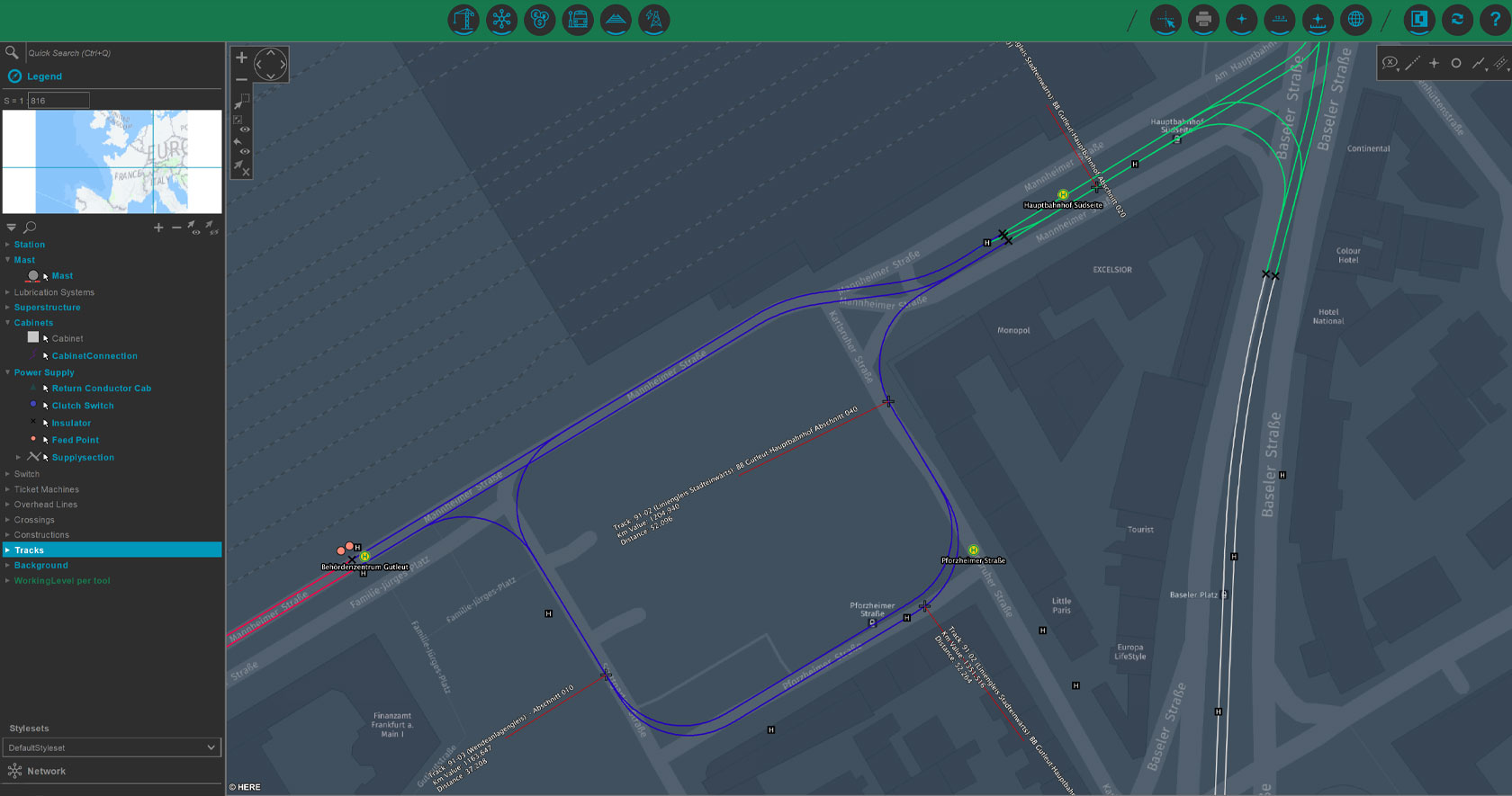
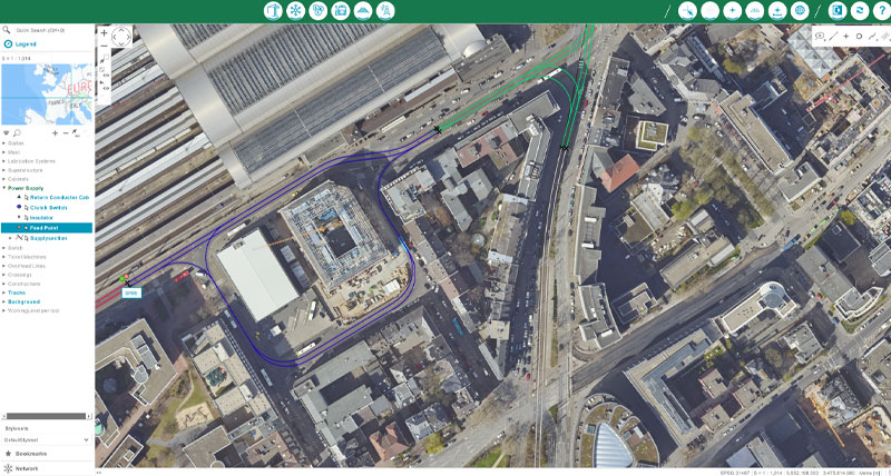
Track characteristics
-
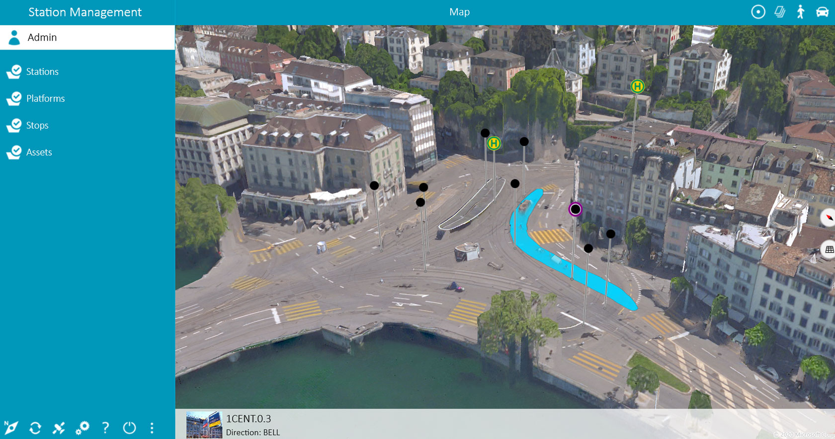
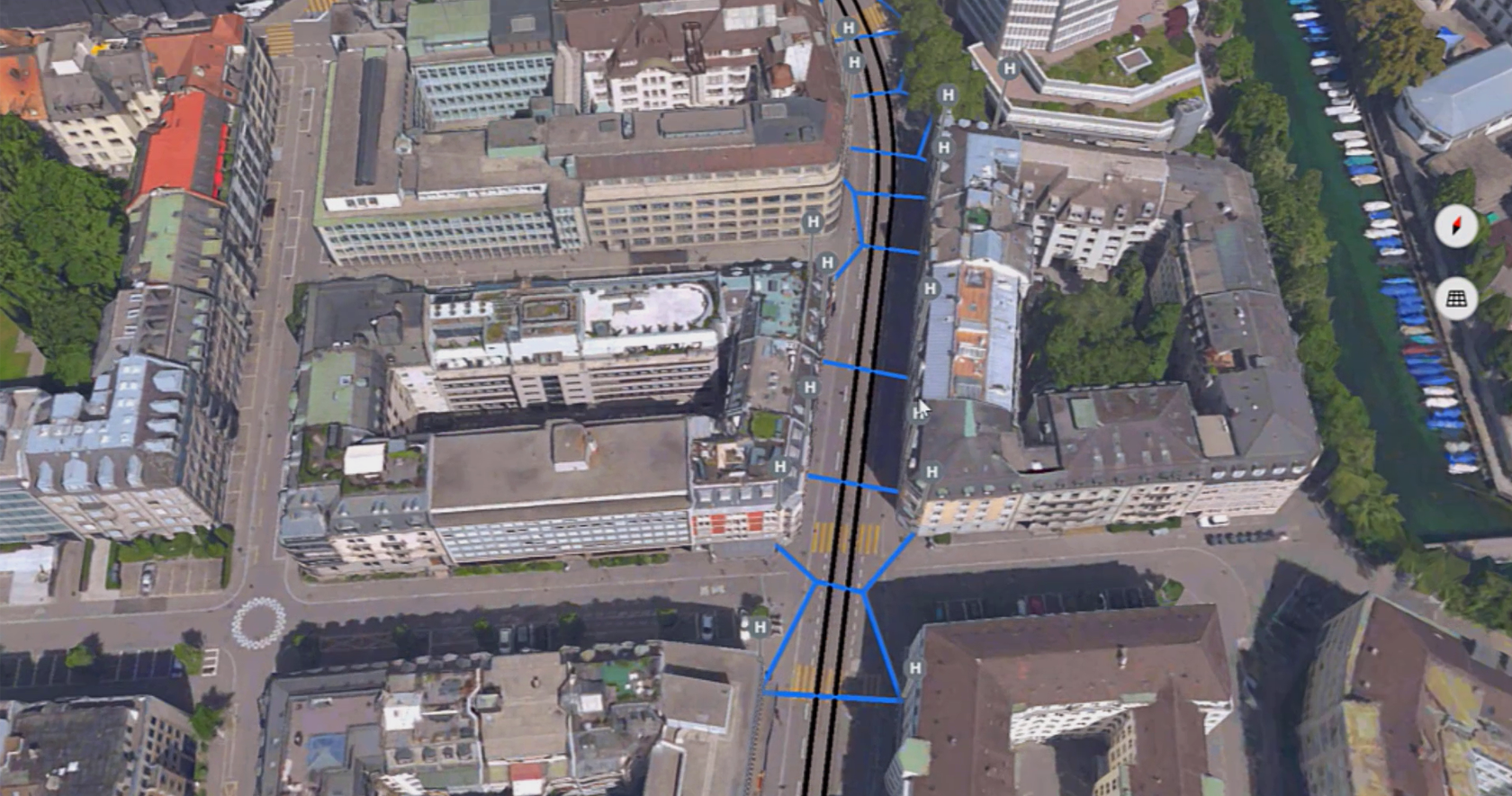
Station management
-
Electrification
-
Construction / Building
More information

All aboard to digitally transform
Streamline your processes. Optimize your assets, infrastructure and workforce. Improve your network’s efficiency and reliability.
Built on M.App Enterprise
By leveraging our platform for building smart monitoring solutions, organizations can visualize, inspect, validate and share data in desktop, browser and mobile devices.

Support portal
Visit our online home for customer support, software licensing, product tutorials, user community engagement and more.
All aboard to digitally transform
Streamline your processes. Optimize your assets, infrastructure and workforce. Improve your network’s efficiency and reliability.