Geospatial intelligence
Collect, produce, manage, analyse and exploit geospatial information to get actionable intelligence.

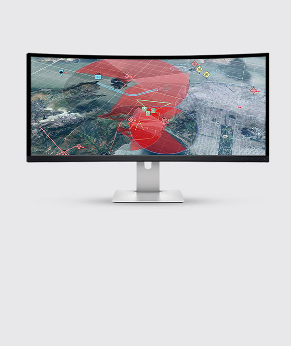
Machine learning for information supremacy
With AI, analysts can spend less time sifting through vast geospatial datasets and more time acting on results.
Hexagon provides capabilities for analysing and exploiting large amounts of map and imagery data for defence planning and operations.
From battlefields to command centers, our geospatial intelligence solutions help defence agencies transform data into informed decision-making.
Overview
Defence and intelligence agencies need to shorten the timeframe between geospatial data collection and producing geospatial intelligence that operators can act on.
Hexagon's geospatial intelligence capabilities help militaries integrate, analyse, exploit and disseminate information to support mission-critical planning and operations. Our solutions support:
- Data integration: Fuse maps, terrain and imagery with real-time weather, moving tracks and other data sources in their original formats for visualisation and analysis.
- Analysis and exploitation: Machine learning and advanced analytical tools automate the process of identifying targets and objects of interest.
- Product dissemination: In air, on land or at sea, share intelligence from command centers to the front line for faster decision-making.

Explore products
$ProductName
$SustainabilityImpactLabel
$SustainabilityCTABandHeadingLabel
We’re climbing the automation curve
Our transition to Intelligent automation is accelerating. Ultimately, our innovations will give rise to new technologies and applications - many of which we’ve yet to imagine. Today, every Hexagon solution is mapped and tagged according to its level of automation, so customers can clearly track our progress towards the freedom of autonomy.

Land
Products that make an environmental impact in forest monitoring, material reusability, farming or water usage.

Air
Products that make an environmental impact in renewable energy, noise pollution elimination and e-mobility.

Water
Products that make an environmental impact in saving our oceans, reducing pollution and increasing access to clean water.