
Solutions for Survey & Monitoring
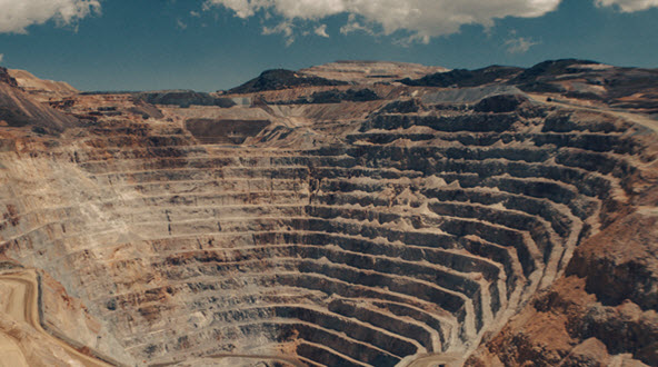
Mine surveying and monitoring are becoming increasingly exacting thanks to advances in terrestrial laser scanning, airborne laser scanning (Lidar), airborne photogrammetry and unmanned aerial vehicles (UAVs). Hexagon provides complete solutions for making sense of all the resulting data, pairing planning and visualisation software with solutions for infrastructure positioning; aerial, terrestrial and underground scanning; and processing the millions of point data generated by scanning.
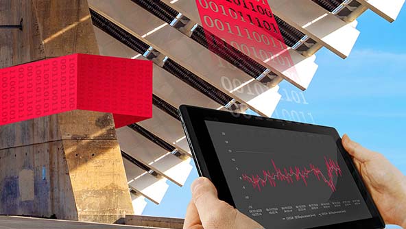
We help customers successfully manage, analyse and model survey data throughout the surface and underground mining lifecycle, integrating tools for 3D mine visualisation, block model management, slope stability monitoring, rockfall hazard mitigation, and structural monitoring of tailings dams, waste material dumps, plants and other mine infrastructure. Our full-scale, automated point cloud analysis and modelling includes flexible tools for inspecting and meshing data from the field and using it to create and update surfaces that can instantly update downstream processes such as coding block models with new topography percentages, creating long-term or short-term cuts and visualising mining progress.
Explore our solutions for Survey & Monitoring below.
-
 Product
Unleash the real power of field survey data by efficiently managing it and translating it into actionable insights.
-
 Product
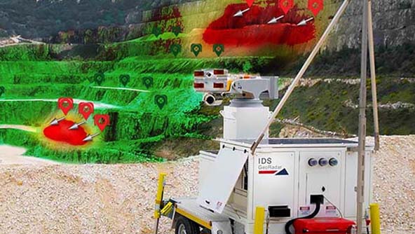
Innovative radar system able to locate, track and collect information on rockfalls, avalanches and debris flows in real time
-
×Conditional autonomyAfter user configuration, the system automatically detects rockfall events and triggers alerts.
-
-
 Product
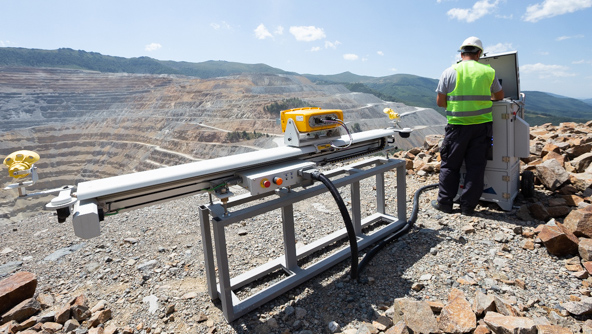
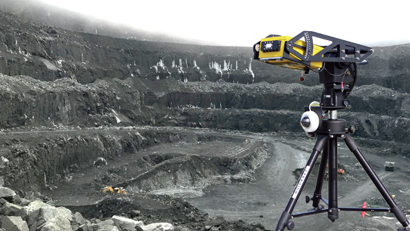
Ground-based semi-permanent radar for long-range monitoring of slopes in open pit mines, landslides and dams monitoring.
-
×Partial autonomyThe system autonomously acquires radar data, manages the supply system and provides diagnostic information.
-
-
 Product
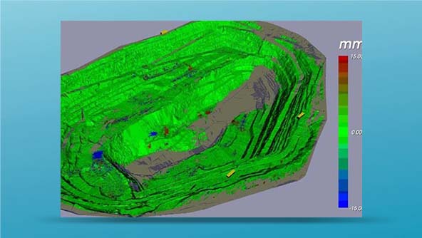
FPM360 TrueVector unifies data, giving monitoring experts a complete view of the entire pit for managing slope hazards.
-
×Partial autonomyAutomatic processing of data coming from multiple radars to produce vector displacement information.
-
-
 Product
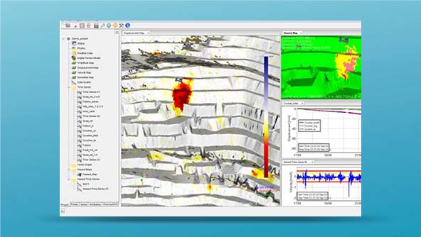
Software to manage slope stability risks, providing reliable data for fast interpretation and decision-making.
-
×Partial autonomyAutomatic alert and notification based on user-defined criteria applied to radar measurement (Hazard Map and Time series).
-
-
 Product
The HxGN GeoMonitoring Hub can analyse and cross-check all measurement results delivered by automated monitoring systems.
-
×Partial autonomyAutomatic alert based on user defined criteria on geodetic and geotechnical sensor measurement.
-
-
 Product
Compact and portable high-resolution radar system for early warning and real-time focus monitoring in open pits, quarries, strip coal mines and tailing dams.
-
×Partial autonomyThe system autonomously acquires radar data, manages the supply system and provides diagnostic information.
-
-
 Product
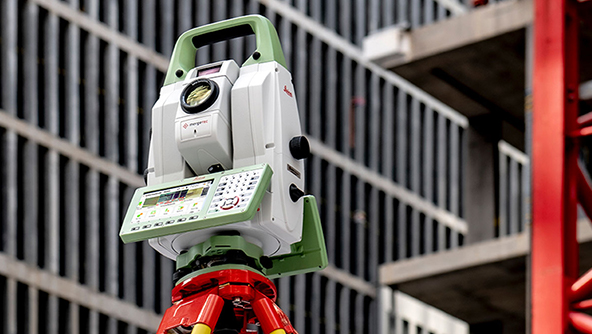
This multistation combines high-end total station capabilities with 3D laser scanning, GNSS connectivity and digital imaging.
-
×High autonomyThe MS60 enables to perform automated all surveying and layout tasks with a single instrument, including 3D laser scanning.
-
-
 Product
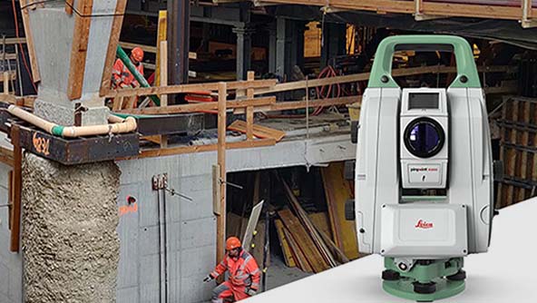
The pefect total station for permanent or campaign monitoring projects, performing secure and continuous data collection.
-
×Human-Assisted autonomyThe TM60 enables autonomous measurement and monitoring of complex structures and objects.
-
-
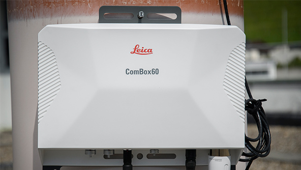
 Product
Future-proof GNSS receiver delivering 24/7 high-precision monitoring with robust connectivity and onboard analytics.
-
 Product
Automatic deformation software connects to any sensor hardware and monitors, collects, controls, processes and combines data.
-
×Partial autonomySensors are set up in the software with defined thresholds, the software runs and only triggers for intervention when needed.
-
-
 Product
The monitoring software for autonomous sensor control and uninterrupted data logging in the field.
-
×Human-Assisted autonomyAutonomous monitoring sensor control, ensuring a continuous dataflow.
-
-
 Product
The semi-automated campaign monitoring solution.
-
 Product
Communication and power management for simple in-field monitoring sensor setup that supports IoT and autonomous operation.
-
×High autonomyAutonomous control of field sensors in communication failure and remotely stores data until connections are restored.
-
-
 Product
Ground-based radar combining strength of SAR technology with full 3D spatial resolution for long-range open-pit mine monitoring with 360° coverage.
-
×Partial autonomyThe system autonomously acquires radar data, manages the supply system and provides diagnostic information.
-