Achieving ambitious climate goals with a digital twin
Klagenfurt, Austria, realized carbon savings of 14,000 tons of avoided CO2 emissions

The challenge
Klagenfurt is the only city in Austria to be part of the EU Cities Mission 2030. It has set a goal of being climate neutral by 2030. Its Smart City strategy sets out how it can achieve climate neutrality in nine fields of action, with more than 200 measures planned to ensure a sustainable, resilient living space for future generations.
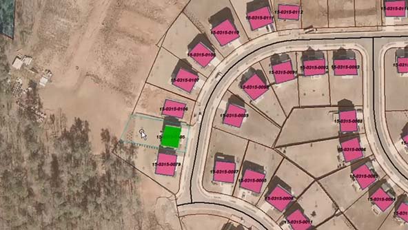
Like in many other countries, in Austria data is collected and updated extensively – including on a massive scale by municipal administrations. However, more data does not necessarily mean more knowledge, and the data collected and maintained is rarely shared, analyzed and made available in a practical way. The challenge was to connect and include all Klagenfurt stakeholders and to create a space where all the information can be easily accessed and handled.
The solution
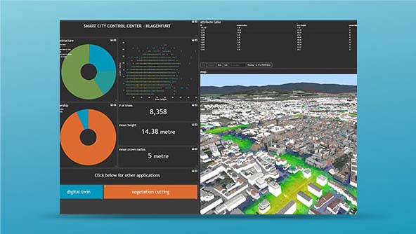
Klagenfurt approached longtime partner Hexagon to come up with a data-driven, AI-powered solution based on remote sensing, aerial filming, photogrammetry and municipal geodata – a solution that serves residents, City decision-makers, local craftsmen and industry at the same time.
Together with Hexagon, City representatives developed the Digital Twin Klagenfurt, a user-friendly web application. Using AI, the digital twin maps the total area of properties with different land use categories to better understand how properties within the city are used. The 3D model is accessible by the public. It shows how valuable individual plots of green space are for the urban area’s climate and provides initial information to assess if photovoltaic and solar thermal systems can be installed on building surfaces. A study aimed to quantify the carbon-positive effects of the digital twin shows impressive results: carbon savings of 14,000 tons of avoided CO2 emissions for each year in which the digital twin has been operational.
“This project is an important step into the future of our city. It demonstrates how we are using digital technologies to make Klagenfurt smarter, more efficient and more livable.”
Learn more
Also explore
ERDAS IMAGINE