Hexagon's Safety, Infrastructure & Geospatial division
Making the world's critical services and infrastructure more resilient and sustainable.

Are you ready for something more?
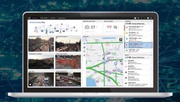
Go beyond dispatch and experience a full public safety platform

Lead the charge
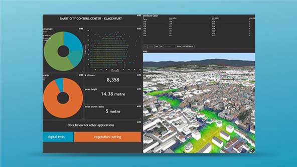
Power your sustainability efforts and move toward renewable energy grid management.

Hexagon announces acquisition of Qognify
Expanding solutions for enterprise physical security and business operations

We help our customers make a difference
We’re more than just digital reality software solutions. We’re innovators, problem solvers and partners. We’ve got your back.

Warfare reimagined: Unlocking superiority
By embracing digital transformation, defence forces can ensure they're ready for the evolving landscape of modern warfare.
Hexagon's Safety, Infrastructure & Geospatial division improves the resilience and sustainability of the world's critical services and infrastructure. Our technologies transform complex data about people, places and assets into meaningful information and capabilities for better, faster decision-making in public safety, utilities, defense, transportation and government.
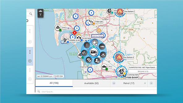
We are the global leader in public safety solutions, helping to protect 1 billion people.
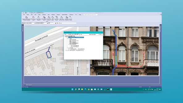
Building on our long-standing leadership in computer-aided dispatch, we provide a public safety platform for data collection, management, analysis, collaboration and response.
We enable reliable utilities and communications networks for 1 billion consumers.
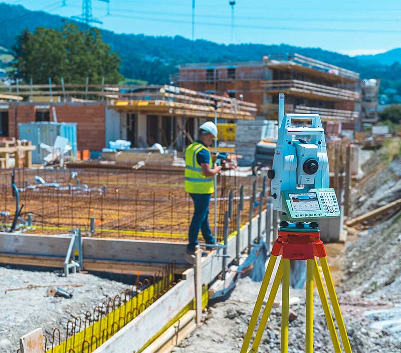
Leading electricity, gas, telecommunications and water service providers rely on us for their network planning, design, maintenance and real-time grid operations.
We support more than two dozen departments and ministries of national defense.
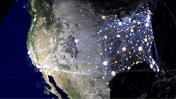
We deliver mapping and imagery intelligence capabilities and enable high-performance, real-time applications for command and control, mission planning and more.
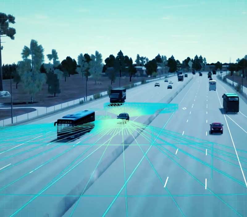
We ensure safe and efficient transportation for millions of travellers.
We support aviation, maritime, rail and road planning, operations and safety, from mapping and maintaining infrastructure to monitoring traffic and services.
We aid government services in more than 100 countries.
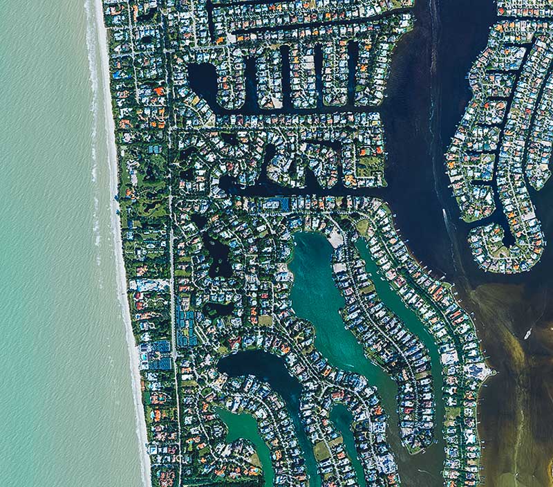
Our geospatial data collection, management and analysis capabilities support land and property administration, census taking, natural resources management, sustainability mobility and more.


-
 FeaturedPlatform
A collaborative SaaS workspace where teams and organizations can share and act on data in a secure environment
-
×Partial autonomyProvide actionable insights during complex emergencies. Uses AI and ML for filtering, highlighting, or subscribing to data.
-
-
 FeaturedSuite
Agile, cloud-deployable, next-gen call-taking and computer-aided dispatch capabilities for faster, more effective response
-
×Partial autonomyOnCall provides dispatcher with closest available units, roads to take, and informs other agencies about concern.
-
-
 FeaturedPlatform
A platform for configuring applications featuring 2D and 3D maps, business intelligence tools and office-to-field workflows
-
×Partial autonomyTriggers human-defined workflows which can notify field units and mobile operators on incidents automatically.
-
 FeaturedProduct
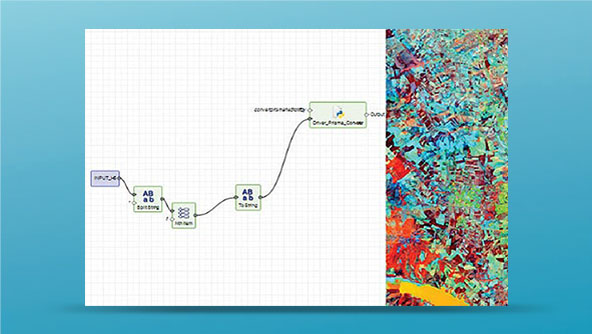
Industry-leading remote sensing software that provides complete tools for imagery and geospatial analysis
-
×Human-Assisted autonomyIncludes AI algorithms for automatic change detection, feature extraction, classification and more.
-
 FeaturedPlatform
Transform your utilities operations with a fully digital, GIS-based network and asset management solution
-
×Partial autonomyWhen assets are created, updated or deleted, business rules automatically run to maintain network topology and relationships.
-
-
 FeaturedPlatform
An API for building mission-critical geospatial desktop and onboard applications in C++ and C#
-
×Partial autonomyProvides the foundations for advanced geospatial analytics applications that can be used to automate operations.
-
 FeaturedPlatform
An all-in-one server for managing and publishing large volumes of data efficiently to numerous applications
-
×Partial autonomyProvides the foundations for advanced geospatial analytics applications that can be used to automate operations.
-
 FeaturedPlatform
A JavaScript API for building geospatial web applications that deliver desktop-like performance
-
×Partial autonomyProvides the foundations for advanced geospatial analytics applications that can be used to automate operations.
All products


- Resource library
- Blog
- Press releases
- Media coverage
-
Resources
- Support and communities
- Geospatial training
- Online training
-
Support and success
- Partners
- Education
- ISO certification
- AI ethical use statement
-
Additional programmes and information
Contact us
Latest articles
Read more- 25 July 2024
- 23 July 2024
- 18 July 2024
- 15 July 2024
- 12 July 2024