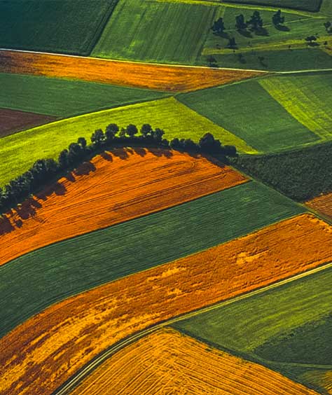
Geospatial mapping and analysis for farms
Use high-resolution imagery, geospatial tools and maps to gain insights for precision agriculture.

Land parcel identification system serves farmers efficiently
Learn how Hexagon's geospatial mapping and analysis solutions help farmers qualify for subsidies in the Netherlands.
From data on crop health, density and growing conditions to real-time field and crop inspections, Hexagon provides agriculture producers with GIS, remote sensing and smart mapping technologies to create precise and predictive digital farming methods.
Overview
Pollution, soil degradation and erosion all contribute to the declining amount of arable land available for farmers to grow the world’s food. The growing number of natural disasters adds to the struggles agriculture producers face to increase operational output.
Hexagon provides geospatial mapping and analysis solutions that help farmers create precise and predictive agriculture operations, maximising the use of land with minimal resources.
Whether it’s multispectral imagery analysis to identify stressed crops, AI-powered feature extraction for crop inventories or using land parcel identification to apply for subsidies, our mapping and analysis solutions make it easier to track and monitor production. Our solutions help farmers and agriculture managers create digital farming methods that streamline operations and enable them to quickly pivot to achieve optimal crop yields.

Explore products
$ProductName
$SustainabilityImpactLabel
$SustainabilityCTABandHeadingLabel
We’re climbing the automation curve
Our transition to Intelligent automation is accelerating. Ultimately, our innovations will give rise to new technologies and applications - many of which we’ve yet to imagine. Today, every Hexagon solution is mapped and tagged according to its level of automation, so customers can clearly track our progress towards the freedom of autonomy.
-
Level 0/None:
Human performs all tasks, no data being used
-
Level 1/Human-assisted:
Human is in charge of performing tasks but certain functions are automated to simplify control
-
Level 2/Partial:
Some tasks are automated so that operation can be autonomous for short periods (or within specific circumstances)
-
Level 3/Conditional:
Autonomous operation is possible within certain bounds, but human intervention may be necessary at short notice
-
Level 4/High:
Designed to complete required tasks autonomously, but may require human intervention if circumstances change beyond specific bounds
-
Level 5/Full:
Control tasks automated under all conditions, but human may request to take over; can complete all expected tasks without human intervention
Our sustainability influence
Our solutions create meaningful improvements in quality, efficiency, productivity, and safety – the antidotes to the status quo of waste, pollution, diminishing margins, and increased risk. Explore the highlighted products helping industry address environmental challenges in land, air and water.
Land
Products that make an environmental impact in forest monitoring, material reusability, farming or water usage.
Air
Products that make an environmental impact in renewable energy, noise pollution elimination and e-mobility.
Water
Products that make an environmental impact in saving our oceans, reducing pollution and increasing access to clean water.