Utility Detection: Underground and Unseen Structures
Uncover underground data and digitise the underground reality with multiple technologies.
Uncover the underground and digitally capture the subsurface data
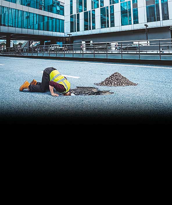
Cutting edge underground utility detection solutions for increased excavation safety and productivity.
Uncover the underground and digitally capture the subsurface data
Cutting edge underground utility detection solutions for increased excavation safety and productivity.
Hexagon is committed to providing you with detection solutions to uncover utility data, digitally capture the subsurface and immediately convert it into actionable information tailored to your needs—both in the field and the office.
Utility detection workflow
-
Avoid
-
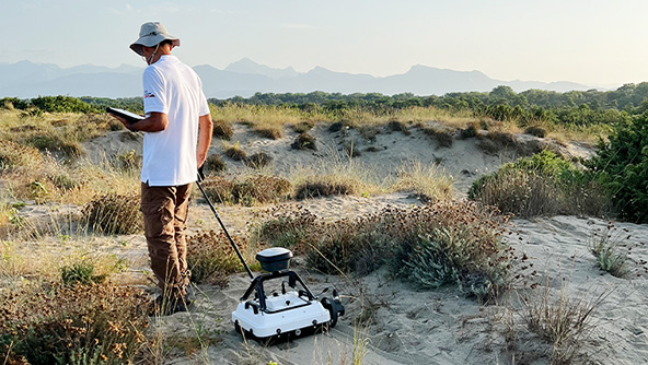
Locate
-
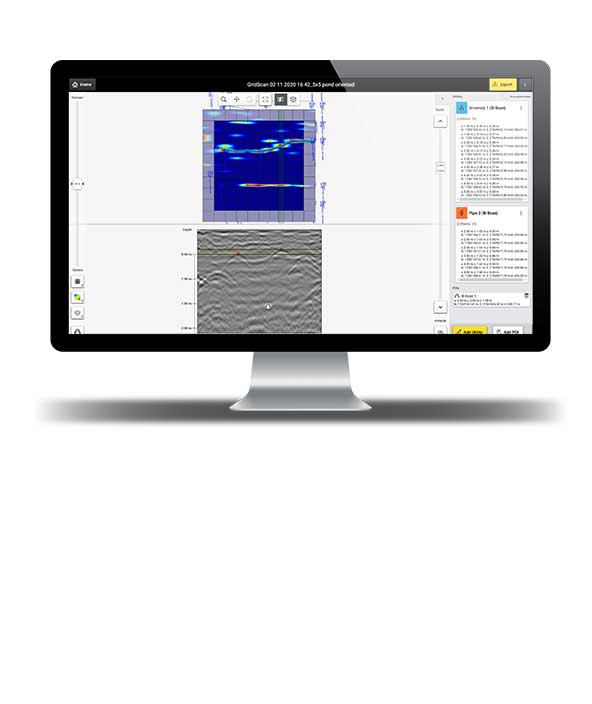
Map
-
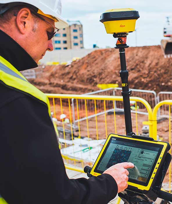
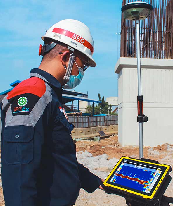
Positioning
Hexagon’s priority is to bring automation and simplicity to detection workflows, enabling users to locate underground utilities easily, quickly and reliably. We pioneered the democratisation of detection technologies and digitalisation of utility avoidance and mapping workflows.
Our solutions increase reliability and productivity. By adding positioning reference to the subsurface information, construction professionals can prevent locating challenges in the future.
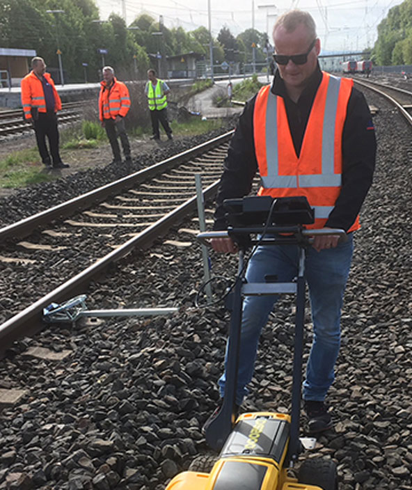
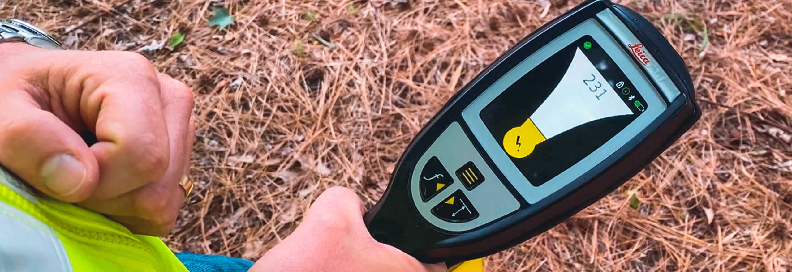
Using an underground utility detection solution that combines electromagnetic locator (EML) and GPS technology helps excavating and dirt-moving contractors not only avoid utility strikes, but also keep records of detection jobs and comply with local health and safety regulations.

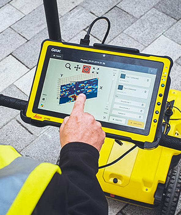
Using the latest Hexagon detection technologies such as electromagnetic locators (EML) and ground-penetrating radar (GPR), localising underground assets becomes a simple and efficient task. Our underground mapping solutions increase the safety of crews on-site and assure protection of buried utilities, ultimately minimising health and safety risks, unplanned costs and downtime.
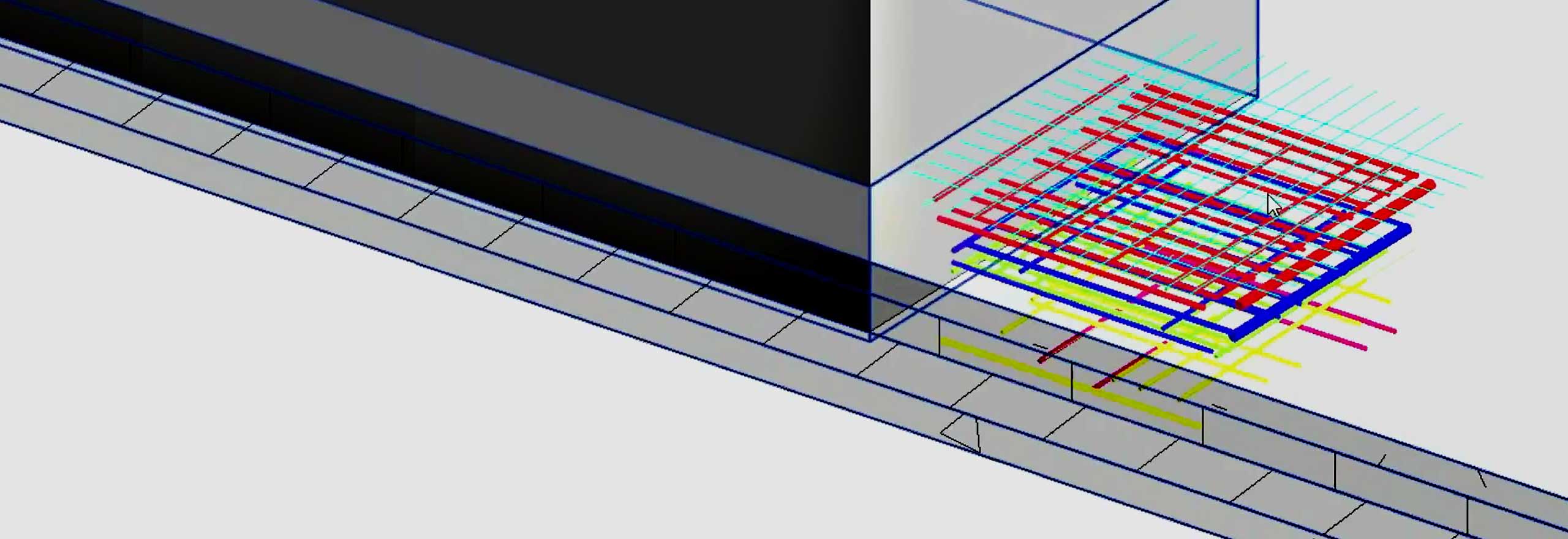
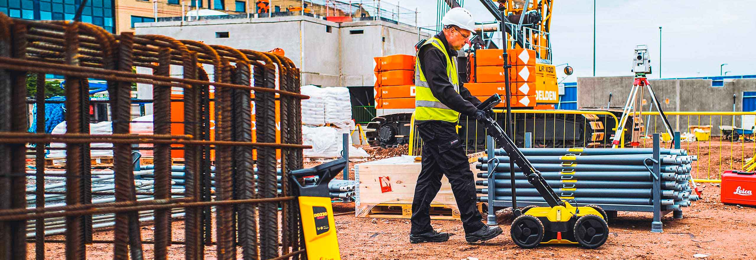
Hexagon underground detection solutions allow you to combine underground information with topographical surveys to create a comprehensive, detailed utility map.

Urbanisation is driving the need for smart cities where utilities workers and construction professionals work smarter with digital detection data. The installation of new utility infrastructure assets to meet growing demand leads utility providers to select digitalised tools and technologies that help improve business efficiencies and ensure the reality matches the design.
That’s why at Hexagon we create detection solutions that enable 3D visualisations of the reality above and below – because what's happening underground affects what's happening above ground. By combining different technologies, we create a 3D impression of our cities, including buried infrastructure assets.
With ground-penetrating radar technology (GPR) for buried assets and laser scanning for above-ground features, you can extensively capture any environment to make the best-informed decisions.

For positioning and measurement activities, a fit-for-purpose solution is required. Hexagon provides several technologies that can improve productivity by adopting a “digital first” approach.
Hexagon offers a complete portfolio of solutions ranging from total stations, GPS/GNSS equipment to laser scanning, mobile mapping and utility mapping and detection solutions and associated software. Our unrivalled product portfolio guarantees that a solution is available to embrace digitalisation.
Hexagons’ end-to-end workflow solutions help users process, report and share information more efficiently and accurately. Our positioning, measurement and reality capture technology can dramatically improve the way data is collected, managed, visualised and shared.

- Avoid
Hexagon’s priority is to bring automation and simplicity to detection workflows, enabling users to locate underground utilities easily, quickly and reliably. We pioneered the democratisation of detection technologies and digitalisation of utility avoidance and mapping workflows.
Our solutions increase reliability and productivity. By adding positioning reference to the subsurface information, construction professionals can prevent locating challenges in the future.
Using an underground utility detection solution that combines electromagnetic locator (EML) and GPS technology helps excavating and dirt-moving contractors not only avoid utility strikes, but also keep records of detection jobs and comply with local health and safety regulations.
- Locate
Using the latest Hexagon detection technologies such as electromagnetic locators (EML) and ground-penetrating radar (GPR), localising underground assets becomes a simple and efficient task. Our underground mapping solutions increase the safety of crews on-site and assure protection of buried utilities, ultimately minimising health and safety risks, unplanned costs and downtime.
Hexagon underground detection solutions allow you to combine underground information with topographical surveys to create a comprehensive, detailed utility map.
- Map
Urbanisation is driving the need for smart cities where utilities workers and construction professionals work smarter with digital detection data. The installation of new utility infrastructure assets to meet growing demand leads utility providers to select digitalised tools and technologies that help improve business efficiencies and ensure the reality matches the design.
That’s why at Hexagon we create detection solutions that enable 3D visualisations of the reality above and below – because what's happening underground affects what's happening above ground. By combining different technologies, we create a 3D impression of our cities, including buried infrastructure assets.
With ground-penetrating radar technology (GPR) for buried assets and laser scanning for above-ground features, you can extensively capture any environment to make the best-informed decisions.
- Positioning
For positioning and measurement activities, a fit-for-purpose solution is required. Hexagon provides several technologies that can improve productivity by adopting a “digital first” approach.
Hexagon offers a complete portfolio of solutions ranging from total stations, GPS/GNSS equipment to laser scanning, mobile mapping and utility mapping and detection solutions and associated software. Our unrivalled product portfolio guarantees that a solution is available to embrace digitalisation.
Hexagons’ end-to-end workflow solutions help users process, report and share information more efficiently and accurately. Our positioning, measurement and reality capture technology can dramatically improve the way data is collected, managed, visualised and shared.
Explore
Hardware and software detection solutions to identify, position and document underground utilities for safer excavations.
- Detection systems
Cable locators help you easily avoid buried cables and pipes before excavation work.
 Product
Leica DD300 utility locator detects underground assets deeper, faster and more accurately than many other solutions.
-
×Human-Assisted autonomyAutonomously identifies utilities with EML signal. Self-health check, online calibration and GPS assistant.
-
 Product
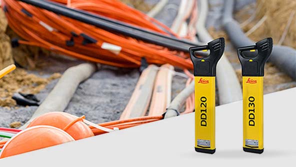
The Leica DD100 Series cable locators feature automatic controls making it easy-to-use, requiring minimal user experience.
-
×Human-Assisted autonomyAutonomously identifies the cables with EML signal.
-
 Product
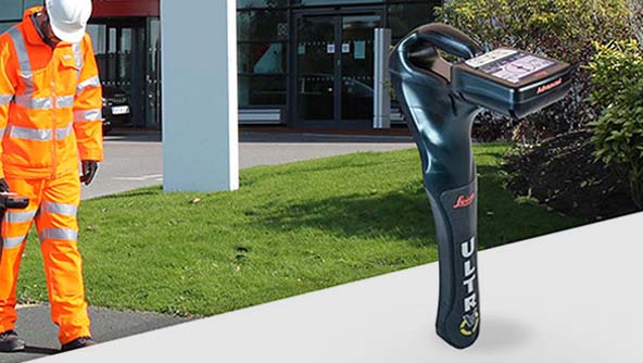
Leica ULTRA enables fast and reliable detection and tracing of underground utilities.
-
×Human-Assisted autonomyAutonomously identifies more complicated utilities with EML signal. Map to cm accuracy and GNSS network.
-
- Detection systems
Increase your safety and ultimately save your time and money with Hexagon's Detection Systems.
 Product
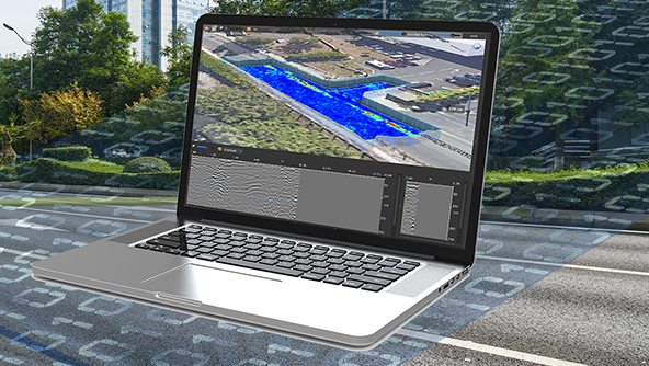
IQMaps is post-processing software for advanced GPR data analysis, providing fast interface between users and GPR data
-
×Partial autonomyArtificial intelligence algorithm for auto-detection of the pipes and anomalies.
-
- Detection systems
Identify potential threats and collect more information with ground penetrating radar for utility detection.
 Product
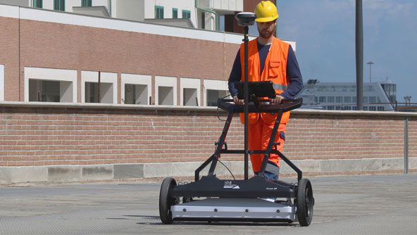
Ground-penetrating radar for experts who need to locate and map all types of underground utilities.
-
×Human-Assisted autonomyLive raw data analysis in the field with automatic pipe tracking and real time positioning.
-
 Product
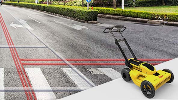
Locate and map underground utilities with simple detection workflows that anyone can understand.
-
×Human-Assisted autonomyAutomated data analysis and 3D utility map in the field. Positioning in real time. Machine Control integration.
-
 Product
Compact GPR array solution with EsT technology for extended depth range and ultra-high resolution
-
×Human-Assisted autonomyField data is automatically processed using A.I. to obtain the underground network with no human interaction (cloud-based).
-
 Product
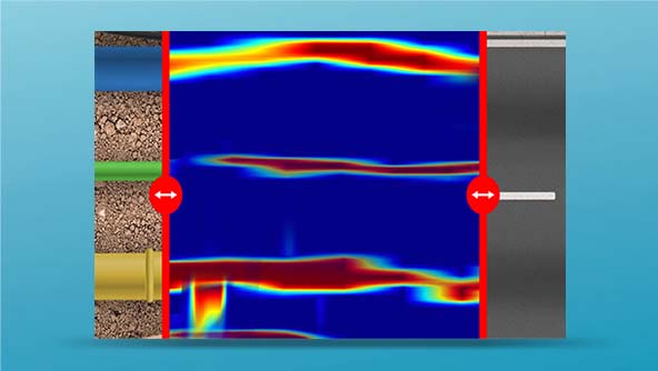
The most advanced solution to measure tunnel anomalies such as lining thickness, reinforced areas, cavities and wet zones.
-
×Human-Assisted autonomyNo contact solution to increase productivity and safety.
-
 Product
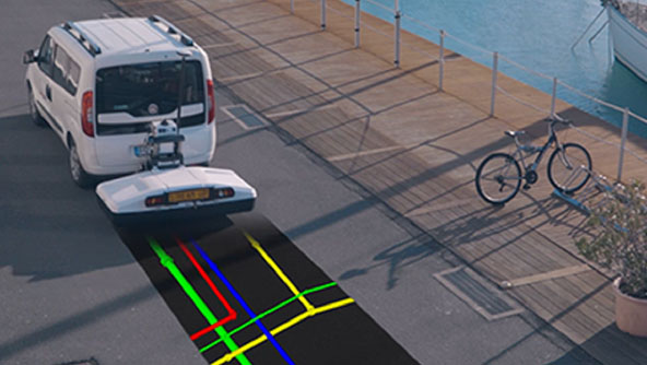
Multi-channel, multi-frequency ground penetrating radar system for utility mapping over extensive areas.
-
×Human-Assisted autonomyThe data collected on the field are automatically processed to visualize to 3D data.
-
 Product
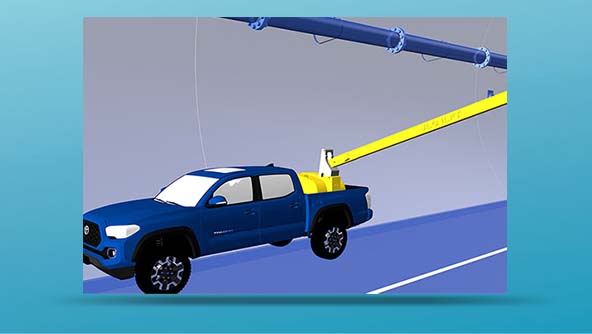
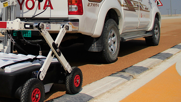
A vehicle-towed ground penetrating radar solution for extensive 3D mapping of buried structures and geologic features.
-
×Human-Assisted autonomyCover big areas in a relatively short time and simplify the setup.
-
- Detection systems
See through concrete structures and reveal true data with accurate scanning and real time analysis.
 Product
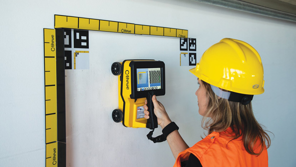
Locate rebars, voids, cables, conduits and other objects buried in concrete structures before cutting or drilling.
-
×Human-Assisted autonomyFor concrete inspection to detect shallow and deep rebar, tension cable conduits and voids.
-
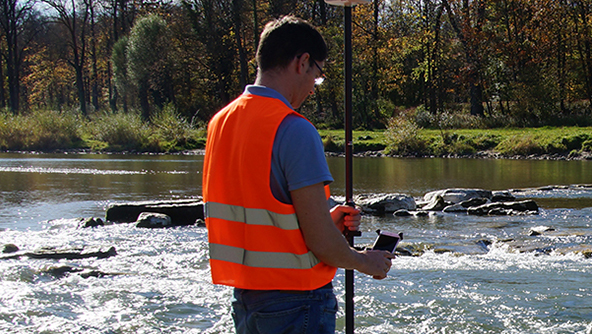
GNSS systems connect hardware and software to enable positioning tasks with precision and accuracy.
- GNSS systems
Compact and lightweight GNSS smart antennas for accurate and reliable positioning work.
 Product
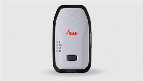
Leica Zeno FLX100 smart antenna captures spatial data in a simple and flexible way, allowing you the freedom to work.
 Product
Collect high-accuracy geospatial data on your smartphone when using the Leica Zeno GG04 plus Smart Antenna.
 Product
Leica GG04 plus Tablet Solution includes a rugged Android tablet with a large screen to perform in any environment.
- GNSS systems
Integrated software for managing GNSS correction services, along with processing and visualising GNSS data.
 Product
Leica Zeno Connect handles all communications between the GNSS receiver and the application, including correction sources.
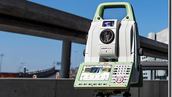
Measurements have never been so easy to perform as with Hexagon's total stations.
- Total stations
Achieve the highest accuracy and reliability with our total stations that provide superb angle and distance technology.
 Product
The Leica Nova TS60 is for highly demanding surveying and engineering projects that require the highest level of accuracy.
-
×Human-Assisted autonomyThe most accurate total station TS60 works anywhere and under any condition at the highest accuracy and automation.
-
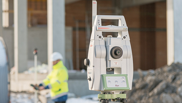 Product
The Leica TS13 is an upgradable, mid-range automated total station for efficient measurement.
-
×Human-Assisted autonomyThe TS13 comes with ATR technology and uses SpeedSearch to search, lock and measure prisms quickly and automatically.
-