lan
Hexagon Logo.svg
  • Contact us
  • Language Alert English
    • Deutsch
    • English
    • Español
    • Português
    • 日本語


  • Product groups
  • Find a product
  • Find a partner
  • Get support, training and services
  • Contact sales

Explore our top technologies driving innovation across industries

    • Anti-jam systems

      A battle-proven A-PNT solution that prevents interference and jamming

    • ATS800

      Discover enhanced scanning accuracy and productivity with state-of-the-art laser trackers

    • Correction services

      Achieve centimetre-level accuracy for agriculture applications

    • Geospatial solutions

      Visualise and analyse geospatial data efficiently

    • Hexagon MinePlan OP Engineering Short Term

      All the tools an engineer needs to produce short-term tactical schedules for open pit mines

    • Hexagon OP Collision Avoidance System

      Protect people, vehicles, and equipment with 360-degree awareness and ongoing safety upgrades

    • Machine control and automation

      Solutions to increase accuracy, productivity, and uptime on-site

    • MAESTRO

      An all-digital CMM with transformative metrology technologies

    • Reality capture

      Capture accurate and detailed 3D digital realities of the physical world with multiple technologies

    • What we do
    • Technology overview

      Hexagon operates in metrology, reality capture, and positioning technology domains

    • Featured technologies
    • AI-driven solutions

      Find AI-enabled technologies to improve your business

    • Digital twins for industry

      Transform your business using digital twin technology

    • Robotics and autonomy

      Automate your systems with Hexagon’s pioneering robotics expertise

    • Explore research and development
    • Explore the Innovation Hub
    • Airborne mapping

      Gain high-quality geospatial data with airborne imaging and LiDAR technologies for efficient mapping and surveying

    • Mobile mapping systems

      Capture imagery and LiDAR data in motion for fast, efficient mapping of infrastructure and large areas

    • Machine control for construction

      Keep machine work aligned with digital designs using real-time guidance in the cab

    • Mine operations

      Improve mining efficiency with connected fleet management and drill and blast optimisation technologies

    • Precision agriculture

      Integrate precision farming technologies into agricultural machinery with customisable OEM hardware and software

    • 3D laser scanners

      Capture detailed surface geometry quickly and accurately with 3D laser scanners for a wide range of measurement applications

    • Automated measurement systems

      Detect manufacturing defects earlier with automated measurement technologies that support faster corrective action

    • Coordinate measuring machines (CMMs)

      Measure complex components accurately with CMMs and software built for efficient quality inspection

    • Machine tool measuring systems

      Improve machining accuracy and efficiency with high-precision probing systems for measurement directly on the machine tool

    • Metrology software

      Streamline inspection workflows with intelligent metrology software that turns measurement data into actionable insights

    • Portable measuring systems

      Bring accurate measurement directly to parts and assemblies with portable metrology systems and software

    • Monitoring
    • Mine safety

      Protect mine workers and equipment with connected safety technologies that detect risks and help prevent incidents

    • Detection
    • Utility detection and mapping solutions

      Locate hidden utilities and create accurate underground maps to support safer construction and excavation

    • Agricultural operational management

      Gain greater visibility and control over large-scale agricultural operations with enterprise management software

    • CAD/CAM and production software

      Optimise CNC machining with CAD/CAM software that streamlines toolpath programming and improves production efficiency

    • Metrology software

      Streamline inspection workflows with intelligent metrology software that turns measurement data into actionable insights

    • Mine planning and processing

      Connect mine planning with real-time material tracking to allow informed decision making

    • Positioning services

      Achieve centimetre- to decimetre-level positioning accuracy with GNSS correction services delivered through global and regional networks

What we do

Technology overview

Hexagon operates in metrology, reality capture, and positioning technology domains.

A silver part of a machine which is being constructed
  • Find a product
  • Contact sales

Explore solutions to transform your industry

    • Aerospace

      Enhance efficiency with advanced aviation technologies

    • Agriculture

      Enhance autonomy and productivity with advanced navigation and control solutions

    • Automotive

      Drive efficiency with integrated manufacturing and autonomy

    • Defence

      Boost security with integrated defence solutions

    • Energy and power utilities

      Optimise energy systems with intelligent monitoring and predictive analytics

    • General manufacturing

      Enhance productivity with smart manufacturing

    • Mining

      Boost efficiency with the power of one integrated solution

    • Public safety

      Data, insights and capabilities for better incident management and situational awareness

    • Aerospace
    • Agriculture
    • Automotive
    • Buildings
    • Construction
    • Consumer products
    • Defence
    • Education and research
    • Electronics
    • Energy and power generation
    • Engineering services
    • Forestry
    • General manufacturing
    • Government
    • Healthcare and life sciences
    • Mapping and geospatial content
    • Marine positioning
    • Mining
    • Public safety
    • Shipbuilding
    • Surveying
    • Transportation
    • Utilities and communications
    • Insights
    • Custom-build your AI

      Sector-specific data needs tailored solutions, not one-size-fits all

    • Level up your digital twins

      Unlock endless business value with the right reality capture tools

    • Create a robotics-first future

      Reimagine operations with an unparalleled automation portfolio

    • Thought leadership
    • Blogs
    • Newsletters
    • Magazines
    • Featured stories
    • Digital twins for sports product design

      Wyve designs, simulates, and manufactures surfboards using measurement data.

    • AI-powered medical segmentation

      VGTRAINER and VGSTUDIO MAX help AnatomikModeling cut CT segmentation to 20 seconds per scan

    • Interpret 3D datasets with Coenradie

      Coenradie is elevating reality capture and AI-powered categorisation with Hexagon's point cloud software

    • See all customer stories
    • Innovation at Hexagon
    • Technology overview

      Enable true autonomy in your operations with Hexagon’s measurement technologies

    • Research and development

      World-class engineers, researchers, and product specialists don’t wait for solutions, they create them

    • Innovation Hub

      Hexagon’s early-stage research hub focused on breakthrough technologies

    • Special reports
    • Future of robotics 2035 report

      Expert perspectives on robotics, automation, and autonomy for the next industrial era

    • Digital twin industry report

      Insights from 650+ executives on benefits, challenges, and the real impact

    • Advanced manufacturing report

      Strategy-defining insights on data, collaboration, and automation for manufacturing leadership

    • Your central hub for informational articles, in-depth research, reports and more
    • Magazines
    • Reports
    • Blogs
    • Events

Meet The Robot Generation

The conclusion of our three-part survey of 18,000 adults and children analyses the impact of a generational robot gap.

Meet The Robot Generation
Featured customer story

How FSDI built high-speed rail to the millimetre

China's oldest railway survey and design institute used Leica Geosystems technology to plot 1,776 km of track to sub-millimetre tolerances.

A construction worker wearing protective gear operates a surveying instrument outdoors.
  • Newsroom
  • Investor relations
  • Legal & Compliance
  • Sustainability
  • Events
  • Contact us
    • About Hexagon

      The global leader in measurement technologies, helping the world's most vital industries build, navigate, and innovate

    • Why measurement matters
    • Our leadership
    • Our culture
    • Research and development
    • Ethics and compliance
    • Global locations
    • Careers

      Search opportunities that define the future

    • Job listings

      Join our global workforce, united by curiosity and driven to solve real-world challenges with precision and purpose.

    • Meet our people

      Discover what it’s like to work at Hexagon and how we’re making a difference, one innovation at a time.​

    • Sustainability at Hexagon

      Discover our sustainability goals and impact

    • Corporate social responsibility

      Learn how our CSR supports education, diversity, environment, and innovation

    • Supply and demand

      See how we embed sustainability from source to solution

    • Technology to power net-zero

      Explore how we are decreasing our carbon footprint

    • Annual and Sustainability report 2025
    • Our partners

      Meet the global innovators partnering with Hexagon

    • Find a partner

      Explore the partner directory

    • Become a partner

      Work with us to change the future

Discover Hexagon’s brand portfolio

    • Leica Geosystems

      Precision measurement, surveying, and geospatial solutions for professionals across the infrastructure, construction, and mapping industries worldwide

    • IDS GeoRadar

      Delivers radar-based sensing solutions for mining, civil engineering, geophysical, and safety applications

    • NovAtel

      Develops assured positioning, correction services, anti-jam/spoof, sensor fusion, and autonomy solutions for land, sea, and air

    • Septentrio

      Designs and manufactures high-precision GNSS receivers and low-SWaP solutions for mission-critical and compact applications

    • Hexagon AGTEK

      Provides construction takeoff, estimating, and modeling to accurately quantify, plan, and track project performance

    • Hexagon Antcom

      Manufactures customisable, professional-grade GNSS and communications antennas for high-precision applications

    • Hexagon Multivista

      Provides capture, create, and analyse services to turn real-world conditions into actionable insights across the construction project lifecycle

    • Hexagon OxBlue

      Provides construction camera systems for remote visibility into jobsite progress, safety, and security

    • Hexagon R-evolution

      Applies Hexagon's measurement and autonomous technologies to green-tech ventures, turning environmental data into a business asset

    • Hexagon Robotics

      Develops multi-purpose industrial humanoids powered by Hexagon's sensor expertise, AI-driven autonomy, and spatial intelligence

    • Hexagon SmartNet

      Operates the world’s largest GNSS/GPS correction network, delivering centimetre-level RTK positioning globally

    • Hexagon Veripos

      Delivers high-accuracy GNSS positioning and correction services for offshore marine oil and gas operations

Octave Announcement

Octave and Hexagon are separate companies

Octave became an independent public company in May 2026. Visit Octave for Asset Lifecycle Intelligence, Safety, Geospatial and Infrastructure, ETQ and Bricsys. Read more about the changes here.

R&D India

Learn about one of our largest R&D centres, driving high-value engineering innovation across Hexagon’s divisions.

Header image rnd latest.jpg

R-evolution

R-evolution is the green tech business venture of Hexagon AB, positioned to put data to action to save our planet trough profitable impact projects around the globe.

BLK scanning Costa Rica

Contact us
Language Alert English
  • Deutsch
  • English
  • Español
  • Português
  • 日本語

  • Product groups
  • Find a product
  • Find a partner
  • Get support, training and services
  • Contact sales
  • Find a product
  • Contact sales
  • Newsroom
  • Investor relations
  • Legal & Compliance
  • Sustainability
  • Events
  • Contact us

Explore our top technologies driving innovation across industries

    • Anti-jam systems

      A battle-proven A-PNT solution that prevents interference and jamming

    • ATS800

      Discover enhanced scanning accuracy and productivity with state-of-the-art laser trackers

    • Correction services

      Achieve centimetre-level accuracy for agriculture applications

    • Geospatial solutions

      Visualise and analyse geospatial data efficiently

    • Hexagon MinePlan OP Engineering Short Term

      All the tools an engineer needs to produce short-term tactical schedules for open pit mines

    • Hexagon OP Collision Avoidance System

      Protect people, vehicles, and equipment with 360-degree awareness and ongoing safety upgrades

    • Machine control and automation

      Solutions to increase accuracy, productivity, and uptime on-site

    • MAESTRO

      An all-digital CMM with transformative metrology technologies

    • Reality capture

      Capture accurate and detailed 3D digital realities of the physical world with multiple technologies

What we do

Technology overview

Hexagon operates in metrology, reality capture, and positioning technology domains.

A silver part of a machine which is being constructed
    • What we do
    • Technology overview

      Hexagon operates in metrology, reality capture, and positioning technology domains

    • Featured technologies
    • AI-driven solutions

      Find AI-enabled technologies to improve your business

    • Digital twins for industry

      Transform your business using digital twin technology

    • Robotics and autonomy

      Automate your systems with Hexagon’s pioneering robotics expertise

    • Explore research and development
    • Explore the Innovation Hub
    • Airborne mapping

      Gain high-quality geospatial data with airborne imaging and LiDAR technologies for efficient mapping and surveying

    • Mobile mapping systems

      Capture imagery and LiDAR data in motion for fast, efficient mapping of infrastructure and large areas

    • Machine control for construction

      Keep machine work aligned with digital designs using real-time guidance in the cab

    • Mine operations

      Improve mining efficiency with connected fleet management and drill and blast optimisation technologies

    • Precision agriculture

      Integrate precision farming technologies into agricultural machinery with customisable OEM hardware and software

    • 3D laser scanners

      Capture detailed surface geometry quickly and accurately with 3D laser scanners for a wide range of measurement applications

    • Automated measurement systems

      Detect manufacturing defects earlier with automated measurement technologies that support faster corrective action

    • Coordinate measuring machines (CMMs)

      Measure complex components accurately with CMMs and software built for efficient quality inspection

    • Machine tool measuring systems

      Improve machining accuracy and efficiency with high-precision probing systems for measurement directly on the machine tool

    • Metrology software

      Streamline inspection workflows with intelligent metrology software that turns measurement data into actionable insights

    • Portable measuring systems

      Bring accurate measurement directly to parts and assemblies with portable metrology systems and software

    • Monitoring
    • Mine safety

      Protect mine workers and equipment with connected safety technologies that detect risks and help prevent incidents

    • Detection
    • Utility detection and mapping solutions

      Locate hidden utilities and create accurate underground maps to support safer construction and excavation

    • Agricultural operational management

      Gain greater visibility and control over large-scale agricultural operations with enterprise management software

    • CAD/CAM and production software

      Optimise CNC machining with CAD/CAM software that streamlines toolpath programming and improves production efficiency

    • Metrology software

      Streamline inspection workflows with intelligent metrology software that turns measurement data into actionable insights

    • Mine planning and processing

      Connect mine planning with real-time material tracking to allow informed decision making

    • Positioning services

      Achieve centimetre- to decimetre-level positioning accuracy with GNSS correction services delivered through global and regional networks

Explore solutions to transform your industry

    • Aerospace

      Enhance efficiency with advanced aviation technologies

    • Agriculture

      Enhance autonomy and productivity with advanced navigation and control solutions

    • Automotive

      Drive efficiency with integrated manufacturing and autonomy

    • Defence

      Boost security with integrated defence solutions

    • Energy and power utilities

      Optimise energy systems with intelligent monitoring and predictive analytics

    • General manufacturing

      Enhance productivity with smart manufacturing

    • Mining

      Boost efficiency with the power of one integrated solution

    • Public safety

      Data, insights and capabilities for better incident management and situational awareness

    • Aerospace
    • Agriculture
    • Automotive
    • Buildings
    • Construction
    • Consumer products
    • Defence
    • Education and research
    • Electronics
    • Energy and power generation
    • Engineering services
    • Forestry
    • General manufacturing
    • Government
    • Healthcare and life sciences
    • Mapping and geospatial content
    • Marine positioning
    • Mining
    • Public safety
    • Shipbuilding
    • Surveying
    • Transportation
    • Utilities and communications
    • Insights
    • Custom-build your AI

      Sector-specific data needs tailored solutions, not one-size-fits all

    • Level up your digital twins

      Unlock endless business value with the right reality capture tools

    • Create a robotics-first future

      Reimagine operations with an unparalleled automation portfolio

    • Thought leadership
    • Blogs
    • Newsletters
    • Magazines

Meet The Robot Generation

The conclusion of our three-part survey of 18,000 adults and children analyses the impact of a generational robot gap.

Meet The Robot Generation
    • Featured stories
    • Digital twins for sports product design

      Wyve designs, simulates, and manufactures surfboards using measurement data.

    • AI-powered medical segmentation

      VGTRAINER and VGSTUDIO MAX help AnatomikModeling cut CT segmentation to 20 seconds per scan

    • Interpret 3D datasets with Coenradie

      Coenradie is elevating reality capture and AI-powered categorisation with Hexagon's point cloud software

    • See all customer stories
Featured customer story

How FSDI built high-speed rail to the millimetre

China's oldest railway survey and design institute used Leica Geosystems technology to plot 1,776 km of track to sub-millimetre tolerances.

A construction worker wearing protective gear operates a surveying instrument outdoors.
    • Innovation at Hexagon
    • Technology overview

      Enable true autonomy in your operations with Hexagon’s measurement technologies

    • Research and development

      World-class engineers, researchers, and product specialists don’t wait for solutions, they create them

    • Innovation Hub

      Hexagon’s early-stage research hub focused on breakthrough technologies

    • Special reports
    • Future of robotics 2035 report

      Expert perspectives on robotics, automation, and autonomy for the next industrial era

    • Digital twin industry report

      Insights from 650+ executives on benefits, challenges, and the real impact

    • Advanced manufacturing report

      Strategy-defining insights on data, collaboration, and automation for manufacturing leadership

    • Your central hub for informational articles, in-depth research, reports and more
    • Magazines
    • Reports
    • Blogs
    • Events
    • About Hexagon

      The global leader in measurement technologies, helping the world's most vital industries build, navigate, and innovate

    • Why measurement matters
    • Our leadership
    • Our culture
    • Research and development
    • Ethics and compliance
    • Global locations
Octave Announcement

Octave and Hexagon are separate companies

Octave became an independent public company in May 2026. Visit Octave for Asset Lifecycle Intelligence, Safety, Geospatial and Infrastructure, ETQ and Bricsys. Read more about the changes here.

    • Careers

      Search opportunities that define the future

    • Job listings

      Join our global workforce, united by curiosity and driven to solve real-world challenges with precision and purpose.

    • Meet our people

      Discover what it’s like to work at Hexagon and how we’re making a difference, one innovation at a time.​

R&D India

Learn about one of our largest R&D centres, driving high-value engineering innovation across Hexagon’s divisions.

Header image rnd latest.jpg
    • Sustainability at Hexagon

      Discover our sustainability goals and impact

    • Corporate social responsibility

      Learn how our CSR supports education, diversity, environment, and innovation

    • Supply and demand

      See how we embed sustainability from source to solution

    • Technology to power net-zero

      Explore how we are decreasing our carbon footprint

    • Annual and Sustainability report 2025

R-evolution

R-evolution is the green tech business venture of Hexagon AB, positioned to put data to action to save our planet trough profitable impact projects around the globe.

BLK scanning Costa Rica
    • Our partners

      Meet the global innovators partnering with Hexagon

    • Find a partner

      Explore the partner directory

    • Become a partner

      Work with us to change the future

Discover Hexagon’s brand portfolio

    • Leica Geosystems

      Precision measurement, surveying, and geospatial solutions for professionals across the infrastructure, construction, and mapping industries worldwide

    • IDS GeoRadar

      Delivers radar-based sensing solutions for mining, civil engineering, geophysical, and safety applications

    • NovAtel

      Develops assured positioning, correction services, anti-jam/spoof, sensor fusion, and autonomy solutions for land, sea, and air

    • Septentrio

      Designs and manufactures high-precision GNSS receivers and low-SWaP solutions for mission-critical and compact applications

    • Hexagon AGTEK

      Provides construction takeoff, estimating, and modeling to accurately quantify, plan, and track project performance

    • Hexagon Antcom

      Manufactures customisable, professional-grade GNSS and communications antennas for high-precision applications

    • Hexagon Multivista

      Provides capture, create, and analyse services to turn real-world conditions into actionable insights across the construction project lifecycle

    • Hexagon OxBlue

      Provides construction camera systems for remote visibility into jobsite progress, safety, and security

    • Hexagon R-evolution

      Applies Hexagon's measurement and autonomous technologies to green-tech ventures, turning environmental data into a business asset

    • Hexagon Robotics

      Develops multi-purpose industrial humanoids powered by Hexagon's sensor expertise, AI-driven autonomy, and spatial intelligence

    • Hexagon SmartNet

      Operates the world’s largest GNSS/GPS correction network, delivering centimetre-level RTK positioning globally

    • Hexagon Veripos

      Delivers high-accuracy GNSS positioning and correction services for offshore marine oil and gas operations


Searching...
No results found
  1. Home
    >
  2. Industries
    >
  3. Heavy construction for infrastructure
    >
  4. Segments
    >

Segments

Aerial view of airplanes in the airport terminal

Airport Construction

Learn more
Bridge construction with mountains in background

Bridge Construction

Learn more
Commercial construction site with a crane

Commercial and Industrial Construction Solutions

Learn more
cargo ships in a canal

Ports and Canals Construction Technology

Learn more
A contractor and project manager looking at an iPad on a construction site

Residential construction technology

Learn more
A busy roadway, managed by Hexagon’s solutions

Road Construction Technology

Learn more
Cars coming out of a tunnel onto the highway

Tunnel Construction

Learn more
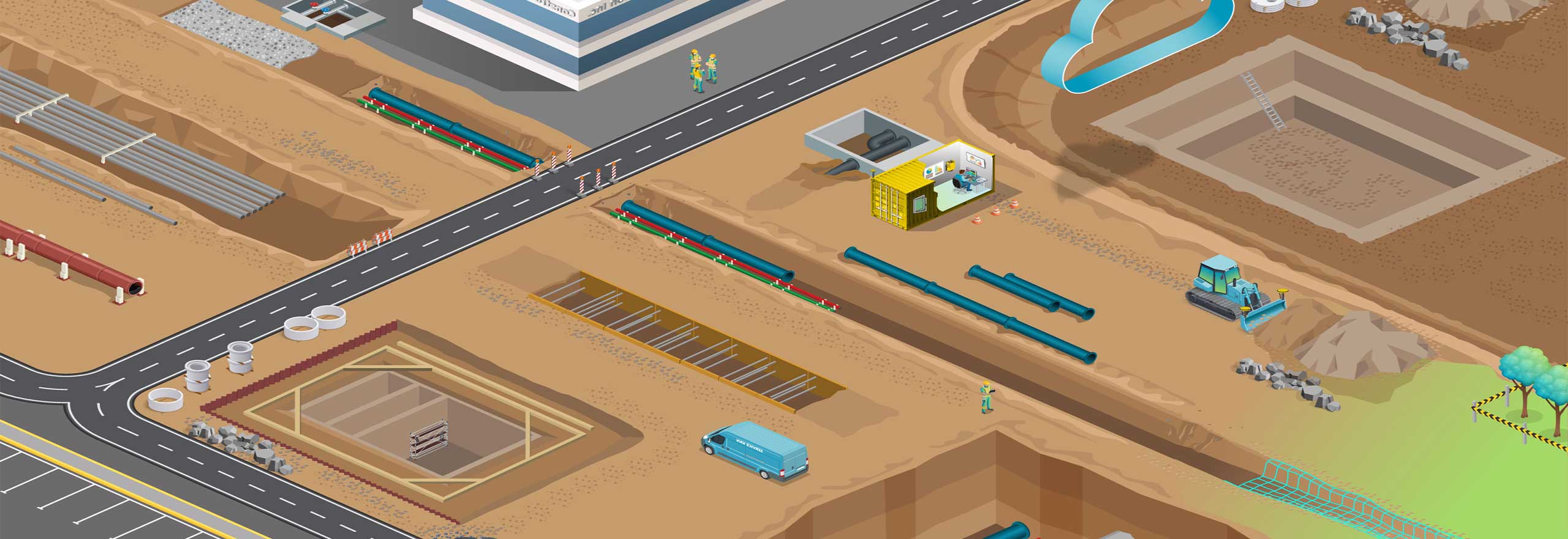
Graphical depiction of utility construction

Utility Construction

Learn more

Hexagon Logo

Get started

  • Contact sales
  • Search all products
  • Global locations
  • Get support
  • Start your career

Discover Hexagon

  • Who we are
  • Leadership
  • Sustainability
  • Investor relations

Explore more

  • Customer stories
  • Upcoming events
  • Newsroom
  • Ethics and compliance
  • Facebook
  • Instagram
  • LinkedIn
  • Twitter
  • YouTube
  • Legal
  • Privacy
  • Terms of use
  • Imprint
  • Report website issue
  • Cookie settings
© Hexagon AB and/or its subsidiaries. All rights reserved.
Language Alert English
  • Deutsch
  • English
  • Español
  • Português
  • 日本語