Explore Multivista solutions
Construction photos and videos, webcams, UAV services and more from the leader in construction documentation.
Ready to get started?
$ProductName
$SustainabilityImpactLabel
$SustainabilityCTABandHeadingLabel
-
 Product
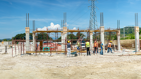
Deliver quality, transparency, and confidence throughout every phase of construction with high-resolution photos and 360º imagery linked to project plans.
-
×Partial autonomyOur platform gives you instant access to a complete photographic record of your construction project anytime, anywhere.
-
-
 Product
Gain confidence in every build with precise 3D laser scanning data used to create as-built drawings, models, and deviation analysis.
-
×Partial autonomyReceive data in point cloud, or let us create 2D CAD drawings and 3D Revit models with Scan to Plan, Scan to BIM services.
-
-
 Product
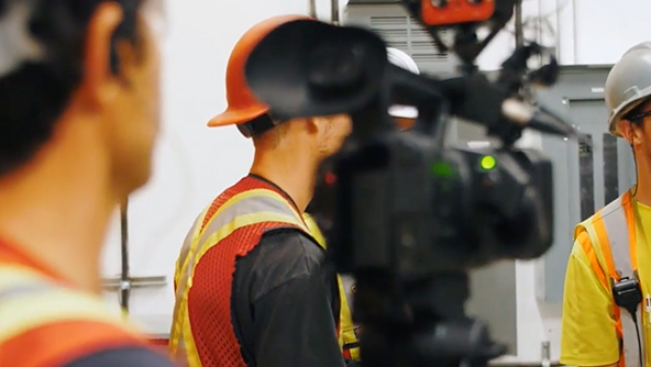
Improve safety, training, and operational readiness with high-definition video documentation and site-specific videos for maintenance, troubleshooting, and key building systems.
-
×Partial autonomyDetermine what should be captured for training and operations videos and ensure high-quality deliverables.
-
-
 Product
"Walk" the jobsite remotely at any phase for better QA/QC, Inspection and monitoring, validation of as-built conditions, or marketing and promotion.
-
×Partial autonomyArchitecture, engineering, and construction users receive access to 3D workflow functionalities within our platform.
-
-
 Product
With 360 Photo from Multivista, project teams can update schedules, demonstrate progress to stakeholders, resolve RFIs and change orders, manage disputes, and get paid faster.
-
×Partial autonomyUsing Multivista's 360 photos you could walk your job site virtually with up-to-date, accurate interior and exterior views.
-
-
 Product
Improve visibility across your project with UAV and drone-captured high-resolution aerial imagery and detailed orthomosaic maps
-
×Partial autonomyAll UAV-captured photos, videos, panoramas are uploaded into our cloud-based platform for anytime access by all team members.
-
-
 Product
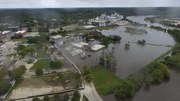
A managed service to support your insurance claims, so you can get back on track quickly.
-
×Partial autonomyWe help you maintain visual records. After a disaster, assessing damage is as simple as comparing before and after images.
-
-
 Product
Enhance security and maintain 24/7 visibility in tough jobsite conditions with rugged construction webcams providing live streaming video and AI-powered insights.
-
×Partial autonomyWe help coordinate every detail, including webcam setup, 24/7 hosting of the streaming video footage and ongoing maintenance.
-
-
 Product
Streamline feasibility, design, and construction with authoritative 3D models and 2D drawings generated throughout the project lifecycle.
-
×Partial autonomyReceive data in point cloud, or let us create 2D CAD drawings and 3D Revit models with Scan to Plan, Scan to BIM services.
-
-
.jpeg?h=4320&iar=0&w=8192&hash=53E7D6BB087693F66CBD9BF041AEF4A6) Product
ProductSpecialized BIM staffing supporting modeling workloads, coordination, and documentation accuracy.
-
 Product
Improve efficiency and consistency with strategic BIM implementation through automated workflows and integrated data systems.
-
 Product
Reduce risk and improve project outcomes with constructability modeling and VDC support for general contractors.
-
 Product
Enhance planning and training with reality data transformed into interactive digital environments.
-
 Product
Track progress with confidence using automated model-to-photo comparisons that generate accurate schedule-based metrics.
-
 Product
Reduce rework by identifying construction deviations and risks early with AI-driven model-to-scan comparisons.
-
 Product
Improve earthwork accuracy with geospatial capture and volume calculations that deliver precise cut-and-fill insights.
-
 Product
Reduce risk, cost, and rework in firestopping assessments by automating the detection of unsealed penetrations using image recognition and advanced reality capture.
-
×Conditional autonomyOnce the Multivista image processing engine identifies penetration, our system sends a task to the specialist in charge.
-
-
 Product
Streamline BIM workflows by converting point cloud data into as-built 3D Revit models for planning, documentation, and architectural, structural, or MEP coordination.
-
 Product
Reduce change orders and improve coordination by converting 3D laser scan data into precise 2D drawings that enable digital twins and long-term lifecycle value.
-
 Product
Enable remote project management with Site-Walk 360°, immersive 3D walkthroughs for QA/QC, as-built validation, inspections, and marketing.