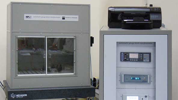
A battle-proven A-PNT solution that prevents interference and jamming
Discover enhanced scanning accuracy and productivity with state-of-the-art laser trackers
Achieve centimetre-level accuracy for agriculture applications
Visualise and analyse geospatial data efficiently
All the tools an engineer needs to produce short-term tactical schedules for open pit mines
Protect people, vehicles, and equipment with 360-degree awareness and ongoing safety upgrades
Solutions to increase accuracy, productivity, and uptime on-site
An all-digital CMM with transformative metrology technologies
Capture accurate and detailed 3D digital realities of the physical world with multiple technologies
Hexagon operates in metrology, reality capture, and positioning technology domains
Find AI-enabled technologies to improve your business
Transform your business using digital twin technology
Automate your systems with Hexagon’s pioneering robotics expertise
Sensor, perception, steering, and software solutions to help you advance your autonomous platforms
Software solutions for large companies to plan, optimise, analyse, and manage field operations
Scalable positioning solutions, that simplify integration and expedite your time to market
Navigation and implement control solutions for precision agriculture
Digitalise cities and countries with highly efficient airborne sensors and workflows
On demand high-resolution aerial imagery and elevation data
Capture, prepare, manage, and deliver point cloud data seamlessly
Sensors and software to enable fast and comprehensive data collection on the go
Enabling the future of automated inspection
Enables manufacturers to generate, manage and optimise CNC machining toolpaths for efficient production
Enables designers and engineers to simulate product and process performance
From entry-level to ultra-high accuracy, CMMs for every requirement
Enable the non-contact digital capture of shapes and surface data for quality control and reverse engineering
Customisable software that delivers intelligent and powerful data acquisition, analysis and reporting
Enable accurate measurement directly in the manufacturing environment to drive process improvement
Allow operators, metrology technicians and engineers to act actively for quality improvements
Local service and support to help you overcome your manufacturing challenges and achieve your goals
Leverage data to minimise loss, maximise precision, and realise true pit value
Strategically improve fleet management and equipment health
Make sense and take action from monitor and survey data
Unlock full resource value with data-driven mine planning and design
Enhance process activity safety and efficiency form pit to port
Plan operations with long-term sustainability in mind
Gain insights to strengthen safety culture and prevent accidents
Pave the way toward value-driven autonomous mining operations
Data-driven insights to improve prediction, prevention and decisions
An assured positioning, navigation, and timing solution that protects against interference and jamming
Centimetre-level accuracy for land, airborne, or marine applications
Maximise your GNSS receiver's positioning performance
Deliver precise and reliable positioning, navigation, and timing solutions for a wide range of applications
An ideal solution that refines GNSS and INS data to deliver highly accurate post-mission trajectories and mapping
Deliver reliable, continuous 3D position, velocity, and attitude performance
Enhance positioning, navigation, and timing (PNT) by providing detailed situational awareness and interference mitigation
High precision products that integrate a GNSS receiver and antenna into one compact enclosure
Provides critical information to make decisions regarding your quality of position
Measure and verify construction projects with software that transfers design data into reality
Visualise, document, and verify every stage of construction projects
Measure accurately with high-performing manual, robotic, and scanning total stations
GNSS technology to enable positioning tasks with precision and accuracy
Seamless field and office workflows for surveying
Detect, position, and document underground utilities for safer construction work
Cloud-based storage, visualisation, and collaboration platform for geospatial data
Environmental and structural monitoring technology that deliver real-time movement insights
Solutions for increasing productivity, efficiency, and safety in heavy construction machine operation
On-demand high-resolution aerial imagery and elevation data
Sensors and processing workflows for airborne mapping
Automatic, digital, and rotating laser levels for construction, surveying, monitoring and more
Enhance efficiency with advanced aviation technologies
Enhance autonomy and productivity with advanced navigation and control solutions
Drive efficiency with integrated manufacturing and autonomy
Boost security with integrated defence solutions
Optimise energy systems with intelligent monitoring and predictive analytics
Enhance productivity with smart manufacturing
Boost efficiency with the power of one integrated solution
Data, insights and capabilities for better incident management and situational awareness
Sector-specific data needs tailored solutions, not one-size-fits all
Unlock endless business value with the right reality capture tools
Reimagine operations with an unparalleled automation portfolio
VGTRAINER and VGSTUDIO MAX help AnatomikModeling cut CT segmentation to 20 seconds per scan
Coenradie is elevating reality capture and AI-powered categorisation with Hexagon's point cloud software
How Hexagon enables hairpin precision at the world's leading physics lab
Expert perspectives on robotics, automation, and autonomy for the next industrial era
Insights from 650+ executives on benefits, challenges, and the real impact
Strategy-defining insights on data, collaboration, and automation for manufacturing leadership
The global leader in measurement technologies, helping the world's most vital industries build, navigate, and innovate
Search opportunities that define the future
Discover our sustainability goals and impact
Learn how our CSR supports education, diversity, environment, and innovation
See how we embed sustainability from source to solution
Explore how we are decreasing our carbon footprint
Meet the global innovators partnering with Hexagon
Explore the partner directory
Work with us to change the future
A digital industrial platform for manufacturers to connect and collaborate across people, technology and data
The robotic total station productivity powerhouse for everyday surveying, from cadastral to construction.
Skanska is building Norway’s Project Rogfast – the world’s longest and deepest road tunnel – with Hexagon’s technologies.
Learn more about Octave, now an independent public company following its separation from Hexagon in May 2026, encompassing Asset Lifecycle Intelligence, Safety, Geospatial and Infrastructure, ETQ and Bricsys.
R-evolution is the green tech business venture of Hexagon AB, positioned to put data to action to save our planet trough profitable impact projects around the globe.
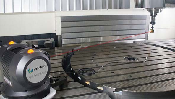
헥사곤 매뉴팩처링 인텔리전스 사업부는 수공구부터 자동화 솔루션, CMM(3차원 측정기), 이동식 측정기, 레이저 트래커 및 광학 스캐너에 이르기까지 차원 측정이 중요한 분야에 적합한 산업 측정 시스템을 제공합니다
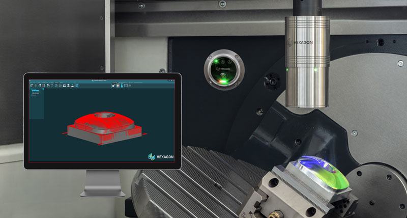
Extend HYPERSCAN with optional contact probing for selected inspection tasks – within the same coordinate system.
Connects to all 
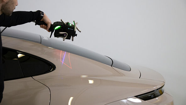
handheld 3D scanners delivering an ergonomic solution for measuring standard tubes.
Engineered for performance, versatility and everyday usability
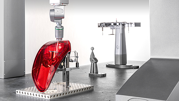
Quality remastered via speed, ease of use, connectivity and adaptability
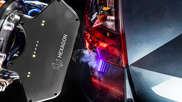
See how the world's best Formula 1 team uses Hexagon's technology to achieve total accuracy, reach peak efficiency and go faster on and off the track.
2D 스캐너는 플러시 및 갭, 프로파일 측정 및 표면 검사와 같은 애플리케이션을 위한 비접촉식 스캔을 제공합니다.
3D 레이저 스캐너를 사용하면 품질 관리 및 리버스 엔지니어링을 위한 형상 및 표면 데이터의 비접촉 디지털 캡처가 가능합니다.
모든 측정 요구 사항에 적합한 보급형부터 초고정밀까지 다양한 3차원 측정기(CMM)를 제공합니다.
Inspection solutions for advanced measurement and process control for the tube and wire production industry.
공작 기계 측정 센서는 머시닝 센터에서 공작물을 측정하여 공정 정확도와 효율성을 개선합니다.
공작 기계, 로봇, CMM과 같은 장비의 지오메트리 분석, 모니터링 및 정확도 향상을 위한 솔루션입니다.
레이저 트래커는 대규모 이동식 측정을 위한 매우 정확하고 안정적이며 견고한 솔루션을 제공합니다.
자동화된 측정 및 프로세스 제어와 광범위한 작업 현장의 산업 자동화 애플리케이션을 위한 솔루션입니다.
카메라 기반 3D 광학 측량 시스템입니다.
산업용 데오도라이트와 토탈 스테이션은 대형 부품의 검사 및 조립을 위해 매우 큰 측정 용량을 제공합니다.
이동식 다관절 측정기를 사용하면 제조 환경에서 직접 정확하게 측정하여 공정을 개선시킬 수 있습니다.
당사 제품을 사용하여 표준에 맞게 기기를 교정하면 측정 품질과 신뢰성을 보장하고 법적 측정 표준을 준수할 수 있습니다.
핸드헬드 3D 스캐너는 높은 휴대성, 사용 편의성 및 투자 가치를 갖춘 현대식 제조 검사를 위한 핵심 제품 카테고리입니다.
Nexus is a platform to enhance smart manufacturing collaboration, accelerating innovation and time to market.
Register for a seamless shopping experience and dive into our extensive range of metrology accessories and software training modules.