マッピングアプリケーション用の位置決め後処理
ポスト処理ソフトウェアで位置、速度、姿勢の正確性を強化します。
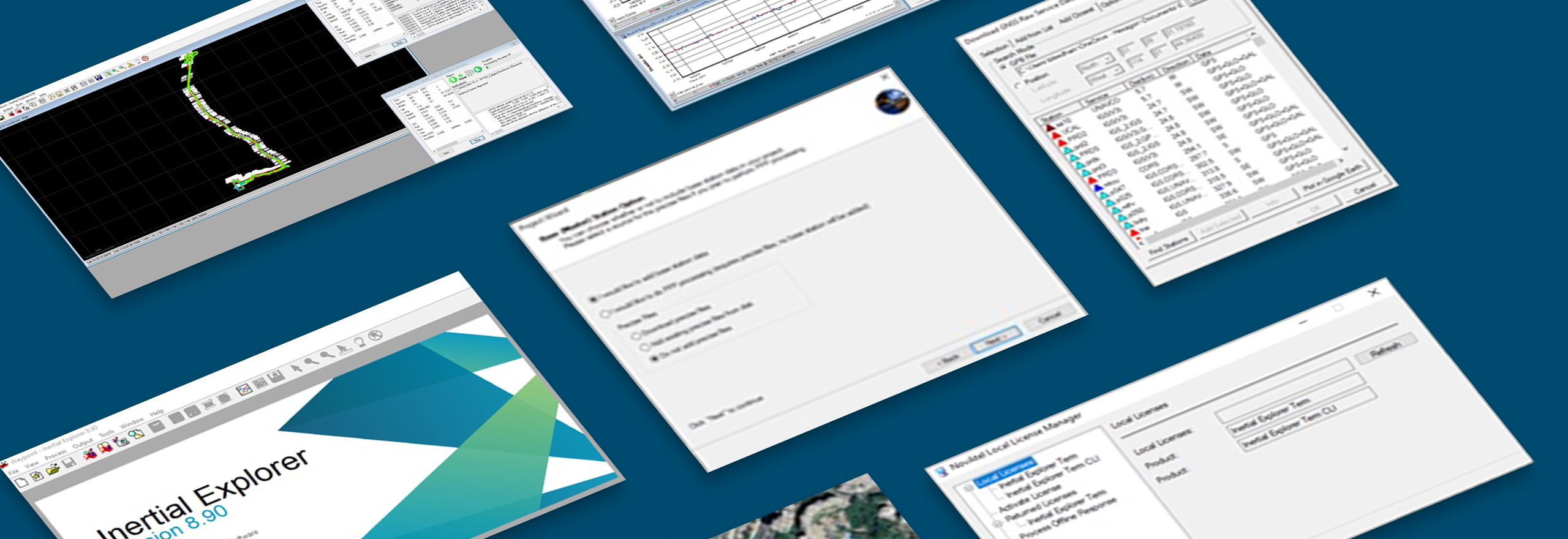
Waypoint®後処理ソフトウェア
Waypointはクラス最高のGNSSおよびGNSS+INS後処理ソフトウェアです。
Hexagonのソリューションは、マッピング・アプリケーションに正確なポスト・エミッションの位置、速度、姿勢を提供します。Waypoint後処理ソフトウェアは、以前に取得した Global Navigation Satellite System(GNSS)とInertial Measurement Unit(IMU)データを処理することで、ソリューションの精度を最大化します。
概要
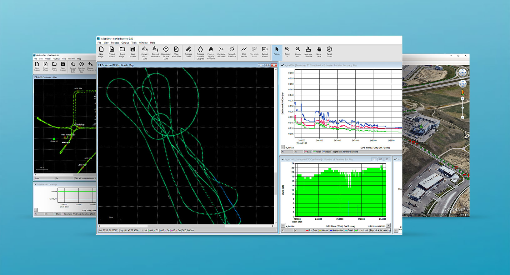
HexagonのGNSS後処理ソリューションは、マッピングアプリケーションで正確なポストエミッションローカリゼーションが必要な場合に最適です。当社のWaypoint後処理ソフトウェアは、データを前後に処理し、結果のスムージングと組み合わせ、非常に正確な位置、速度、姿勢の軌跡を提供します。このソリューションは、品質分析プロットツールで出力の信頼性と精度を評価し、柔軟な結果エクスポートオプションを提供します。
検索する
$ProductName
$SustainabilityImpactLabel
$SustainabilityCTABandHeadingLabel
私たちは自動化曲線に登っています
インテリジェントな自動化への移行は、加速しています。最終的に、私たちの革新は、まだ想像もしなかったような新しいテクノロジーや用途を生み出します。現在、Hexagonのすべてのソリューションは、その自動化レベルに従ってマッピングおよびタグ付けされているため、ユーザーは自律性の自由に対する私たちの進歩を明確に追跡できます。
-
レベル 0/ 自動化なし:
人間がすべての作業を実行し、データは使用されない
-
レベル 1/ 人による支援:
人間が作業を行うが、一部の機能を自動化して制御を簡素化する。
-
レベル 2/ 部分的自動化:
一部の作業を自動化し、短時間(または特定の状況下)での自律的な運用を可能にする。
-
レベル 3/ 条件付き自動化:
一定の範囲内で自律的な運用が可能だが、急遽、人間の介入が必要になることもある
-
レベル 4/ 高自動化:
自律的に必要なタスクを完了するように設計されているが、特定の範囲を超えた状況の変化には人間の介入が必要な場合がある
-
レベル 5/ 完全自動化:
あらゆる条件下で制御タスクが自動化されているが、人間が引き継ぐことを要求することができる

土地
森林モニタリング、材料再利用性、農業、水利用分野において環境に影響を及ぼす製品。

空気
再生可能エネルギー、騒音公害の排除、e モビリティ分野において環境に影響を及ぼす製品。

水道事業
海の保護、汚染の削減、きれいな水へのアクセス向上において環境に影響を及ぼす製品。