鉱山地質工学調査
実証済みの3D画像処理技術を採用する地質工学調査用の点群処理ソフトウェア。
最新の3Dイメージング技術を使用した鉱山地質調査
LIDARスキャンと写真測量から3次元点群データを処理し、詳細な情報をすばやく簡単に生成できます。
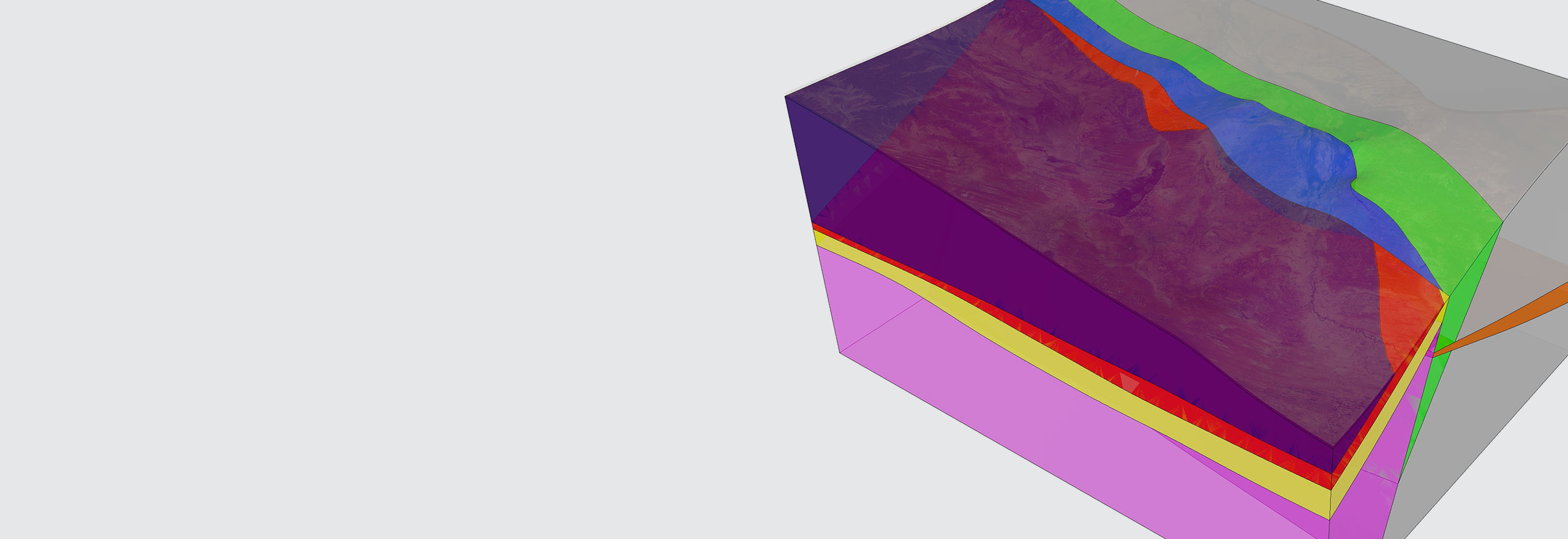
Hexagonは、地質工学技術者に、点群からジオテクニカル情報を抽出するために設計された鉱山調査ソフトウェアを提供します。岩石質量特性評価では、不連続性の方向性と間隔を含む、地質構造の重要な属性が点群から抽出されます。
概要
掘削孔データを分析して断層やその他の構造の特性を評価することは、地質工学技術者が鉱山計画用に岩石特性を理解し、使用するために不可欠です。
Hexagonの鉱山地質調査ソフトウェアは、LIDARスキャンおよび写真測量からの3D点群データの点群処理を活用することで、詳細な地質工学情報を迅速かつ容易に生成します。以下を含みます:
- 現場のブロックサイズおよび目地間隔を含む、セルマッピングおよび岩盤発破前条件
- 斜面の不安定性、落石モデリング、および負荷の正確な測定のための断面分析
- 落石と地盤移動に対する変化検知
岩石質量特性評価では、不連続面の方向性と間隔を含む、地質構造の重要な属性が点群から抽出されます。方向性結果をステレオネット上にプロットし、一次ジョイントセットを決定します。

検索する
$ProductName
$SustainabilityImpactLabel
$SustainabilityCTABandHeadingLabel
私たちは自動化曲線に登っています
インテリジェントな自動化への移行は、加速しています。最終的に、私たちの革新は、まだ想像もしなかったような新しいテクノロジーや用途を生み出します。現在、Hexagonのすべてのソリューションは、その自動化レベルに従ってマッピングおよびタグ付けされているため、ユーザーは自律性の自由に対する私たちの進歩を明確に追跡できます。
-
レベル 0/ 自動化なし:
人間がすべての作業を実行し、データは使用されない
-
レベル 1/ 人による支援:
人間が作業を行うが、一部の機能を自動化して制御を簡素化する。
-
レベル 2/ 部分的自動化:
一部の作業を自動化し、短時間(または特定の状況下)での自律的な運用を可能にする。
-
レベル 3/ 条件付き自動化:
一定の範囲内で自律的な運用が可能だが、急遽、人間の介入が必要になることもある
-
レベル 4/ 高自動化:
自律的に必要なタスクを完了するように設計されているが、特定の範囲を超えた状況の変化には人間の介入が必要な場合がある
-
レベル 5/ 完全自動化:
あらゆる条件下で制御タスクが自動化されているが、人間が引き継ぐことを要求することができる

土地
森林モニタリング、材料再利用性、農業、水利用分野において環境に影響を及ぼす製品。

空気
再生可能エネルギー、騒音公害の排除、e モビリティ分野において環境に影響を及ぼす製品。

水道事業
海の保護、汚染の削減、きれいな水へのアクセス向上において環境に影響を及ぼす製品。