Tactical edge mapping
Rapidly collect location data and map areas of interest for mission-critical operations.

Tactical edge mapping in the field
Our user-friendly sUAS gathers tactical high-resolution imagery for critical situational awareness prior to operations.
Hexagon provides armed forces with tactical edge mapping capabilities that can operate autonomously in a fully-disconnected environment—capturing and storing high-resolution imagery, vector, terrain and other content at a low cost.
Overview
Mission-critical operations are dynamic with on-the-ground conditions quickly changing. Defence agencies and units in fields of operation must be able to rapidly collect, process, visualise and analyse imagery from areas of interest to gather intelligence and adjust tactics.
Hexagon’s tactical edge mapping solutions deliver high-performance rapid location data collection capabilities for mapping areas of interest and enabling geospatial intelligence (GEOINT) at the tactical and disconnected edge. With other solutions, organisations can also maintain libraries of high-threat areas, manage multiple 2D and 3D globes and share unclassified imagery with coalition forces and other agencies.

Explore products
$ProductName
$SustainabilityImpactLabel
$SustainabilityCTABandHeadingLabel
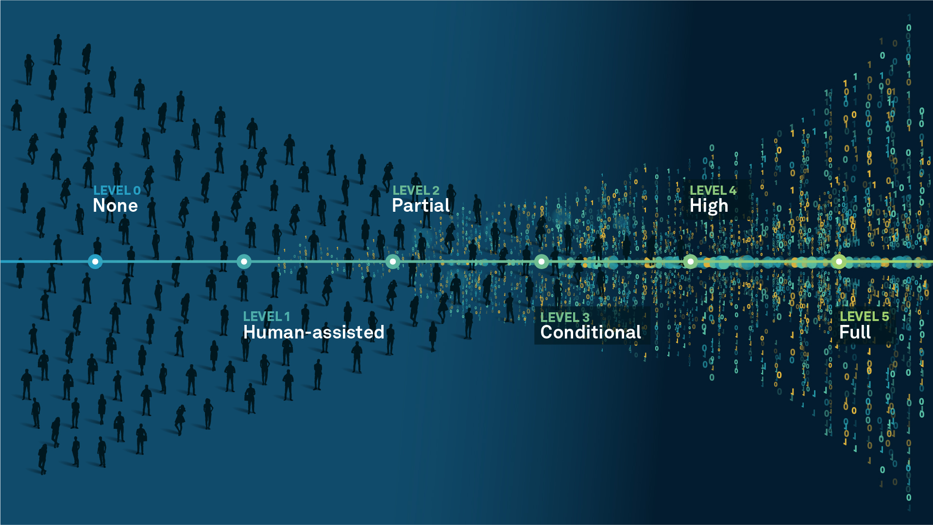
We’re climbing the automation curve
Our transition to Intelligent automation is accelerating. Ultimately, our innovations will give rise to new technologies and applications - many of which we’ve yet to imagine. Today, every Hexagon solution is mapped and tagged according to its level of automation, so customers can clearly track our progress towards the freedom of autonomy.
Human-driven
All tasks completed by human labour; no data is leveraged across the operation.
Human-assisted
Labour is primarily conducted by a human workforce. Some functions have been automated to simplify control.
Partial automation
Some tasks are automated for short periods of time, accompanied by occasional human intervention.
Conditional automation
Human workforce is used for intervention as autonomous operations begin to increase productivity.
Highly autonomous
Autonomous systems complete required tasks within specific bounds, unleashing data and building smart digital realities.
Full autonomy
A smart digital reality™ enables autonomous systems to complete all tasks without human intervention.

Land
Products that make an environmental impact in forest monitoring, material reusability, farming or water usage.

Air
Products that make an environmental impact in renewable energy, noise pollution elimination and e-mobility.

Water
Products that make an environmental impact in saving our oceans, reducing pollution and increasing access to clean water.