Digital Realities
Digital realities fuse the physical and digital worlds into one machine-readable reality.

Machine-readable reality
Digital realities make the world itself machine-readable.

AI-enabled semantic data
Digital realities aren't just data points, but detailed semantic information that AI algorithms autonomously extract.

Ensure Public Safety with Real-Time Data
Model real-world scenarios and respond to security threats and other emergencies with real-time actionable 3D data.

Infrastructure management
Digital realities offer real-world data for planning and building sustainable, resilient infrastructure.

Environmental simulations
Support urban development with environmental simulations of specific scenarios like water flow and air circulation.

Commitment to sustainability
Digital realities combine all the most important real-world data to help us make the best sustainable decisions.

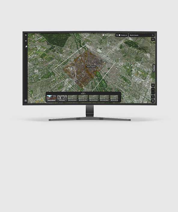
Reality Cloud Studio, powered by HxDR
Hexagon's newest all-in-one, simple to use, centralised, and powerful cloud application for reality capture data.
Digital realities are workflow-driven feedback loops that fuse the physical and digital worlds into one reality. Real-time sensor and software feeds, coupled with autonomous technologies, work together to drive sustainability through improvements in productivity, efficiency, quality and safety.
-
HxDR
-
Semantic mesh
-
Hexagon Content Program
-
Real-world simulations
-
Digital twins
Hexagon's digital realities
HxDR brings digital realities to life. It is a scalable cloud-native platform for storage, visualisation and collaboration of reality capture and geospatial data, and it makes custom enterprise solutions available for specific uses like field-to-cloud reality capture, semantic mesh and real-world simulations. All these features are available in an easy-to-use, browser-based application that provides a custom toolset for visualising digital realities.
HxDR for reality capture enables users to upload scans to HxDR for cloud storage — including field-to-cloud direct data upload from compatible Leica Geosystems BLK scanners. HxDR users can then give data access to anyone around the world for download and cloud-based work.
HxDR is also the host and data store for the Hexagon Content Program, our extensive catalogue of accurate, aerial data and geospatial data, where users can purchase nationwide high-resolution aerial imagery and explore large-scale 3D models.

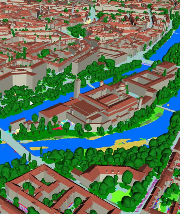
Every data point has meaning
We are able to create a digital reality that not only reflects the real world, but also tells us what we need to know about it. This is what we call the semantic mesh, which is derived from data captured by the Hexagon Content Program and is visualised in the HxDR platform.
The mesh is not just a beautiful visualisation of the physical world — the data is processed by Al algorithms to gain autonomous semantic information attributes. The mesh then becomes a place to gather information within the digital reality, where semantic information is used to visualise planning, coordinate smart cities and manage infrastructure. Mass-scale computer vision and advanced technology create interactive web-based renderings. These renderings enable high-performing 3D visualisation.

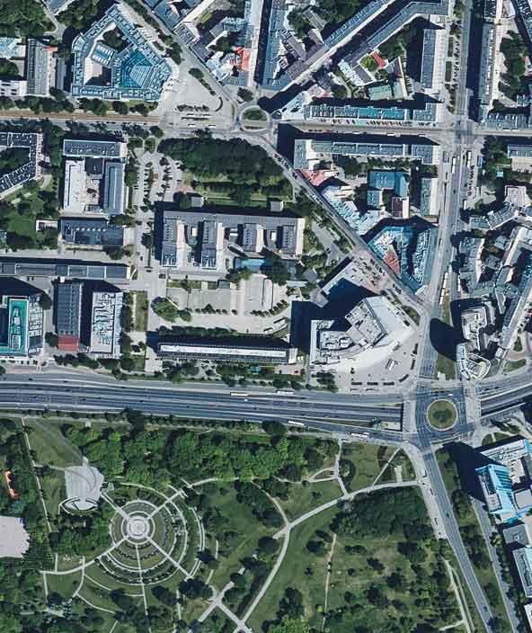
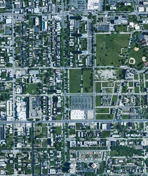
Largest library of high-res aerial imagery
The first step toward creating a digital reality is to capture reality as accurately and efficiently as possible.
The HxGN Content Program is Hexagon’s aerial data program and offers the largest library of aerial imagery and digital surface models across the United States, Europe and parts of Canada. The data is ortho-rectified, accurate,and available at multiple resolutions. This data forms part of Hexagon’s digital realities and is available for purchase through the HxDR Data Store.
The Hexagon Content Program uses advanced Hexagon sensors to capture data, and it follows rigorous acquisition and processing standards to offer the highest positional accuracy for applications such as mapping, urban planning, asset management, public safety, utility mapping and insurance. The exceptional data consistency over large areas makes this the ideal training data set for machine learning and AI algorithms. The flexible data-use terms allow users to create derived products.

Visualise the world to plan ahead
With digital twins, algorithms and a machine-readable reality, we can leverage data to help us to respond to what the future might bring. Hexagon's digital realities accomplish this in ways that significantly advance data-streaming capabilities to combine the semantic mesh with real-world simulation tools.
With Hexagon’s portfolio of digital reality technologies, you can utilise your real-world data and semantics within it to simulate important environmental scenarios. Combining Hexagon's simulation technologies with HxDR allows customers to solve problems and build custom applications. Enabling users to build their own digital erality encourages collaboration within teams and collaboration between software, algorithms and applications. It’s here where data and semantics are the key drivers for simulation and where digital realities come into full visual clarity.

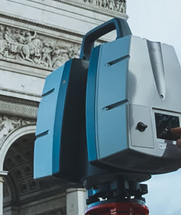
Reality capture sensors and workflows
Hexagon reality capture sensors allow users to build their own digital reality, which makes their reality capture data machine-readable and available for custom analytics. With autonomous reality capture workflows that create complete digital twins and apply semantic data, Hexagon’s portfolio of sensors and software meet the data capture needs of any project, of any scale, for numerous industries around the world.
Autonomous Leica BLK sensors connect directly to a digital reality to create an autonomous field-to-cloud workflow. After data capture, sensors like the BLK2FLY, BLK ARC and BLK2GO can upload their data autonomously to HxDR for cloud-based data storage and visualisation. HxDR users can then utilise AI-based automeshing and cloud-based collaboration to extract unprecedented value from their data and to maximise the efficiency, speed and intelligence of autonomous workflows from capture to deliverable.

Explore
$ProductName
$SustainabilityImpactLabel
$SustainabilityCTABandHeadingLabel
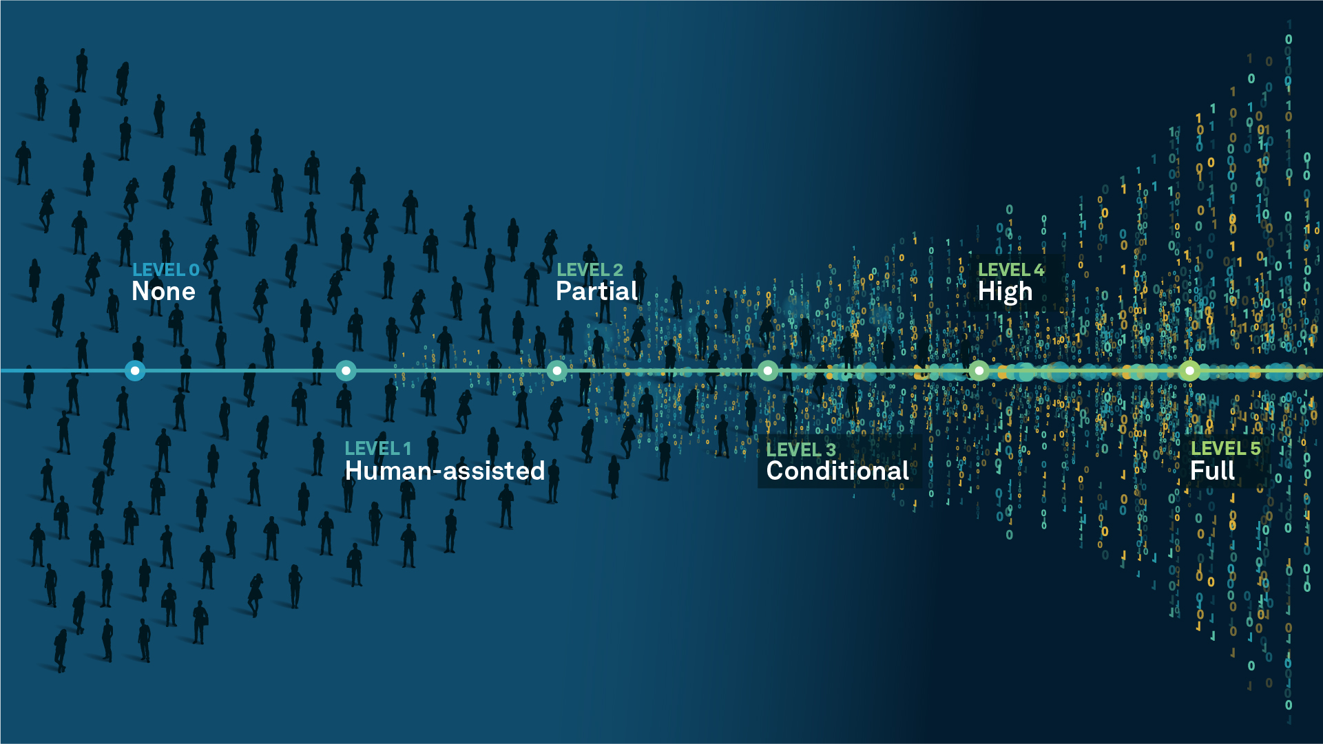
We’re climbing the automation curve
Our transition to Intelligent automation is accelerating. Ultimately, our innovations will give rise to new technologies and applications - many of which we’ve yet to imagine. Today, every Hexagon solution is mapped and tagged according to its level of automation, so customers can clearly track our progress towards the freedom of autonomy.
Human-driven
All tasks completed by human labour; no data is leveraged across the operation.
Human-assisted
Labour is primarily conducted by a human workforce. Some functions have been automated to simplify control.
Partial automation
Some tasks are automated for short periods of time, accompanied by occasional human intervention.
Conditional automation
Human workforce is used for intervention as autonomous operations begin to increase productivity.
Highly autonomous
Autonomous systems complete required tasks within specific bounds, unleashing data and building smart digital realities.
Full autonomy
A smart digital reality™ enables autonomous systems to complete all tasks without human intervention.

Land
Products that make an environmental impact in forest monitoring, material reusability, farming or water usage.

Air
Products that make an environmental impact in renewable energy, noise pollution elimination and e-mobility.

Water
Products that make an environmental impact in saving our oceans, reducing pollution and increasing access to clean water.