Other geospatial products
ER Mapper
ERDAS ER Mapper technology saves time and disk space with revolutionary algorithm processing and other geoprocessing tools.ER Viewer
ERDAS ER Viewer displays popular geospatial file types in a free desktop image viewer application and Microsoft Office Plugin.ERDAS Extensions for ArcGIS
ERDAS Extensions for ArcGIS unlocks the power of remote sensing and stereo photogrammetry inside your ArcGIS environment.Spatial Modeler SDK
Hexagon Geospatial Developer Network subscription provides a C++ toolkit for building, modifying and running workflows on geospatial data.PRO600
PRO600 provides stereo viewing and terrain editing inside of a MicroStation environment.ORIMA
ORIMA supplies engineering-grade aerial triangulation for ADS and frame sensor imagery.Ready to get started?
Talk to an expert and discover what Hexagon can do for your organization.

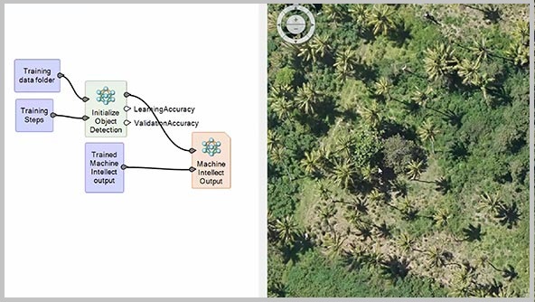
Oil Palm Mapping Tech Talk
Learn how to perform object detection using deep learning convolution neural networks in ERDAS IMAGINE.