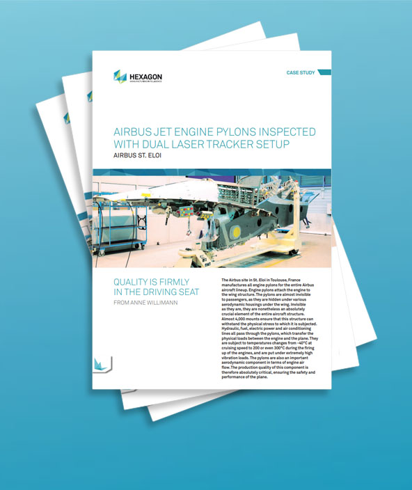
Airbus jet engine pylons inspected with dual laser tracker setup
Airbus - France
Contact us
Exponential improvement in turnover rates
The metrology lab at the St. Eloi pylon unit inspects every single pylon before it is assembled on the planes. 80 pylons are inspected every month. François Richer, Company Customer Coordinator in the Quality Management Department, explains: The first pylon measurement and control tools were Kern theodolites with a camera and adhesive target markers. This method represented a real technological breakthrough during the 1990s. In 1999, Airbus St. Eloi purchased two Leica LTD500 laser trackers, which were used sequentially, measuring about 600 pylons per year at that time. The exponential rate of airplane production resulting from increased demand quickly exceeded the capacity of the metrology lab. François Richer continues: With a target rate increase of 54% over the period between 2006 and 2010, we had to react and find a solution to overcome this bottleneck.
Major time-savings accomplished with a dual laser tracker setup

The initial plan to build a second metrology lab was quickly abandoned. The lack of space and the difficulties in constructing an identical lab forced us to explore different methods of saving time, And so the idea of placing two Leica Geosystems laser trackers in parallel to synchronize the measurement was quickly adopted, with the main requirement that the system be easy to use.
Therefore, the St Eloi team contacted the support service of the Leica Geosystems parent company in Switzerland, and the programmers at both firms went to work. There were numerous challenges: in addition to finding a solution for placing the two measuring systems in parallel and synchronizing the measurements, the constraints of taking specific non-identical measurements on each side of the pylons (with a different number of measurement points) were considerable. The financial advantage of this solution is also important: the two existing laser trackers can be retained, while time savings of 50% in the measurement cycle can be made simply by altering the tracker management software.
Adopting a single software package for simple measurements in rapid succession
The software originally used by Airbus had at that time no longer satisfied the time requirements, recalls Stéphane Malet, a sales engineer at Leica Geosystems responsible for southwestern France and the dedicated local contact of the Airbus sites in the Toulouse region. The current solution is based on the EmScon software from Leica Geosystems. The Airbus in-house development team adopted the EmScon tool by creating a solution that is fully integrated in the application and is capable of adapting to system changes. The gateways and conversions have been reduced to a bare minimum to make the software as simple and economical as possible. The users, who always dreaded the software development and validation phases, were also involved in the developing phase. As one user explains, The software now includes functions that didn’t exist before, with a very simple system of boxes to check off, and with no impact on the model file. The man-machine interface is perfect, safety is optimized, and it is now easy to create and print reports.
The massive streamlining of the software means that the measurement data is instantly accessible, for example when reviewing point measurements, providing responses to user queries and storing all measurement points in a database. Consequently, placing the two Leica LTD 500s in parallel very quickly allowed the measurements to be synchronized. Two points on each side of the pylon create an initial product location plan within the metrology lab while major structural points then enable two distinct coordinate systems to be created: the engine referential and the wing referential. Next, each laser tracker measures the points within its field of view in synch with the other laser tracker. The coordinates of the points are then compared to the engineering department’s coordinates in different referential using an EmScon matrix calculation function, which is then exported into a spreadsheet program. We have tested a number of new ideas using our two laser trackers in parallel measuring a single target at a single moment using both laser trackers works very well. On the pylon of an Airbus A380, we measure 54 points, making a total of 216 points on the 4 pylons. The points representing the engine and wing referential with set orientations are measured twice with different designations in order to identify their true position.
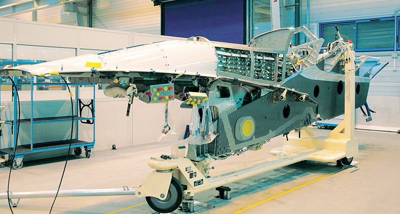
Specific tooling
 The speciality of the Saint Éloi plant was, and still is, the machining and drilling of hard metals. It is wishful thinking to hope to position the parts by measurement alone as the drilling loads of the digitally controlled machines are considerable and the assembly jigs must be extremely robust. The tool jigs, inspected annually, perform the assembly of elementary parts. The laser trackers take an overall snap shot of the pylons. These measurements facilitate the final control and, if necessary, any modifications and corrective actions.
The measurements are updated automatically by re-importing the measurement results database in another database for statistical purposes and, if necessary, corrective actions. François Richer: A statistical analysis of the measures outside the tolerance values makes it possible to identify the cause of the deviation and to implement the necessary corrective actions. Our goal for the future is to eliminate the skilled labour aspects of conducting measurements. Manufacturing and monitoring these unique tools over time represents a high cost, multiplied for each type of pylon. Eliminating these measuring aid tools requires a new measurement solution. With this in mind, a robotic measurement solution – using the Leica T-Probe and a laser tracker, which would guide a robot in 6 degrees of freedom – is currently being evaluated. The accessibility and the mechanical interface of the robot are still to be checked. We are happy that Hexagon Metrology and Leica Geosystems are able to match the technological evolution of our needs to optimize the control aspect of the process. This is what a real partnership is all about.