How Hexagon creates value for mapping and geospatial content industry
Geospatial technology for better analytics and location intelligence
In our rapidly changing world, cities, nations and infrastructure must be mapped more frequently than ever before. Hexagon offers solutions to create, manage and analyse digital twins and better visualise, monitor and simulate changes in order to provide the highest quality of life to citizens.
Accurate digital representations of our world play an essential role in creating a sustainable future. Digital twins, 3D models and location intelligence provide a new level of information that is ideal for monitoring ecosystems, simulating changes and making informed choices.
In past years, we have learned just how unpredictable the world is. Having current, rich digital twins, maps and location intelligence at hand enables us to proactively manage emergencies and compare the past with the present to predict the future.
For the most effective analytical results, maps need to be updated regularly. Hexagon's sensor, software, platform and data solutions support the planning of smarter, greener and more livable cities and nations by providing high-productivity tools to enable in-depth analysis.
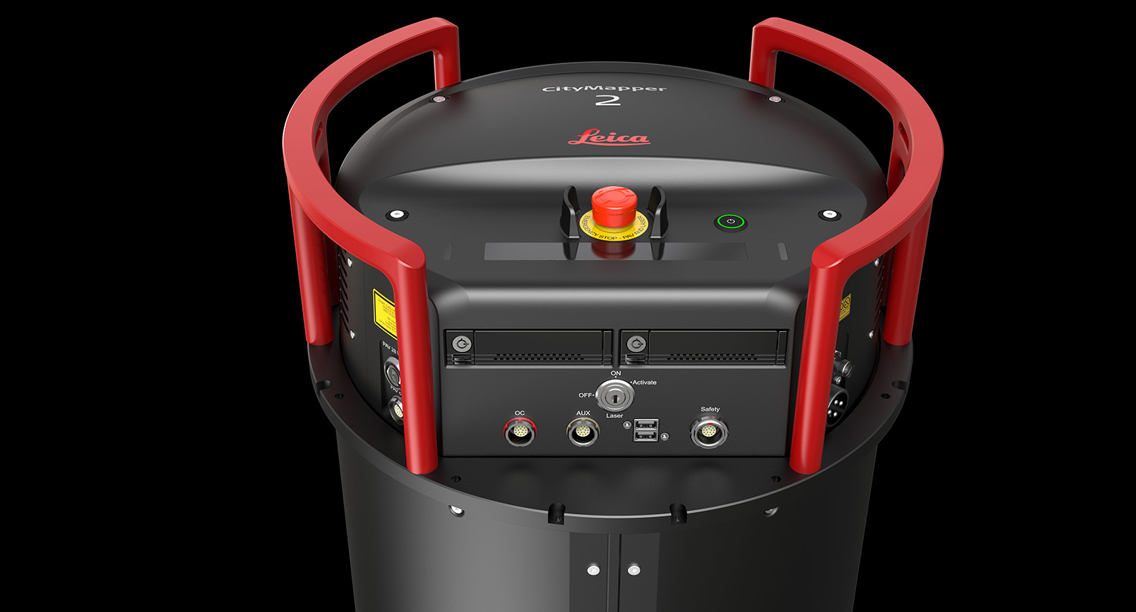
Hexagon has more than 100 years of experience in developing, producing and distributing the world's most accurate and innovative mapping and reality capture solutions. You can rely on the productivity of our sensors to capture more data in less time.
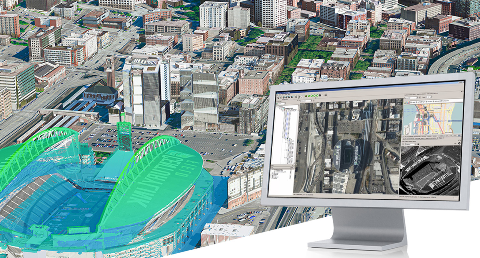
Capture entire countries or cities in 2D or 3D from the air to enable map creation, feature extraction and object detection, or collect street-level data to generate highly detailed photorealistic maps of cities. With an extensive global customer support network, we are a trusted partner for service providers worldwide, delivering the most productive imaging and LiDAR mapping solutions.
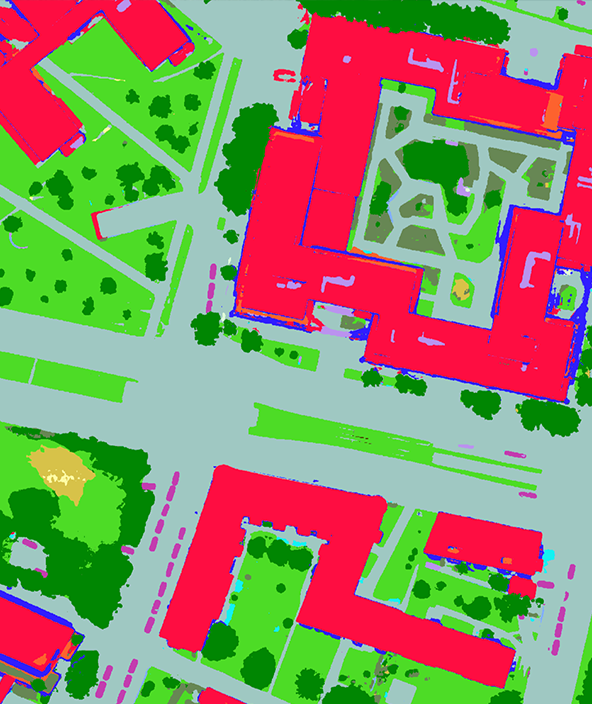
Hexagon offers industry-leading geospatial data processing, GIS, remote sensing, photogrammetry and data management software. Innovative and highly productive workflows enable you to efficiently capture, process, analyse and understand geospatial data to yield actionable information.
- Compute data acquisition parameters to efficiently plan and execute mapping missions while reducing project costs
- Produce all different geospatial data products from imaging and LiDAR sensors faster with high-performance processing workflows
- Collect, process, analyse and understand geospatial data to yield actionable information
- Organise geospatial and business data into centralised libraries and share them with other stakeholders
- Deliver information through web and mobile apps or build your own solutions
Whether you are building real-time situational awareness applications or interactive dashboards that power your daily operations, Hexagon's platforms provide the tools to deliver custom experiences to your organisation and customers. We enable developers to unlock the potential of real-time location intelligence, while providing enterprise platforms for configuring smart, lightweight and dynamic applications.
- Store, visualise and share reality capture and geospatial data on the cloud
- Create powerful applications with static, dynamic and real-time data from any source for 2D and 3D visualisation and analysis
- Combine content, business workflows and geoprocessing into single applications to solve specific business and customer problems
- Support multiple applications from lightweight apps to enterprise-wide situation awareness systems

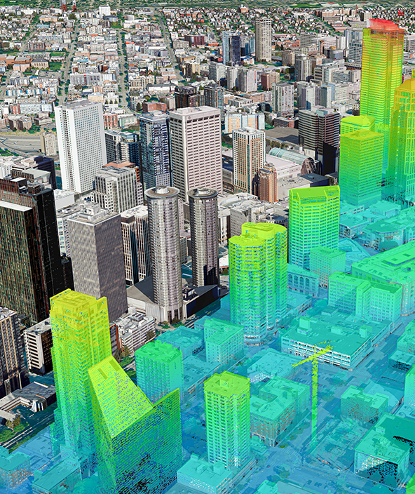
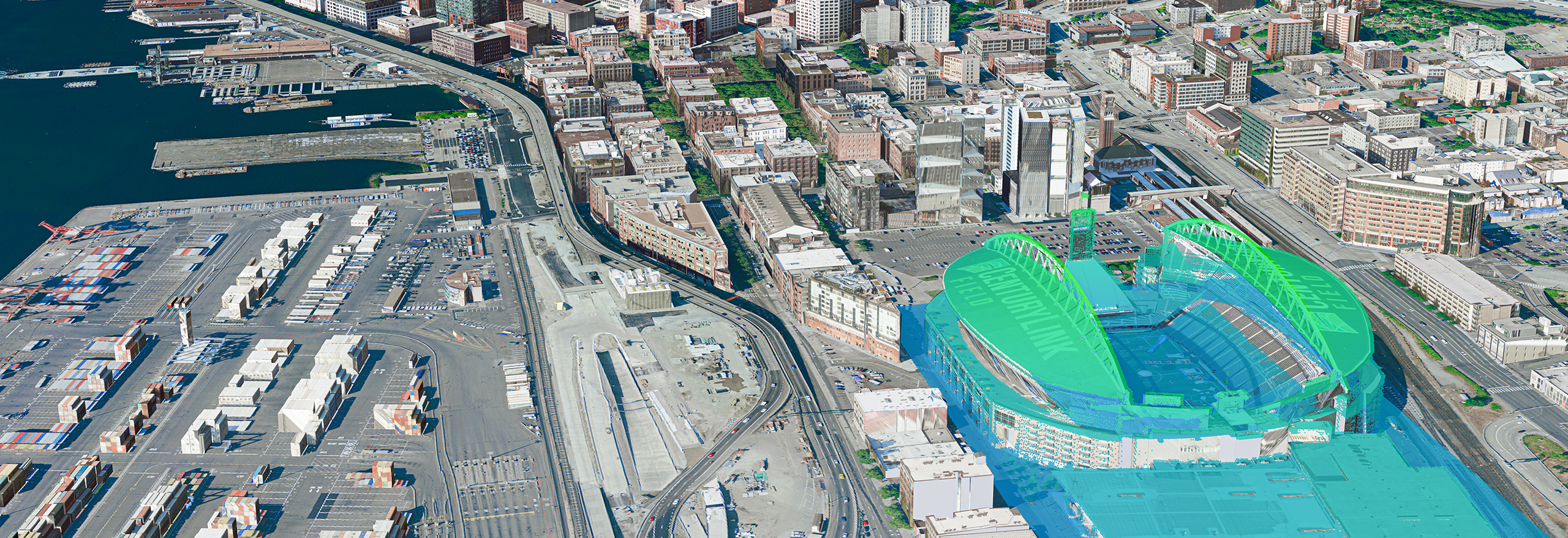
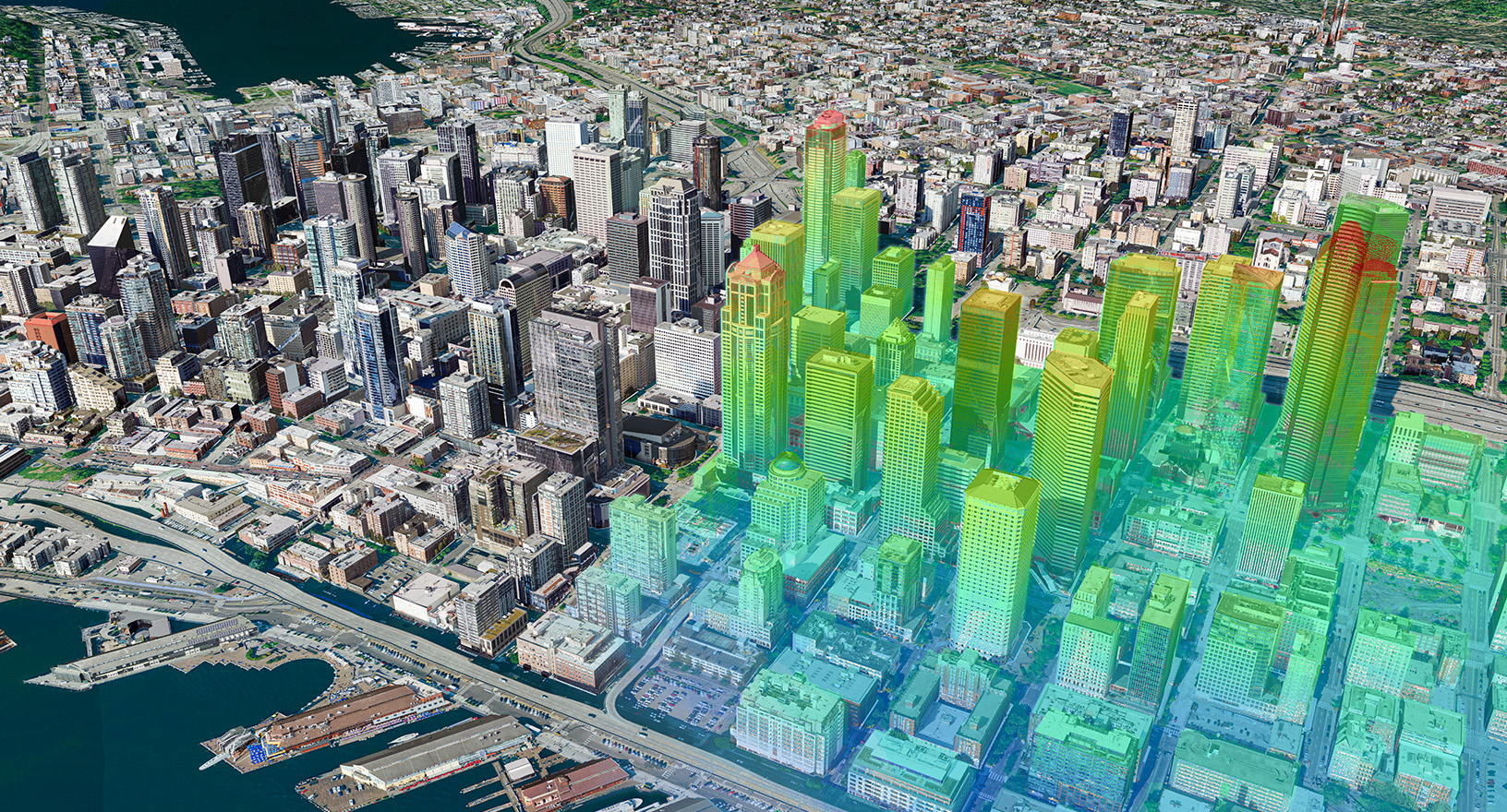
Hexagon's aerial data program, the HxGN Content Program, offers the most extensive library of aerial imagery, elevation data, 3D models and analytics across North America and Europe. All data is orthorectified, highly accurate and available at multiple resolutions. Exceptional data consistency and flexible use terms make the HxGN Content Program ideal for use in AI and machine learning algorithms to extract features, objects and analytics.
Hexagon's extensive data stack enables state governments, city administrations and infrastructure providers to manage and monitor critical assets, anticipate and mitigate risks, visualise projects, engage citizens and create smarter, more sustainable and livable cities and nations. Tech companies use the data to fuel their applications and create more accurate maps.

Transforming and disrupting
Hexagon drives the digital transformation of the mapping industry, empowering customers to leverage geospatial data and location intelligence for informed decision-making. Our sensors, software, platforms and data solutions revolutionise how customers create maps and use geospatial information.
- Airborne mapping sensors capture country- and city-wide data to provide precise 2D and 3D maps
- Vehicle-agnostic mobile mapping efficiently captures street-level data
- Productive data-processing workflows offer fast delivery of data products per customer spec
- Country-wide data programs offer on-demand access to 2D and 3D maps, geospatial data and location intelligence, enabling automatic feature extraction and object detection
- Cloud-based geoinformation platforms enable data monitoring, sharing, analysis and visualisation and aid collaboration and project management
- GIS platforms enable efficient asset management to protect critical infrastructure
- High-tech GPS and GNSS provide precise positioning