Positioning sensors and technologies
Utilise assured positioning solutions for precise navigation.

The world’s most precise and accurate satellite-based positioning
Hexagon’s positioning sensors and technologies increase navigation accuracy and integrity.
From mining to aviation, agriculture to marine, there are many applications for Global Navigation Satellite System (GNSS) technology. Hexagon's GNSS solutions offer stand-alone, relative and post-processed positions as well as heading, attitude, timing and velocity.
-
Positioning
-
Heading
-
Attitude
-
Velocity
-
Timing
A network of satellites, or Global Navigation Satellite System (GNSS), broadcast timing and orbital information for navigation and positioning measurements. Technology using GNSS can compute your location based on the time of flight of signals from four or more satellites. Applications rely upon these satellite signals to work efficiently and accurately. GNSS can be used for many important applications:
- Location: determine your position
- Navigation: identify the best route
- Tracking: monitor an object’s movement
- Mapping: create maps of a specific area
- Timing: compute precise timing
Various GNSS equipment supports the needs and requirements of industries and applications. To use GNSS, you need an antenna and a receiver.
Antennas act like a gatekeeper to satellite signals — they accept high-quality signals and reject low-quality signals. The receivers then de-modulate the satellite signal and compute position, navigation or timing measurements.

Heading determination allows you to know where an object is pointing with respect to true north on the horizontal plane. Hexagon’s technology provides heading solutions for real-time or post-mission processed positioning.
Attitude consists of the roll, pitch and yaw of an object's orientation and movement. It offers a three-dimensional, 360° analysis of the object's movement. These measurements are integral to precise positioning in mobile mapping, airborne reconnaissance, helicopter navigation and motion compensation applications.
You can think of attitude as a plane flying through the air:
- When the wings tip left and right: roll
- When the nose tips up or down: pitch
- When the nose turns left or right: yaw
Hexagon attitude solutions utilise our SPAN technology for sensor fusion of GNSS with inertial technology to offer accurate solutions for any application.
Velocity provides the speed and direction that an object is moving. GNSS receivers determine the direction of the motion of the GNSS antenna relative to the ground to solve for velocity. GNSS-derived velocity measurements are found primarily in guidance applications and speed determination applications.
Hexagon's receivers offer a 1 pulse per second (pps) output tied to GPS time, with timing accuracies measured in nanoseconds. Some receivers also include an external oscillator input to allow a more precise base timing signal and give highly accurate pseudorange and carrier phase measurements.
Explore
$ProductName
$SustainabilityImpactLabel
$SustainabilityCTABandHeadingLabel
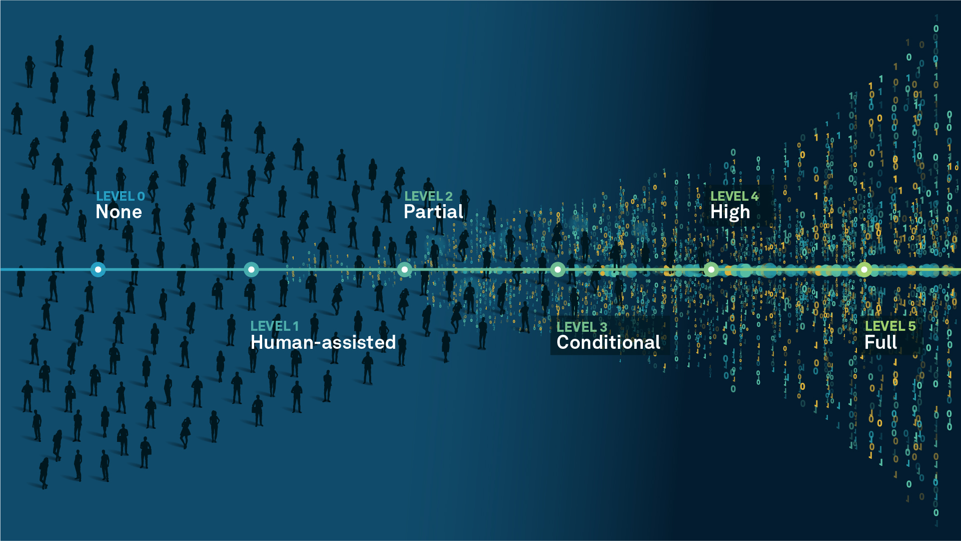
We’re climbing the automation curve
Our transition to Intelligent automation is accelerating. Ultimately, our innovations will give rise to new technologies and applications - many of which we’ve yet to imagine. Today, every Hexagon solution is mapped and tagged according to its level of automation, so customers can clearly track our progress towards the freedom of autonomy.
Human-driven
All tasks completed by human labour; no data is leveraged across the operation.
Human-assisted
Labour is primarily conducted by a human workforce. Some functions have been automated to simplify control.
Partial automation
Some tasks are automated for short periods of time, accompanied by occasional human intervention.
Conditional automation
Human workforce is used for intervention as autonomous operations begin to increase productivity.
Highly autonomous
Autonomous systems complete required tasks within specific bounds, unleashing data and building smart digital realities.
Full autonomy
A smart digital reality™ enables autonomous systems to complete all tasks without human intervention.

Land
Products that make an environmental impact in forest monitoring, material reusability, farming or water usage.

Air
Products that make an environmental impact in renewable energy, noise pollution elimination and e-mobility.

Water
Products that make an environmental impact in saving our oceans, reducing pollution and increasing access to clean water.