Maximize Safety Environmental Monitoring Solutions
Maximise safety with real-time environmental monitoring solutions for natural hazards.
Comprehensive monitoring solutions
Combined technologies provide maximum safety with speed, reliability and depth of data.
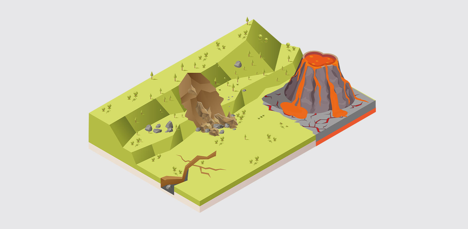
Hexagon provides tailored monitoring solutions for natural environmental hazards like landslides, rockfalls and earthquakes. Movement is monitored 24/7 in real time using a wide range of sensors and monitoring software to ensure the safety of people and assets.
Monitoring technologies
-
Overview
-
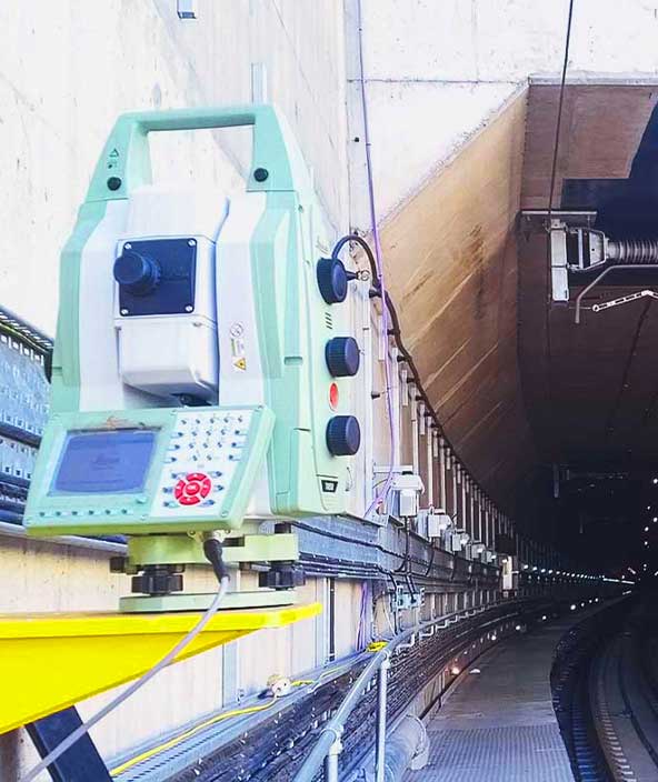
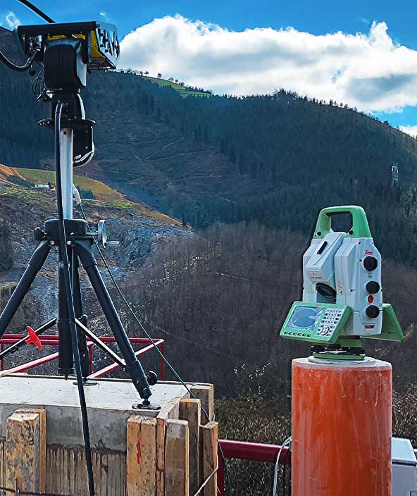
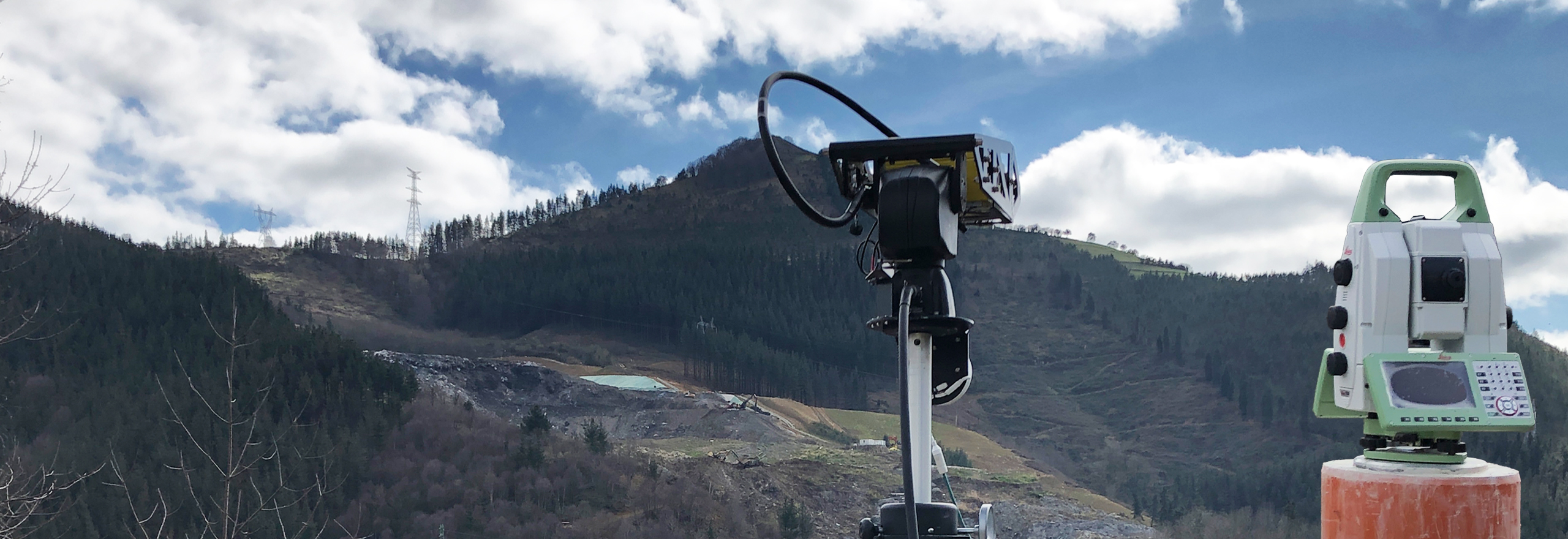
Geodetic sensors
-
Radar
-
Geotechnical and environmental
-
Software
Rockfalls, landslides, avalanches, debris flows and other environmental hazards can threaten inhabited areas and infrastructure, making monitoring crucial for safety. Whether you are monitoring for early warnings to detect natural hazard events, analysing information to predict failures or collecting aftermath data for studies, Hexagon offers monitoring solutions tailored to your requirements.
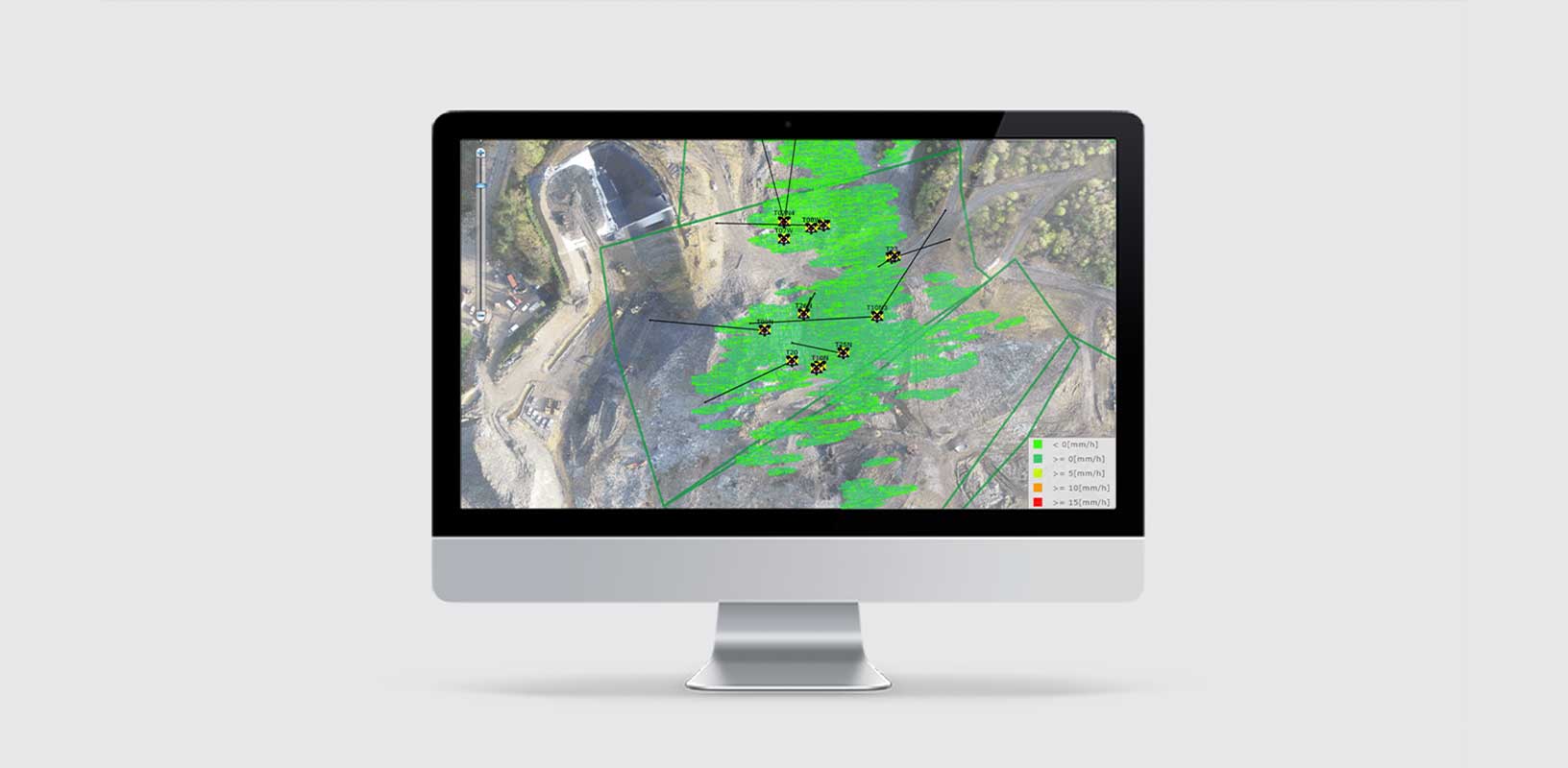
Environmental monitoring collects and provides actionable information about movements, delivering alerts and reports that enable effective management of natural hazard risks. Hexagon’s monitoring installations combine data from geodetic, geotechnical and environmental sensors and radar to create an immediate and comprehensive depiction of movements.
Additionally, Hexagon’s software and expert services work seamlessly with our high-end sensors like total stations, GNSS and radar, and third-party sensors to offer a fully integrated solution that provides peace of mind.
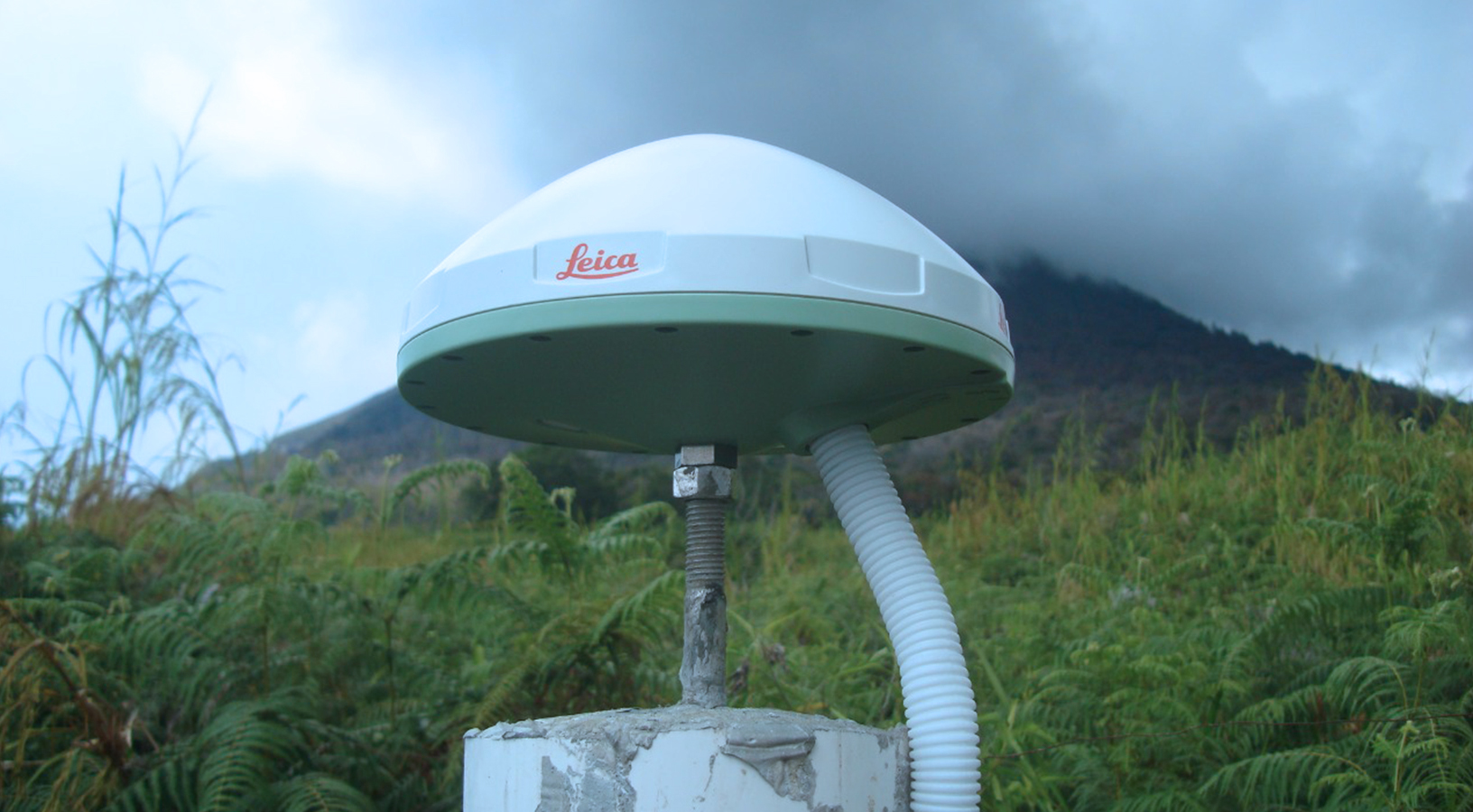
Geodetic sensors provide critical measurement and positioning data for effective environmental monitoring. Hexagon has a broad portfolio of total station and GNSS solutions that easily integrate the highest measurement accuracy and precise positioning from satellites into our monitoring solutions.
Hexagon pioneered the use of total stations for monitoring applications. With the highest measurement accuracy, even movements in the millimetres can be detected to ensure experts can make necessary decisions for maximum safety. Thanks to the latest innovations, data collection is secure, and continuous and point measurements can be complemented with images and point clouds, extending total station applications in monitoring.
Our GNSS solutions complement total stations and radar for precise movement detection by computing positions up to 20 times per second, operating continuously in all weather conditions and delivering the highest-accuracy positioning. Fully integrated into our monitoring software suite and tracking multiple satellite systems, Hexagon’s GNSS solutions deliver confidence.
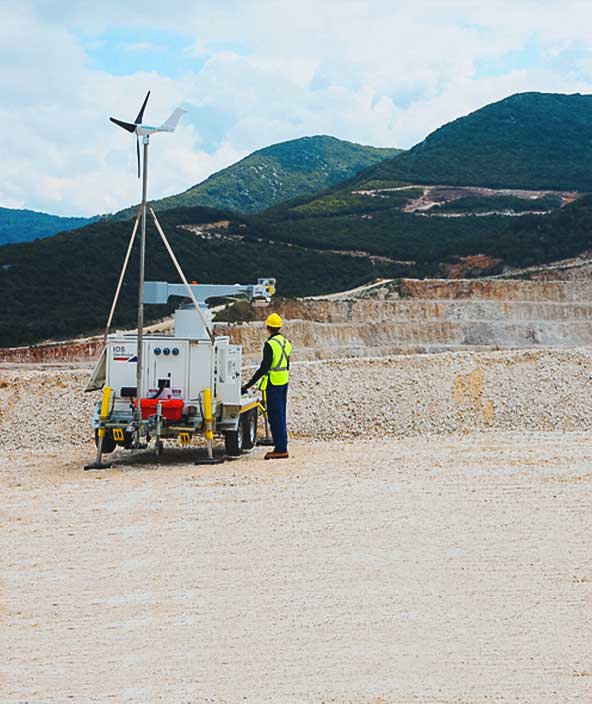
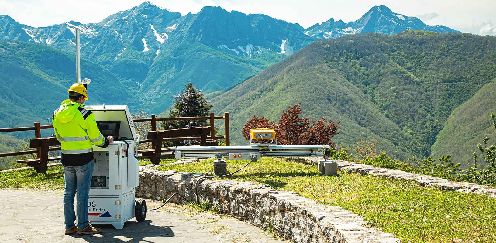
Hexagon is a world leader in radar systems based on microwave interferometry. Operating in real time, our radar measures displacements with sub-millimetre accuracy, detecting even the smallest movement.
Hexagon radar enables remote monitoring of large-area movements. With passive measurement technology, there’s no need to access the monitored object to install equipment, which is ideal for hazardous environments.
Our radar solutions enable monitoring of displacements with a sampling rate up to 200 times per second and at distances up to 5 kilometres to detect the smallest vibrations. Operating day and night and in all weather conditions, our radar is always reliable.
Real-time monitoring with our interferometric radar solutions also means rockfalls, avalanches and debris flows are detected in real time and communicated through immediate alerts issued to geotechnical experts and working crews, increasing safety.
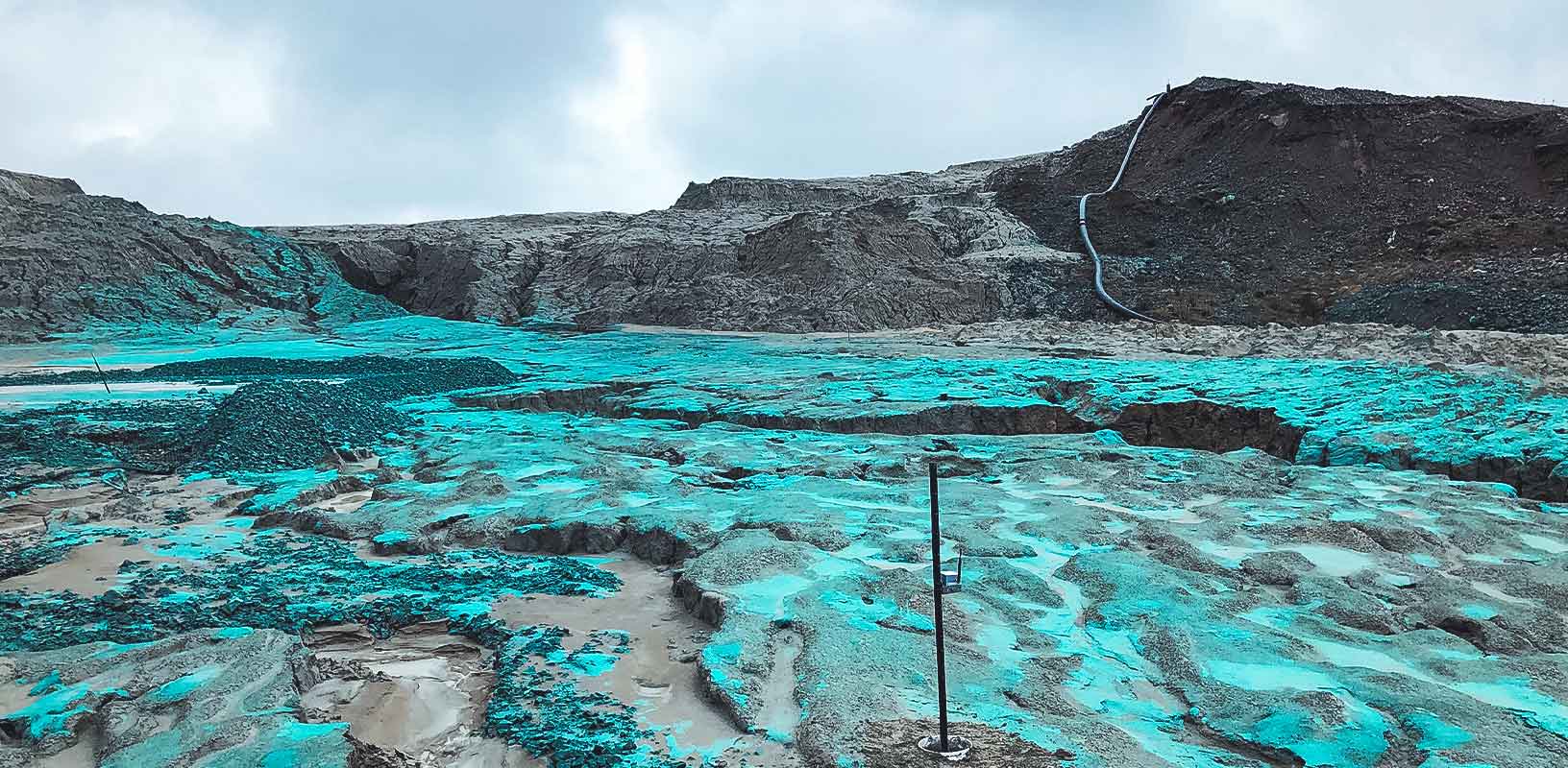
Hexagon’s environmental monitoring solutions integrate a range of geotechnical and environmental sensors, such as piezometers, crack sensors and more, to detect and provide additional information about ground movements and water levels.
Hexagon’s monitoring experts consult on geotechnical and environmental sensors to complement and fill in gaps from geodetic and radar sensors, providing comprehensive monitoring coverage.
Our solutions seamlessly integrate a variety of third-party sensors and ensure continuous data acquisition using edge technology. Compatible with our monitoring software, all this data works toward creating the most complete picture of the monitored environment.
Hexagon’s portfolio of monitoring hardware is perfectly complemented with software tailored to natural hazard and environmental monitoring applications. Our software aggregates and analyses data, eliminates data gaps and creates alerts and reports.
Supporting accurate and reliable data acquisition from geodetic, geotechnical, environmental and radar sensors, our solutions enable data integration between geodetic and radar data sets to provide a clear and comprehensive understanding of the environment and movements.
Measurement results are easily visualised and configured to issue alerts when movements exceed defined limits. Together with cloud services, monitoring results can be accessed anytime and anywhere. Our software solutions also leverage edge computing technology to continuously collect data despite communication disruptions.
Explore
$ProductName
$SustainabilityImpactLabel
$SustainabilityCTABandHeadingLabel
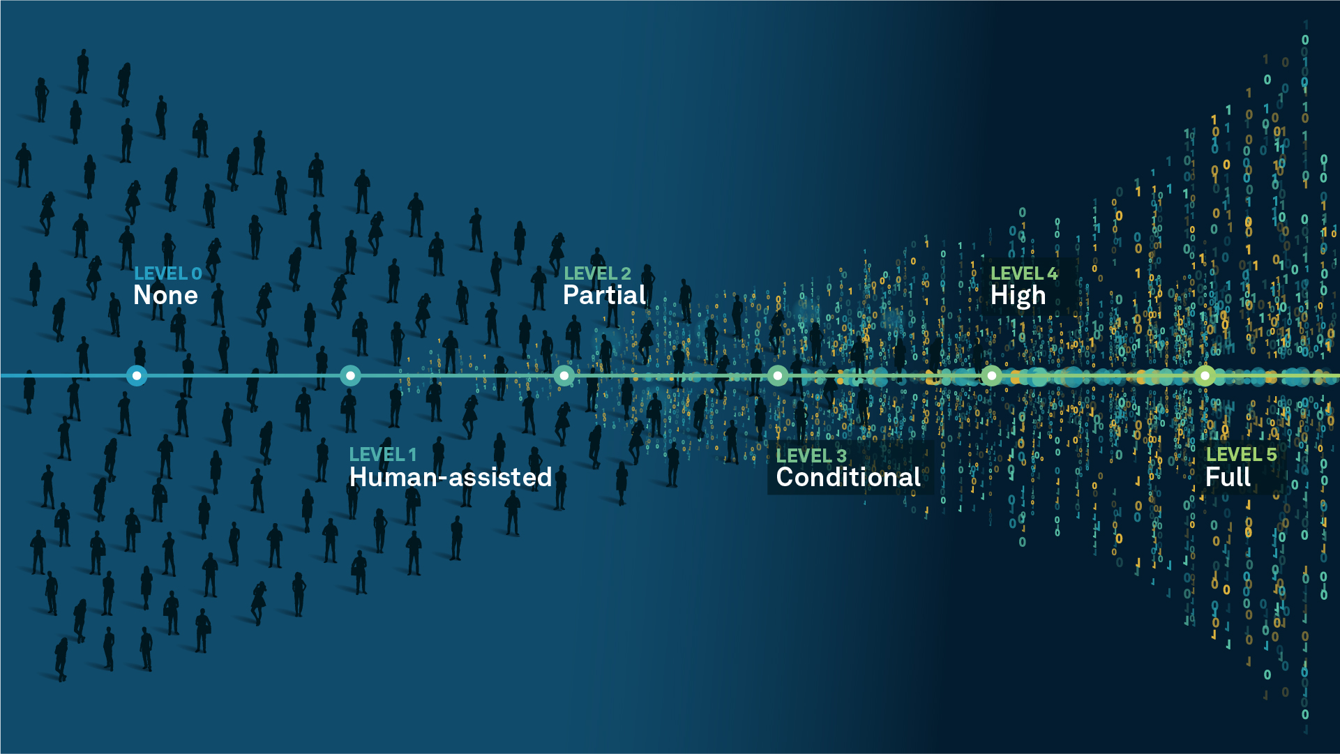
We’re climbing the automation curve
Our transition to Intelligent automation is accelerating. Ultimately, our innovations will give rise to new technologies and applications - many of which we’ve yet to imagine. Today, every Hexagon solution is mapped and tagged according to its level of automation, so customers can clearly track our progress towards the freedom of autonomy.
Human-driven
All tasks completed by human labour; no data is leveraged across the operation.
Human-assisted
Labour is primarily conducted by a human workforce. Some functions have been automated to simplify control.
Partial automation
Some tasks are automated for short periods of time, accompanied by occasional human intervention.
Conditional automation
Human workforce is used for intervention as autonomous operations begin to increase productivity.
Highly autonomous
Autonomous systems complete required tasks within specific bounds, unleashing data and building smart digital realities.
Full autonomy
A smart digital reality™ enables autonomous systems to complete all tasks without human intervention.

Land
Products that make an environmental impact in forest monitoring, material reusability, farming or water usage.

Air
Products that make an environmental impact in renewable energy, noise pollution elimination and e-mobility.

Water
Products that make an environmental impact in saving our oceans, reducing pollution and increasing access to clean water.