Laser scanning efficiency on a whole new level
Conseil scolaire public du Nord-Est de l'Ontario (CSPNE) is a French School Commission with its headquarters in the City of North Bay, in Northern Ontario. They are responsible for supporting that region's French-speaking communities and providing education services from early childhood up to college degrees. The schools they manage are scattered around Highway 11 in the northernmost province until the town of Hearst. A recent growth spur forced the CSPNE to maximise the current buildings, which led to them using portable classrooms to cope with the demand.
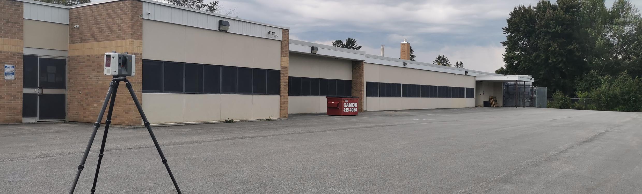
Plans to expand have been set up but the CSPNE realised that digital twins of the schools and administration buildings would optimise the process. This is where DCMS was retained by the CSPNE following a public bid to digitise their entire building portfolio within eight days of August 2021. Founded in 2018 and adapting the Leica RTC360 3D laser scanner and the Leica BLK360 G1 imaging laser scanner two years later, they had many good experiences with reality capture technology. They felt confident in taking on such a large-scale project with their team and the RTC360. Three technicians of the DCMS team were dispatched, namely a drone pilot, a LiDAR specialist, and a virtual visit technician, to go and capture the buildings of the schools.
Scanning two schools a day with one scanner
With more than 53,000 square metres combined the 15 schools had a large area to capture before the new session resumed. The DCMS team worked tirelessly for more than 10 hours a day to scan all the buildings with the help of the CSPNE coordinating with the administrative staff to provide access. It took the DCMS team 250 to 300 set-ups per day to complete the task with the RTC360. The four-battery set came in very handy as it was used to circle them and keep the RTC360 running throughout the day. Just as valuable were the two 256 GB removable jump drives for DCMS as they could simultaneously upload the data while continuing the scans. As the laser scanning continued, the technicians became fonder of the RTC360 and its capabilities.
“It is inspiring to work with colleagues on the field; early starts, late evenings, lots of fun… we happened to name our Leica RTC360 “Louie”, and our Louie, like any other soldier on the field, was truly inspiring, he never quit, no matter what, what a reliable dude,” said Alberto Palomino, Principal AEC Division at DCMS.
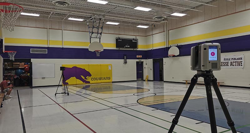
Some rooms were occupied during the first scans, which required the DCMS team to return and capture them in a second run. This is where the Leica Cyclone FIELD 360 mobile app proved extremely useful. Accompanied by the Visual Inertial System (VIS technology) within the RTC360, combining captured data into one data set with Cyclone FIELD 360 is much easier. It helped to reposition the RTC360 and complete the scans of the school to then send the captured data to be processed.
“The Cyclone FIELD 360 mobile app is really helpful when scanning occupied buildings. In some instances, you’re given access to one wing and afterwards to the opposite one. Cyclone FIELD 360 helped us organise independent clusters of data from the same project and rearrange them as groups to align them directly in the field. It’s also cool to do that, just like in a video game”. said Antonio Tomecich, DCMS Partner.
A large-scale project digitised
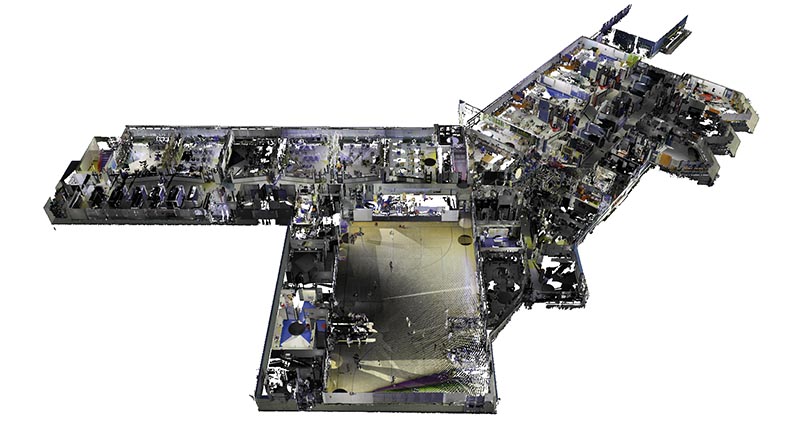
While their team scanned all the school and administration buildings, they continuously uploaded the data so that it could be accessed by their team. After uploading the captured data, the DCMS team in Lima, Peru, used it to create the deliverables within one and a half months. For this task, they used Leica Cyclone REGISTER 360 office software because it can read and process many different file types. The user-friendly interface of Cyclone REGISTER 360 enabled them to work more efficiently and the high processing speed of large data sets was a significant benefit for DCMS. After processing the data, it was exported as E57 or RCP file and then imported to Autodesk Revit to create 3D models of the school and administration buildings.
After processing the data and creating the deliverables, the DCMS team in Montreal did their quality control before sending it to the CSPNE. With the 3D models of the buildings created, the CSPNE had all the required information to plan their infrastructure’s future expansions as precisely as possible. This investment from the CSPNE was essential as designing and planning new buildings can be based on reliable and accurate data of existing conditions, making it easier and more efficient.
Looking at this project, Palomino said: “The process of scanning a building and creating a digital twin has become very efficient, which made it possible to scan 15 schools in only eight days and create the deliverables for all of them in just one and a half months with the right tools.”