Mine Geotechnical Studies
Point-cloud processing software for geotechnical studies employing proven 3D imaging technologies.
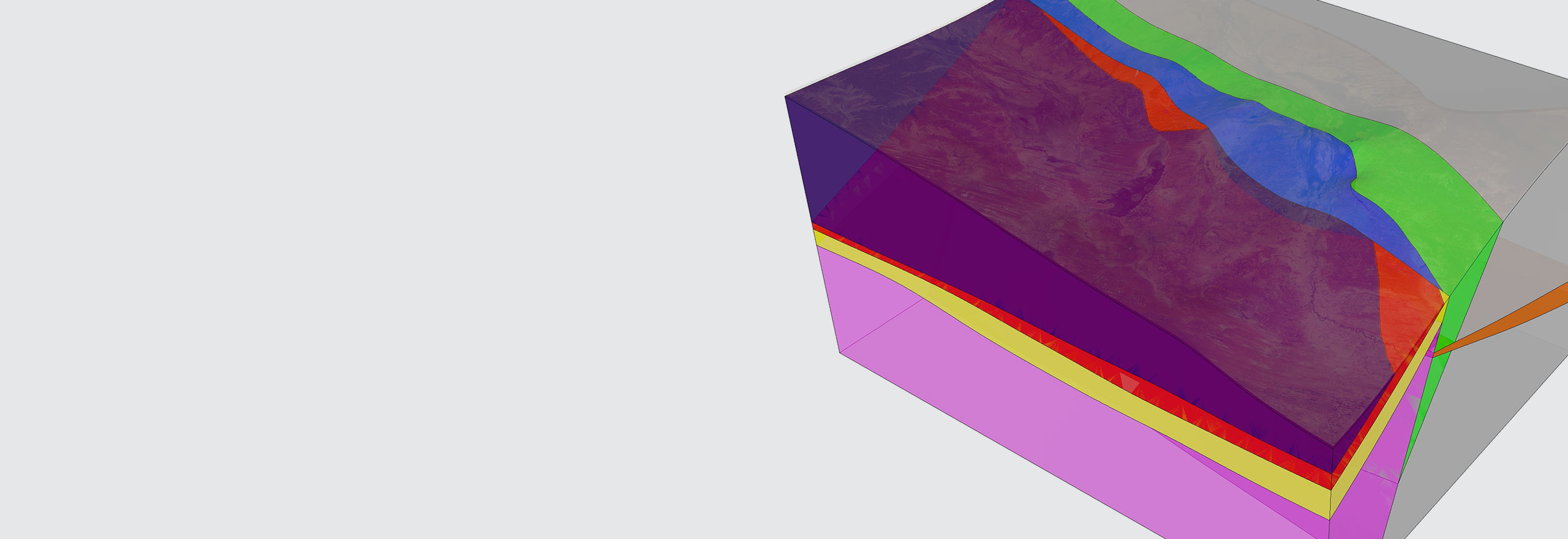
Mine geotechnical investigation using modern 3D imaging technologies
Process 3D point cloud data from LIDAR scans and photogrammetry to quickly and easily generate detailed information.
Hexagon equips geotechs with mine investigation software designed to extract geotechnical information from point clouds. For rock mass characterization, important attributes of the geologic structure are extracted from the point clouds, including discontinuity orientation and spacing.
Overview
Analysing drillhole data to characterize faults and other structures is essential for geotechs to understand and use rock characterization for mine planning.
Hexagon’s mine geotechnical investigation software allows for quick and easily generated detailed geotechnical information by leveraging point-cloud processing of 3D point cloud data from LIDAR scans and photogrammetry. This includes:
- Cell mapping and pre-rock blast conditions, including in-situ block size and joint spacing
- Cross-sections analysis for slope instability, rockfall modeling and accurate measurement of burden
- Change detection for rockfall and ground movement
For rock mass characterization, important attributes of the geologic structure are extracted from the point clouds, including discontinuity orientation and spacing. The orientation results are plotted on a stereonet and the primary joint sets are determined.

Explore
$ProductName
$SustainabilityImpactLabel
$SustainabilityCTABandHeadingLabel
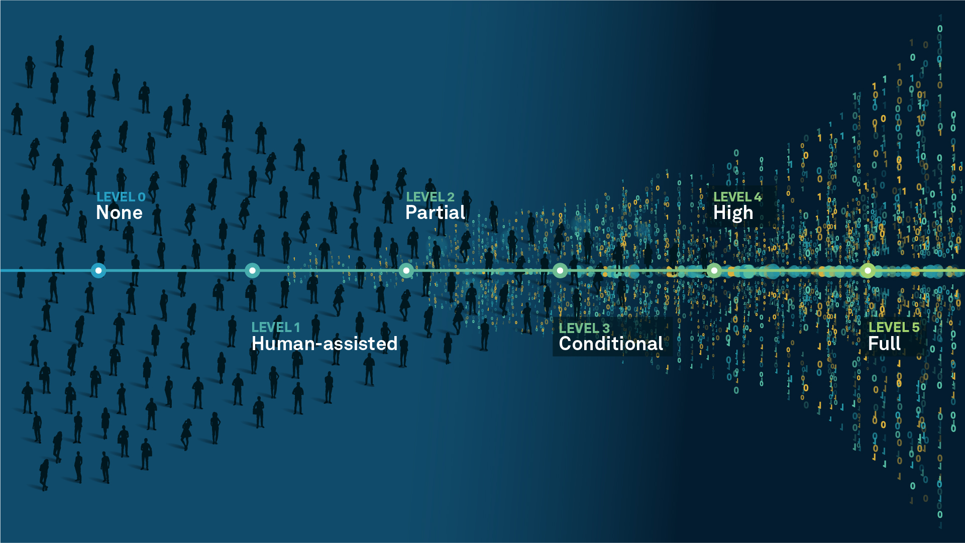
We’re climbing the automation curve
Our transition to Intelligent automation is accelerating. Ultimately, our innovations will give rise to new technologies and applications - many of which we’ve yet to imagine. Today, every Hexagon solution is mapped and tagged according to its level of automation, so customers can clearly track our progress towards the freedom of autonomy.
Human-driven
All tasks completed by human labour; no data is leveraged across the operation.
Human-assisted
Labour is primarily conducted by a human workforce. Some functions have been automated to simplify control.
Partial automation
Some tasks are automated for short periods of time, accompanied by occasional human intervention.
Conditional automation
Human workforce is used for intervention as autonomous operations begin to increase productivity.
Highly autonomous
Autonomous systems complete required tasks within specific bounds, unleashing data and building smart digital realities.
Full autonomy
A smart digital reality™ enables autonomous systems to complete all tasks without human intervention.

Land
Products that make an environmental impact in forest monitoring, material reusability, farming or water usage.

Air
Products that make an environmental impact in renewable energy, noise pollution elimination and e-mobility.

Water
Products that make an environmental impact in saving our oceans, reducing pollution and increasing access to clean water.