Hexagon releases Luciad 2020.1, featuring unique dynamic panoramic imagery capabilities
22 October 2020
Latest release delivers immersive 3D imagery and experiences
(Norcross, GA. USA) Hexagon’s Geospatial division has launched Luciad 2020.1, a significant update to its platform for building advanced location intelligence and real-time, situational awareness applications. Luciad 2020.1 delivers immersive 3D experiences with 360° panoramic imagery support that can be combined with other 3D data layers, a unique capability in the geospatial application market. The latest release also features additional styling for 3D meshes and 3D data integration capabilities.
Hexagon’s Luciad portfolio allows developers to create powerful, high-performance applications that leverage data from any source for visualization and analysis in 2D and 3D. Combining static, dynamic and real-time data, including moving tracks, Luciad-powered applications support defense, aviation, infrastructure and other critical sectors.
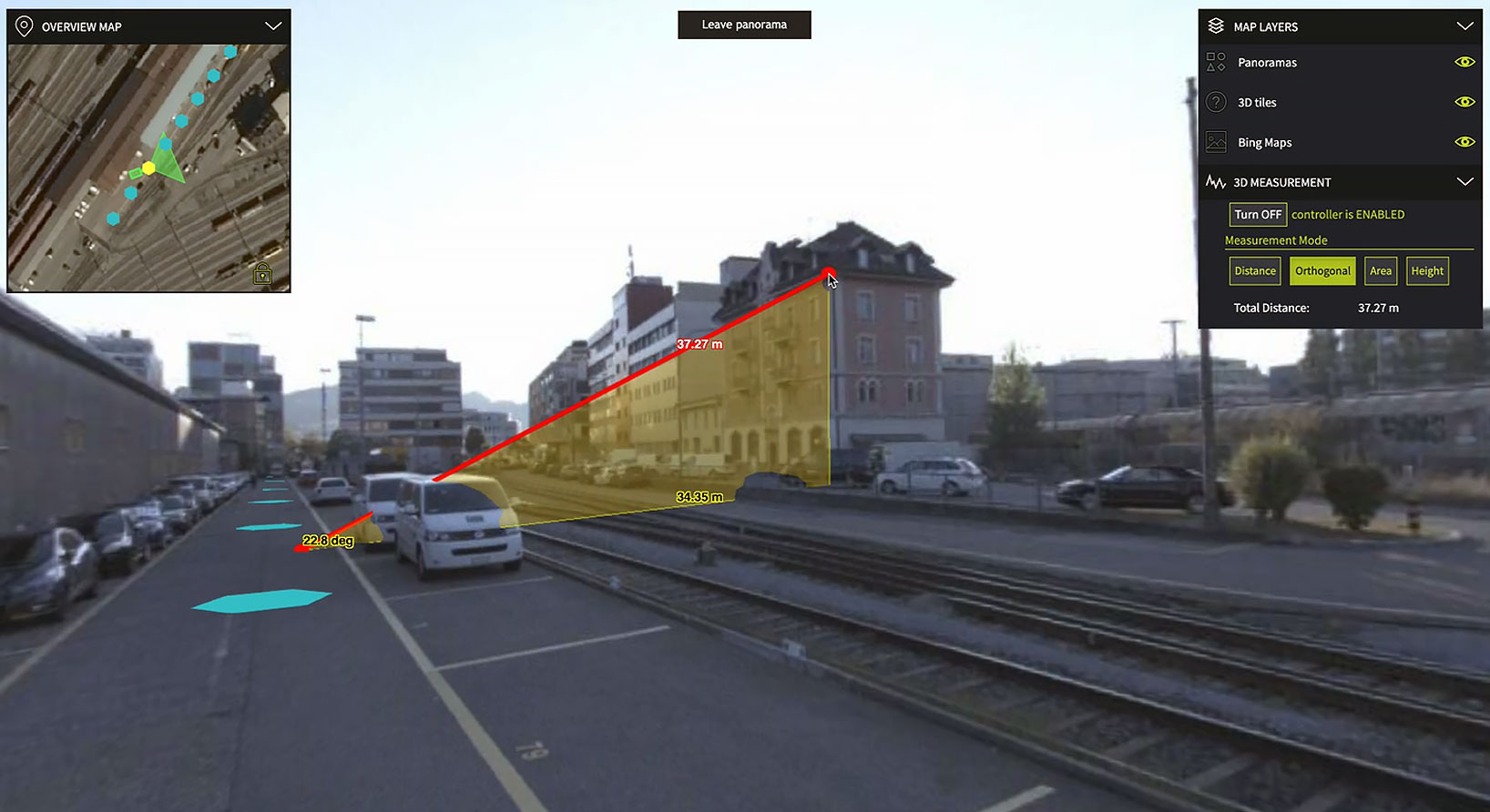
For the 2020.1 release of LuciadRIA, which is used for building browser-based solutions, Hexagon has added 360° panoramic imagery capabilities which can be combined with other 3D data layers to provide complete imagery coverage and detailed information about a location. This capability is the only one of its kind on the market. Panoramic imagery puts users in control of what they want to look at within an image. The panoramic 3D experience is powered by a new streaming imagery data service in LuciadFusion, Hexagon’s OGC-compliant server solution.
“With the addition of panoramic imagery capabilities and other 3D data enhancements, Luciad 2020.1 puts local governments, transportation departments, utility companies and others in control of what they can observe and analyze within a particular scene,” said Mladen Stojic, president of Hexagon's Geospatial division. “With these capabilities, organizations can remotely monitor their assets and infrastructure, significantly reduce manual inspection processes and fully leverage location intelligence across the enterprise.”
The release contains other new features and improvements requested by customers, including military grid coordinate transformations, non-georeferenced WebGL-based views, improved imagery sampling and additional format support and upgrades. For defense customers, the Luciad 2020.1 release consolidates its market-leading military symbology support to be pixel perfect across all Luciad platforms and programming languages.
To learn more about Luciad 2020.1, visit https://www.hexagongeospatial.com/products/luciad-portfolio.
ABOUT HEXAGON
Hexagon is a global leader in sensor, software and autonomous solutions. We are putting data to work to boost efficiency, productivity, and quality across industrial, manufacturing, infrastructure, safety, and mobility applications.
Our technologies are shaping urban and production ecosystems to become increasingly connected and autonomous — ensuring a scalable, sustainable future.
Hexagon's Safety, Infrastructure & Geospatial division improves the performance, efficiency and resilience of vital services. Its Safety & Infrastructure solutions enable smart and safe cities. Its Geospatial software leverages the power of location intelligence.
Hexagon (Nasdaq Stockholm: HEXA B) has approximately 24,500 employees in 50 countries and net sales of approximately 5.4bn EUR. Learn more at hexagon.com and follow us @HexagonAB.
FOR FURTHER INFORMATION
Emily Arnold, Global Communications Manager
Tel: +1 256.730.2582
Email: emily.arnold@hexagon.com