SDKs (visualisation and analysis) for mobility
Build real-time tracking and visualisation applications for your autonomous mobility systems.

Unifly shapes drone space with Luciad at the core
Discover how Unifly’s drone management platform allows users to safely plan and fly UAVs in today’s commercial airspace.
Hexagon provides unmanned systems manufacturers and service providers with flexible SDKs to build customisable, real-time applications for their autonomous mobility solutions. With our capabilities, customers can ingest positioning data to track autonomous transportation and predict behavior on the roads, in the skies and on the water to improve future mobility.
Overview
The use of driverless vehicles is expanding in public and private transportation, furthering the need for solutions that increase the safety and efficiency of transportation networks, while the use of military unmanned systems has become an essential component of security operations in the air, on land and at sea.
Hexagon provides SDKs that developers can use to build geospatial visualisation and analysis solutions for the command, control and monitoring of the world’s increasingly autonomous systems. By combining sensor, satellite, weather and other real-time data, Hexagon’s solutions can track and monitor traffic movements, predict potential hazards and support accurate mobility. Through real-time visual data analytics, developers have the insights they need to ensure the safe operation of their unmanned systems.

Explore products
$ProductName
$SustainabilityImpactLabel
$SustainabilityCTABandHeadingLabel
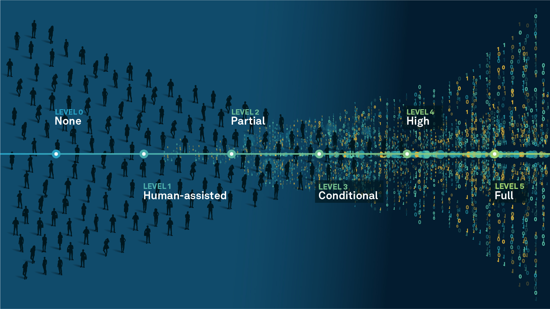
We’re climbing the automation curve
Our transition to Intelligent automation is accelerating. Ultimately, our innovations will give rise to new technologies and applications - many of which we’ve yet to imagine. Today, every Hexagon solution is mapped and tagged according to its level of automation, so customers can clearly track our progress towards the freedom of autonomy.
Human-driven
All tasks completed by human labour; no data is leveraged across the operation.
Human-assisted
Labour is primarily conducted by a human workforce. Some functions have been automated to simplify control.
Partial automation
Some tasks are automated for short periods of time, accompanied by occasional human intervention.
Conditional automation
Human workforce is used for intervention as autonomous operations begin to increase productivity.
Highly autonomous
Autonomous systems complete required tasks within specific bounds, unleashing data and building smart digital realities.
Full autonomy
A smart digital reality™ enables autonomous systems to complete all tasks without human intervention.

Land
Products that make an environmental impact in forest monitoring, material reusability, farming or water usage.

Air
Products that make an environmental impact in renewable energy, noise pollution elimination and e-mobility.

Water
Products that make an environmental impact in saving our oceans, reducing pollution and increasing access to clean water.