Digital twin simplifies documentation of demolition projects
Author: Tobias Scharpenberg
At FISCHER Weilheim GmbH & Co. KG, demolitions and dismantling are precise works in carefully defined workflows and timings. In particular, when it comes to bridges over important road connections, which must be reopened as soon as possible, the time frames for executing the individual workflows are tight. For efficient and sustainable as-built documentation of the infrastructure, the company is testing the use of 3D laser scanners.
The life cycle of infrastructure
The life cycle of infrastructures consists of the phases of design and planning, construction, use and maintenance, modernisation, as well as demolition, recycling and disposal. The heavy construction industry is a diverse sector, with various contractors and their sub-contractors performing a wide range of construction work in these phases on a daily basis. Usually, the focus is on the planning and execution of earthworks and the maintenance of infrastructures. However, there is more to heavy construction than just moving dirt. Planned demolition is just as much a part of the activities of many heavy construction companies as excavation, fine-grading and transport.
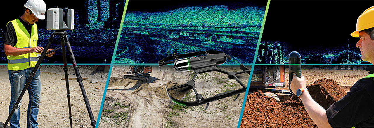
In recent years, digital solutions have taken on a central role in all construction phases to deliver projects efficiently, precisely, safely, sustainably and profitably. From the positioning and measurement of surfaces, spaces and sites to the preparation and mobilisation of precious resources to the execution of the construction work, data and its processing take on a key role. This also applies to modern demolition projects. Especially the as-built documentation with 3D laser scanners before the demolition of infrastructure offers a variety of advantages and is a real game changer when it comes to invoices.
Everything from one single source
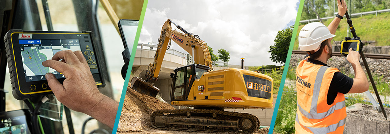
As a leading specialist in transport logistics, circular economy and recycling in Germany, FISCHER Weilheim GmbH & Co. KG takes responsibility for the environment, for people and for a future worth living. That is why the company relies on accurate data management and modern technologies for their projects. After one year of testing with products from different suppliers, the company decided to equip its machine fleet with the Leica MC1 machine control solution from Leica Geosystems.
At FISCHER Weilheim, construction work and surveying are integrated processes. Sven Molt leads the team of eight surveyors who, in addition to the classic surveying work, are also responsible for the 3D machine control of the fleet. A key aspect of the work is digital data management. From surveying the terrain conditions to preparing the design data and completing as-built documentation for invoicing, the team is involved in all phases of heavy construction projects.
The department’s responsibilities also include the invoicing of demolition projects. So far, the team has carried out the required surveying manually. As this process is time-consuming and error-prone, the company also wants to invest in modern technology in this segment. After the positive experience with the surveying equipment and the 3D machine control, a solution from Leica Geosystems for reality capture is now to be tested.
Smart Digital RealityTM: A digital twin as an optimal basis for invoicing
“It is becoming increasingly common that you have to provide more detailed documentation concerning billing,“ explains Molt. “Fixed prices and package deals are a risk for both sides, which can sometimes end favourably for one side and sometimes for the other.“ For this reason, the cubature, i.e., the volume of the object, is preferably used as the basis for calculation. For this, the outer shell of the object is measured, and the volume of the material is then calculated.
To meet the high requirements, the Leica Geosystems team recommends using a 3D laser scanning solution. This allows replicating the physical world and transforming it into a virtual environment. A digital twin of the demolition object is captured with outstanding speed and highest quality. All valuable and useful information can be visualised, extracted, analysed and shared for better collaboration through easy-to-use software solutions. This creates a competitive advantage and makes it possible to capture complex geometries with maximum productivity even under the most challenging conditions. The exact calculation of the volume of an object is done with just a few clicks.
3D reality capture solution delivers reliable data in record time
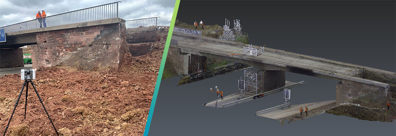
Molt wants to test this solution under real conditions. As part of a larger project, FISCHER Weilheim was commissioned to demolish seven bridges in total. The project will start with two bridges over the A8 highway in southern Germany. As is usual with such projects, the time slot for the surveying process is very tight: Both bridges must be scanned in one day, as demolition work is already taking place the following day.
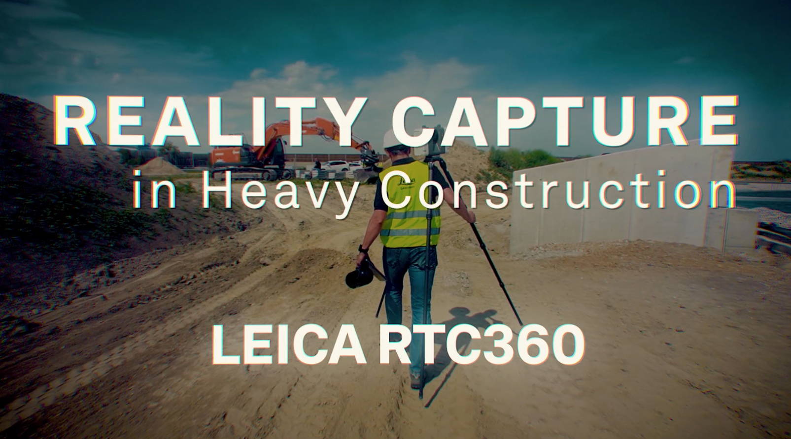
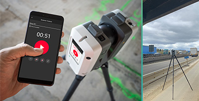
The day before the surveying takes place, the bridge abutments are already cleared. This step is necessary in order to recycle the demolition material of the bridges correctly and makes it possible to capture the entire cubature of the bridges without additional expense. For fast and reliable as-built documentation in the given time, Leica Geosystems recommends the terrestrial 3D laser scanner Leica RTC360.
The solution ensures maximum productivity as it is portable, fast and accurate. At the same time, it offers a high degree of automation and is easy to use. Each scan produces high-resolution point clouds and HDR (High Dynamic Range) images in less than two minutes. Using advanced VIS (Visual Inertial System) technology, the laser scanner automatically records its relative position and orientation as it is moved between set-up locations. This allows instant display of scan data in its actual position in the Leica Cyclone FIELD 360 app on a tablet or smartphone on site. Scans and imagery are automatically captured, pre-registered and verified, enabling real-time quality control and data registration on site and minimising processing time in the office.
After a short inspection of the construction site, the set-up locations of the laser scanner are determined, considering the danger zones. To capture the entire object despite moving traffic, the bridges are scanned from about 12 different positions each. In addition, three to four points per bridge are staked out with the GNSS rover Leica iCON gps 70. This makes it possible to combine the individual scans into a single georeferenced point cloud, providing exact data with a high density of information.
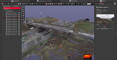
To calculate the cubature of the bridges, the point cloud data is initially optimised and registered in the Leica Cyclone REGISTER 360 software with automated workflows. The data is then transferred to the Leica Cyclone 3DR software, providing comprehensive point cloud management with automated analysis and modelling, including simple steps for surveying, editing and inspecting the digital twin.
To calculate the volume of the bridges, the point cloud data is converted into a meshed 3D model: Each three geometrically neighbouring measuring points form a triangle to represent the surface of scanned objects. The software provides the information necessary for the billing of the demolition project and allows easy validation of the information through the visualisation of the data.
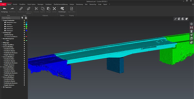
Cyclone 3DR
Precise data leave no room for arguments
Sven Molt likes the process with the Leica Geosystems solution: “From my point of view, it’s a great device. It works simply, fast and straightforwardly. We scanned both bridges within half a day. Without the laser scanner, the effort would have been much higher. We would have had to attach many targets to the bridges and survey them with a total station. If there are errors or an area is skipped, the bridge is gone the next day. There would be no digital twin.“
With the RTC360 solution, infrastructure can be fast and accurately digitised before being demolished. Automated processes maximise productivity and on-site quality control eliminates errors. The result is the basis for a Smart Digital RealityTM that makes it possible to validate measurements and examine details of the digital twin at any time, even after the physical object has been demolished. The technology provides Molt with a completely new basis for invoicing demolition projects: "Even afterwards, you still have the original object in front of you as evidence. You can go into every little detail and measure it. This eliminates a lot of discussions and makes the billing process a lot easier."
Dirt.Simple Data Collection
Our solutions are enabling contractors to improve accuracy, reduce costs, enhance collaboration, and ultimately deliver higher-quality construction projects more efficiently. Discover what Reality Capture can do for you.