Airborne Mapping
Digitalise cities and countries with Hexagon’s highly efficient airborne sensors and workflows.
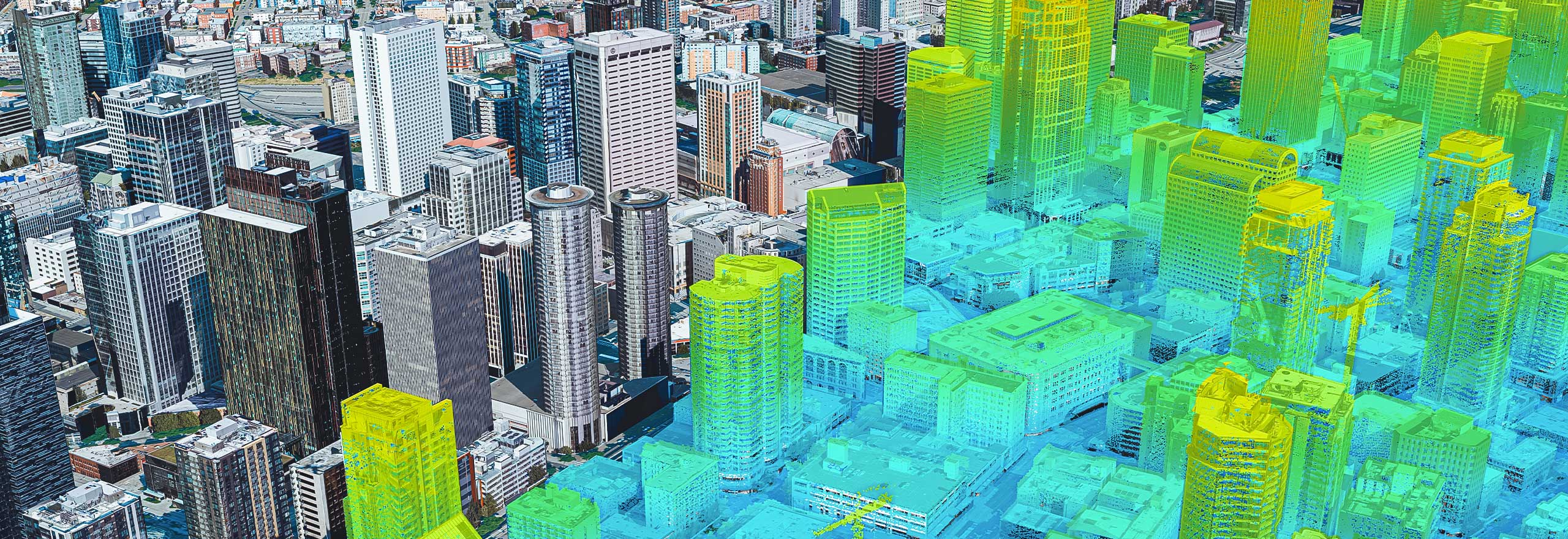
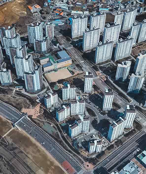
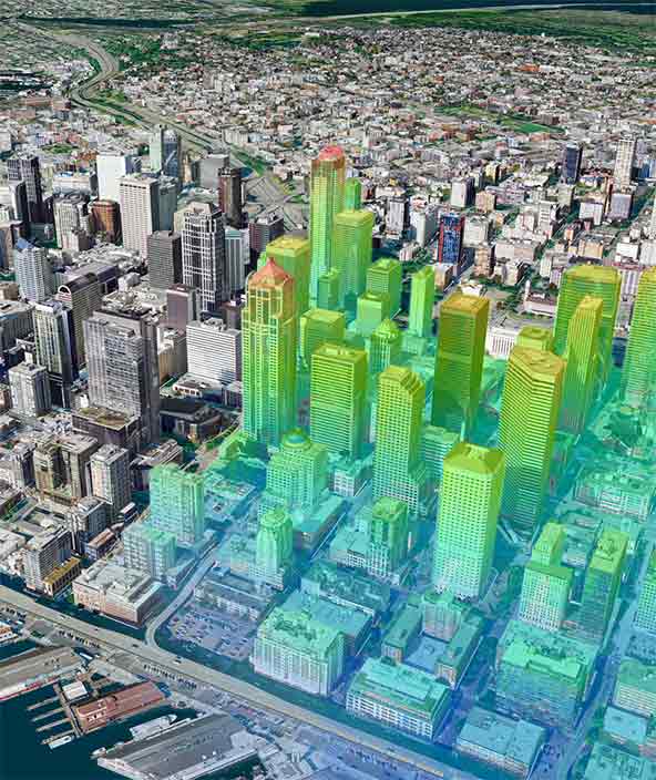
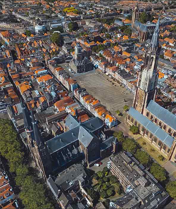
High-performance 3D city mapping
Hexagon’s hybrid airborne sensor efficiently captures entire cities, providing highly accurate 3D imaging and LiDAR data.

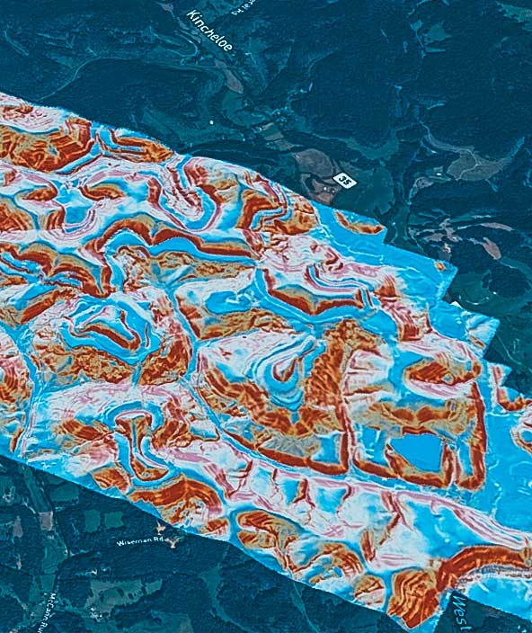
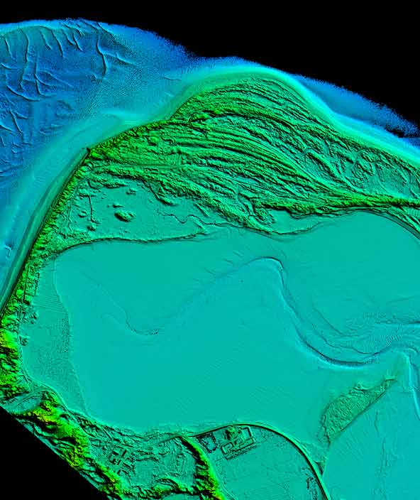
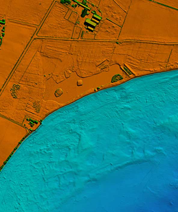
Bathymetric LiDAR sensors for coastal and river survey
Efficiently and safely capture seamless data from water to land for mapping, charting and environmental monitoring.
Hexagon provides industry-leading airborne mapping sensors and software. With 100 years of expertise, we develop airborne mapping cameras and LiDAR solutions that drive innovation and offer customers the most comprehensive portfolio on the market— including Hexagon’s unique hybrid sensing technology.
Maximising mapping efficiency
-
Overview
-
Sensors
-
Software
Mapping a changing world
Cities are rapidly growing due to urbanisation, rural areas are developing as infrastructure evolves and farmlands are adapting to feed an increasing population. To keep up with our changing world, mapping needs to evolve.
Hexagon has significantly increased the efficiency of airborne sensing technology for digital maps, which enables the collection of more data in a single flight and in turn reduces the time and cost of making maps.

The hybrid roadmap
Hybrid sensors that capture airborne imagery and LiDAR data simultaneously drive more efficient and comprehensive data collection to map cities and countries more frequently and with higher detail. As the only solutions provider with industry-leading components for airborne imagery and LiDAR mapping, Hexagon is well positioned to drive the hybrid roadmap.
The comprehensive sensor portfolio provides solutions for topographic and bathymetric LiDAR mapping as well as nadir and oblique imaging. Strong components across all applications provide high flexibility and scalability, enabling customers to tailor sensors to their project needs.

Highest Data Throughput
With the ever-increasing quantities of collected raw data, processing speeds need to be increased in parallel, allowing for the swift delivery of the processed data to the end customer. Leica HxMap, Hexagon’s airborne data-processing workflow, provides the highest data throughput for ortho imagery, stereo imagery and LiDAR data. Providing one unified workflow for all sensor and data types reduces staff training requirements and increases the flexibility to scale your production capacity.
Hexagon also offers common flight planning and management software for all sensor types.

Explore
$ProductName
$SustainabilityImpactLabel
$SustainabilityCTABandHeadingLabel
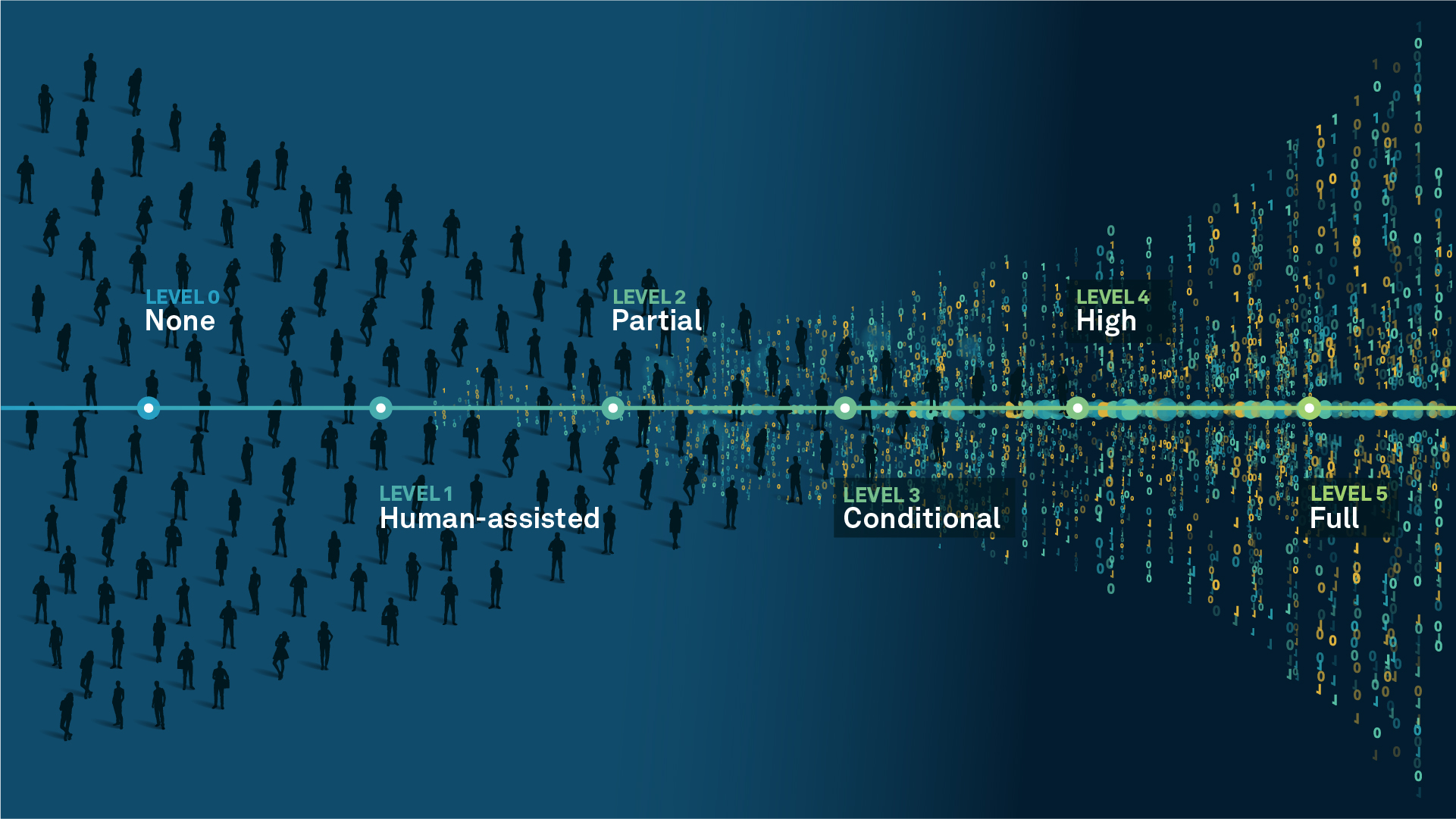
We’re climbing the automation curve
Our transition to Intelligent automation is accelerating. Ultimately, our innovations will give rise to new technologies and applications - many of which we’ve yet to imagine. Today, every Hexagon solution is mapped and tagged according to its level of automation, so customers can clearly track our progress towards the freedom of autonomy.
Human-driven
All tasks completed by human labour; no data is leveraged across the operation.
Human-assisted
Labour is primarily conducted by a human workforce. Some functions have been automated to simplify control.
Partial automation
Some tasks are automated for short periods of time, accompanied by occasional human intervention.
Conditional automation
Human workforce is used for intervention as autonomous operations begin to increase productivity.
Highly autonomous
Autonomous systems complete required tasks within specific bounds, unleashing data and building smart digital realities.
Full autonomy
A smart digital reality™ enables autonomous systems to complete all tasks without human intervention.

Land
Products that make an environmental impact in forest monitoring, material reusability, farming or water usage.

Air
Products that make an environmental impact in renewable energy, noise pollution elimination and e-mobility.

Water
Products that make an environmental impact in saving our oceans, reducing pollution and increasing access to clean water.