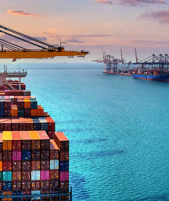
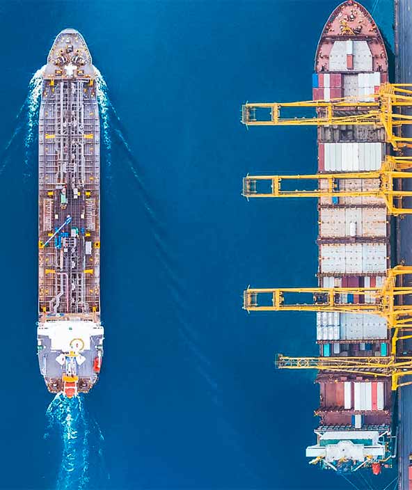
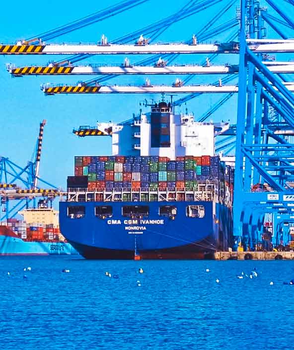
Civil maritime

Situational awareness at sea
Location-based expertise in vessel navigation, tracking, monitoring and analysis
Hexagon’s maritime solutions help civil authorities and commercial shipping companies ensure the safe and efficient movement of vessels, cargo and passengers. Our location-based capabilities support maritime planning and operations through real-time situational awareness, analysis and insights.
-
Overview
-
Cities and nations
-
Buildings
-
Infrastructure
-
Autonomous mobility

Mapping solutions
Leverage location intelligence with solutions that capture, visualise, analyse and derive insights from location data to address a variety of urban and national challenges.
Public safety solutions
Improve the quality, accuracy and availability of critical information with integrated technology solutions that enhance public safety and security performance and productivity.
Transportation solutions
Deploy intuitive, integrated solutions for roads, railways, aviation and maritime to ensure effective planning and operations and enhance safety with minimal disruption.
Design phase
Capture an accurate digital reality of a building site’s existing conditions, features and positioning to help digitally design initial concepts that minimise inputs and reduce waste during the project.
Plan phase
Transform your vision and design into a plan of action, digitally mapping out every detail for the construction phase including materials, scheduling and cost.
Build phase
Orchestrate the construction process more simply, creating a model of productivity and efficiency with higher quality, fewer reworks and less waste while ensuring worksite safety.
Operate and maintain phase
Leverage all data from design, plan and build phases, to create a Smart Digital Reality that delivers full transparency to every element of the completed building to optimise operations, maintenance, safety and resiliency.
Plan phase
Visualise the site above and below ground, digitally mapping out every detail for the construction phase, including time, materials, estimating, scheduling and cost.
Design phase
Digitally capture all the right distances and volumes that are key to construction performance, with accurate positioning and measurements integrated into the 3D model.
Construct phase
Maintain a data-driven approach to orchestrate the entire construction phase, creating a 3D model of productivity and efficiency — with higher quality, fewer reworks and less waste — while layering 4D cost and 5D BIM scheduling data throughout the project.
Operate and maintain phase
Empower asset owners and operators with solutions that go beyond smart infrastructure and provide 24/7 visibility into the operational twin to optimise safety and efficiency throughout all operations and maintenance while extending the life of the infrastructure asset.
Enabling solutions
Autonomous mobility research and development platforms that enable automation functionality across a diverse set of control systems and industrial applications.
Deployment solutions
Deploying autonomous solutions that enable customers to quickly scale from prototype R&D and testing phases to full production in a variety of emerging and fast-paced market segments.