Expanding reality's possibilities
HxDR seamlessly blends technological innovation and data democratisation, powering up digital realities for tomorrow.
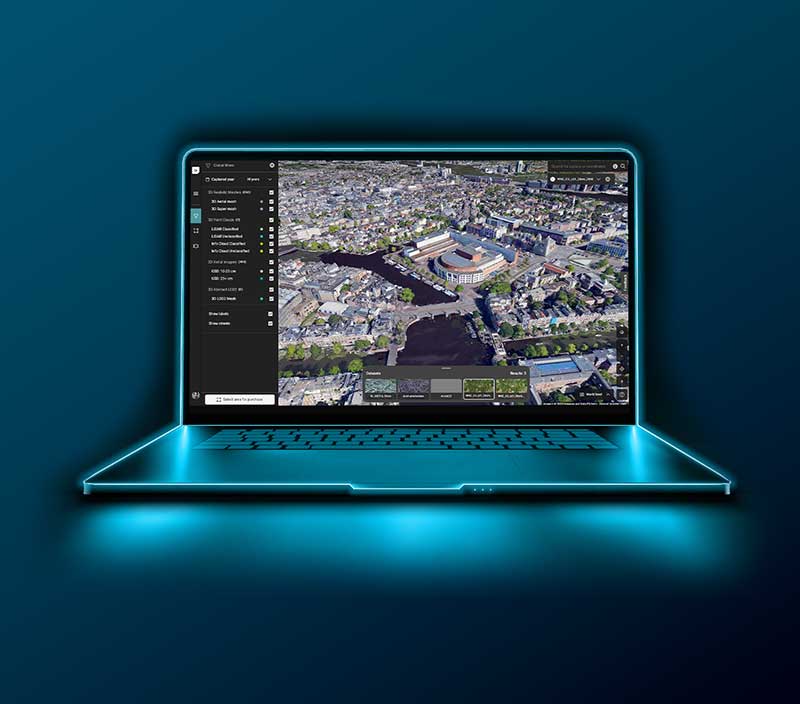
Hexagon Digital Reality (HxDR) is more than just a platform; it's a transformative ecosystem that changes how geospatial and reality data are conceptualised, managed and engaged. Imagine a cloud-based realm where storage isn't just about holding data but intelligently organising it. Picture a platform where visualisation tools don't merely display information but enable insightful interactions. Consider a digital environment where collaboration isn't confined to sending files but extends to real-time engagement with datasets. That's HxDR — a comprehensive, one-stop solution for many industry needs.
Built on a foundation of cutting-edge cloud architecture, HxDR's scalability makes it suitable for individual projects and a strong candidate for corporate-wide adoption. The platform bridges localised data captured from lightweight scanners and more expansive, large-scale data.
“The goal of HxDR is to open up geospatial content and reality capture in the cloud with a set of essential tools and processes that are intuitive, accessible and highly automated,” said Frank Suykens, Senior Vice President of Visual Computing at Hexagon, who has been with HxDR since the very first brainstorming sessions in early 2018.
From its inception, HxDR represented more than a groundbreaking technological accomplishment; it embodied an aspiration towards democratising data — making data capture, management and utilisation so simple that anyone, regardless of skills or background, can do it. HxDR’s platform, accessible to all, is powered by intuitive tools that simplify complex processes and promote greater inclusivity in handling geospatial and reality data.

"With HxDR, we've crafted a platform that extends beyond technology — it's a gateway to innovation and limitless possibilities. This is where vision becomes shared reality, with practical benefits like simplified data management, immersive visualisation and real-time collaboration."
The journey to create HxDR was a process marked by self-challenge and continuous learning. What started as a 'Dropbox for architects' quickly evolved into a large-scale geospatial content store. This evolution paved the way for a platform that enabled users across multiple industries to harness its capabilities.
This foundation dovetails with Hexagon's role as a market leader in sensors, capturing everything from large-scale geospatial data to smaller asset data. HxDR is a single platform capable of managing various data types, catering to different use cases and integrating seamlessly across departments. The HxDR team’s initiative to eliminate data silos and make information accessible and valuable across the board echoes their overarching vision of innovation.
Suykens aptly summarised HxDR's philosophy: "The team has always been focused on building a versatile platform for the long term."
HxDR allows developers the autonomy to build their own applications using the platform's API and the web app developer kit, "StartApp". As a result, HxDR is establishing itself as a true Platform as a Service (PaaS), where customers can develop customised solutions relevant to their sector, including architecture, construction, and even arts and media.
Reality Cloud Studio, a pioneering SaaS offering built on HxDR, automates and streamlines complex, time-intensive reality capture processes for a diverse user base. With its automated scan alignment and 3D mesh creation, it won the Wichmann Innovations Software Award at Intergeo 2023.

Another HxDR-powered service, LocLab Cloud, hosts and connects digital twin models for effective asset management and process optimisation. Together, they exemplify Hexagon's holistic strategy for improved data management, real-time collaboration, and process optimisation across various industries.
Rounding out these offerings, GeoCloud Drive, a service within HxGN GeoCloud powered by HxDR, brings Hexagon’s surveying sensors to the cloud. This enables users to store, transfer, and share data efficiently between field and office.
Strategic collaborations: Showcasing HxDR's real-world impact and innovation
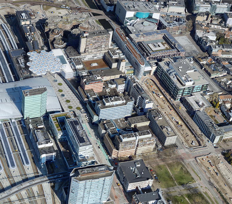
HxDR has demonstrated its real-world utility and impact through significant collaborations. In partnership with Cyclomedia, HxDR facilitated the creation of 3DNL, a detailed 3D model of the Netherlands, accessible on its cloud-based platform. This initiative has enabled a range of applications, from asset management to solar capacity calculations, facilitating virtual collaboration among government agencies, the private sector, and citizens.
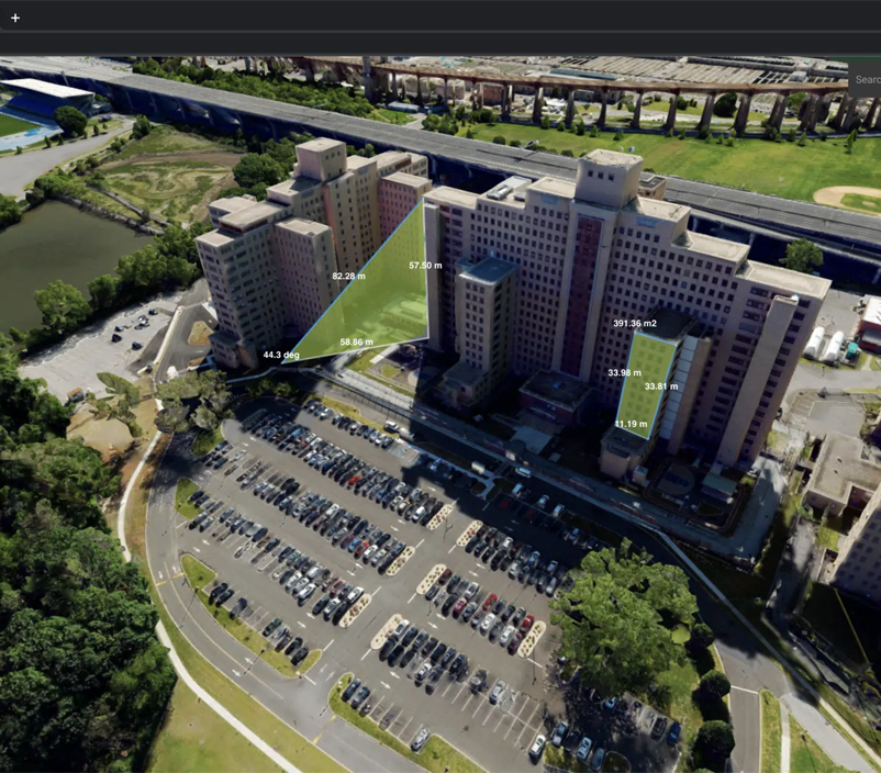
Another example, a solar company may use the digital reality models in HxDR to calculate the pitch and slope of a specific house, create a solar plan and present a proposal to the homeowner. Similarly, construction and engineering companies can design new builds and determine the most efficient access and logistics for the construction phase using the model.
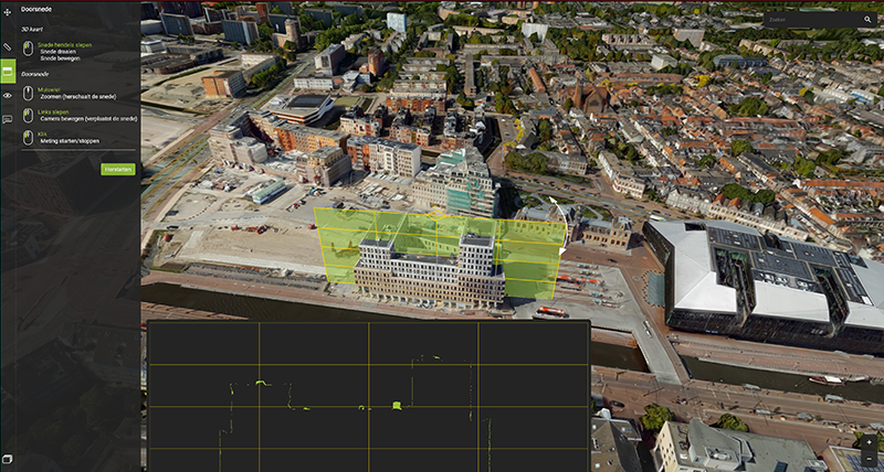
Governmental agencies benefit as well; they can assess urban greenery by calculating the number of trees in a neighbourhood, as well as analyse heat pockets and perform shade analysis. These applications showcase the ability of smart digital realities that replicate real-life geoinformation to provide valuable insights and support infinite data inputs from both the real and digital worlds. They are proving to be instrumental in improving work processes and planning for commercial and government customers, and 3DNL's broad appeal to these diverse users highlights HxDR's capability to manage complex geospatial data.
The project's significance was affirmed when it was awarded the 'Most Innovative Partnership' accolade at the 2023 GeoBuiz Europe Innovation Awards.
A commitment to collaboration and adaptability makes HxDR more than just another software product; it's an investment in the future, echoing its original purpose of democratising geospatial and reality capture data management and setting new industry standards.