Estimate and Plan

Accurate estimates are critical for planning a project. We recognise that your competitive advantage rests on the importance of these estimates being right.

You can't view this video as you didn't accept cookies.

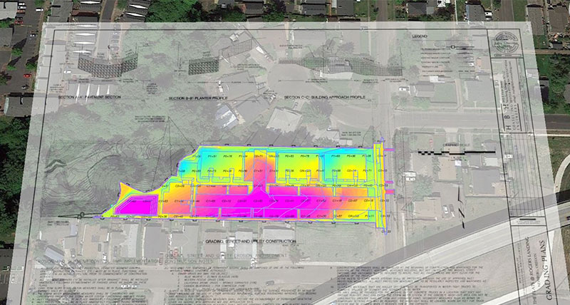
Turn data into comprehensive takeoffs to win bids

From prebid walkthroughs through project completion, you rely on intuitive software solutions to help you submit professional bids and turn your plan into action in the field.

We help you create fast and accurate quantity takeoffs, use drone data to validate and track progress, and create machine control models for all manufactures with speed and simplicity. Our advanced visualisation options, data exports and mobile apps help you find the best approach to ensure you’ve optimised the construction process.

Four key areas to consider in the estimate and planning phase of your construction project

Construction data comes from many different sources, but with the right construction management solution you can take control over all aspects of your construction project.

Learn more about these four key areas below:


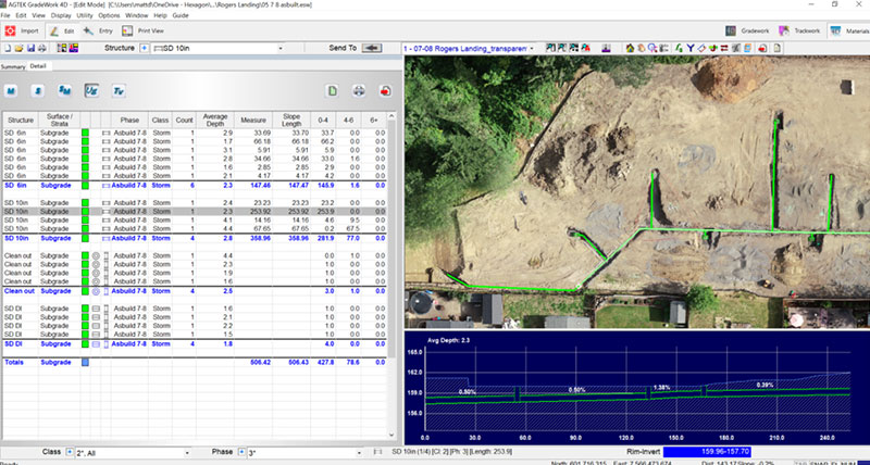
1. Prepare takeoff and control

Quickly and accurately turn data from PDF, CAD and drones into comprehensive takeoffs of all earthwork volumes and material lengths, areas and counts required for sitework and infrastructure projects. The software’s intuitive workflows guide all users through every step with simple routines to determine all cost items broken into phase and class of construction for comprehensive reporting.

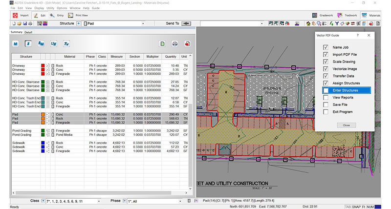
2. Utilise an integrated solution

An integrated solution for paving, pipe and dirt provides more opp. for value engineering so you can easily examine alternative bid options and phasing scenarios. It also helps you complete takeoffs faster by ensuring that no data is entered twice.

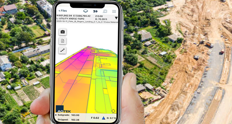
3. Validate existing conditions in the field

Use your phone or tablet to navigate to any location on site without the need for stakes to guide you. Validate data in the field before submitting your bid by comparing existing site conditions with the plan details, cut-fill maps, material quantities, 3D models, and any other takeoff information. 

4. Turn drawings and data into action

Utilise the power of drone imagery and point clouds to validate pre-bid site conditions, extract demolition quantities for infill developments and measure production progress during construction. Validate lengths, areas and counts of what has been done and what work remains. Sync all data to mobile apps to put actionable information in the Foreman’s hands to make faster, more informed decisions.

Download our Dirt Simple Solutions guide

Every construction project comes with its own challenges. Knowing which technology to use and how, can provide competitive advantage. Take a look at what solutions will not only give you massive productivity gains, but also give you the accuracy and precision your project demands.