SDKs (visualisation and analysis) for farms
Create precision agriculture applications to better utilise farm resources and achieve yield gains.

Cultivating precision agriculture with geospatial technologies
Discover how industry-leading software can help farmers see and understand aerial imagery and other geospatial data.
Hexagon provides software development kits for developing visualisation and analytics applications to implement smart farming. Pulling in data such as weather forecasts, crop types, soil types and more, farmers can predict outcomes, determine optimal next steps and save money on resources.
Overview
As populations rise and cities expand, the amount of arable land available to provide food for the world's citizens shrinks. It's more important than ever for commercial farmers to maximise their yields without overspending on resources such as fertiliser, equipment repairs and water.
Hexagon provides SDKs for the development of smart farming and precision agriculture applications that offer a detailed overview of farm operations. With these real-time 3D applications, farmers can view their land by crop type to understand needed actions such as fertilising and watering. They can see a live overview of performance data such as the amount of fertiliser applied, equipment fuel consumption and maintenance intervals. And by leveraging historical field analytics, they can understand which crop types perform best in specific locations.

Explore products
$ProductName
$SustainabilityImpactLabel
$SustainabilityCTABandHeadingLabel
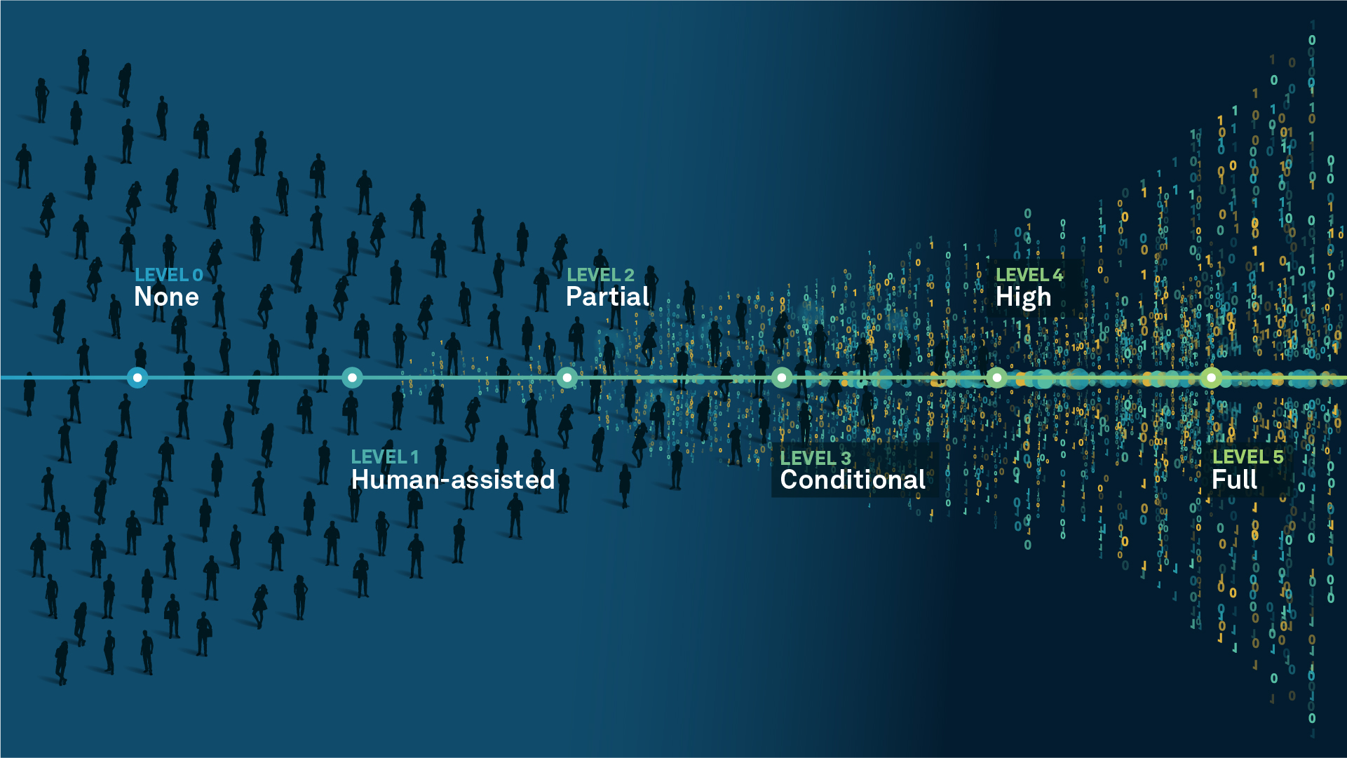
We’re climbing the automation curve
Our transition to Intelligent automation is accelerating. Ultimately, our innovations will give rise to new technologies and applications - many of which we’ve yet to imagine. Today, every Hexagon solution is mapped and tagged according to its level of automation, so customers can clearly track our progress towards the freedom of autonomy.
Human-driven
All tasks completed by human labour; no data is leveraged across the operation.
Human-assisted
Labour is primarily conducted by a human workforce. Some functions have been automated to simplify control.
Partial automation
Some tasks are automated for short periods of time, accompanied by occasional human intervention.
Conditional automation
Human workforce is used for intervention as autonomous operations begin to increase productivity.
Highly autonomous
Autonomous systems complete required tasks within specific bounds, unleashing data and building smart digital realities.
Full autonomy
A smart digital reality™ enables autonomous systems to complete all tasks without human intervention.

Land
Products that make an environmental impact in forest monitoring, material reusability, farming or water usage.

Air
Products that make an environmental impact in renewable energy, noise pollution elimination and e-mobility.

Water
Products that make an environmental impact in saving our oceans, reducing pollution and increasing access to clean water.